
Good Morning! Welcome to August. Today, the Heat Index may not make it to 100. That would be the fist time in many, many days. So, briefly slightly less humidity today and it’s a dry forecast today and Wednesday. But this very slight relief won’t last for long by Thursday & Friday, the humidity will be back and so will the random storms. The Weekend looks steamy with hit or miss storms. Meanwhile, NHC continues to monitor two Invests in the Atlantic. Here’s my brief forecast discussion.
TODAY: Abundant sunshine today. Hot, but Not quite as humid. High 97. Light wind. Low 76. Should be dry today.
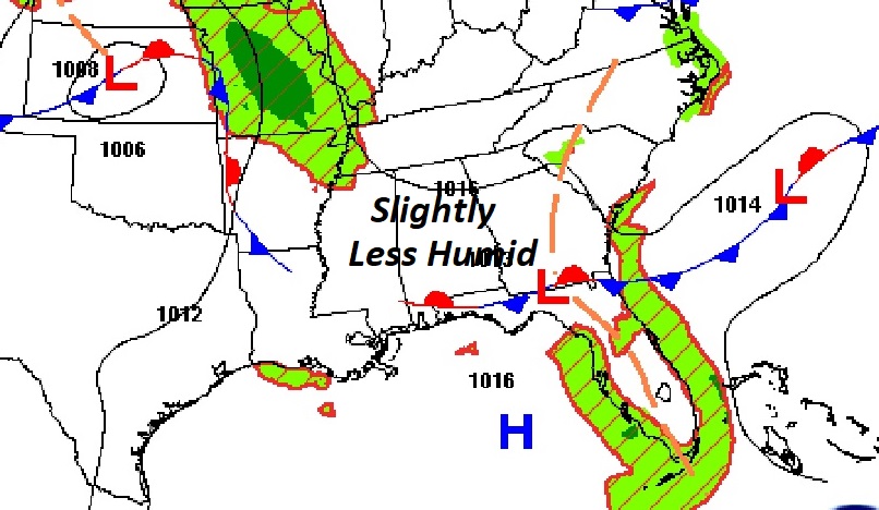
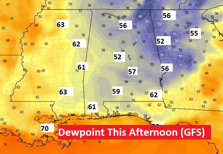
Afternoon dewpoints will be slightly lower today. The GFS model may be overdoing it just a bit. Still though, it would be nice if we did not get to triple digits on the heat index.
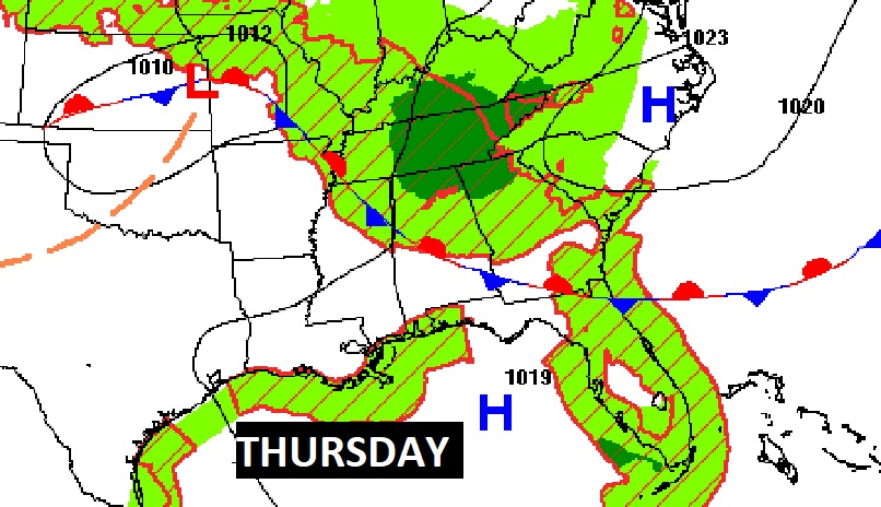
NEXT FEW DAYS: Wednesday will be hot & dry with highs in the mid 90’s. By Thursday and Friday, we’ll be easing back to normal – more humid and random storms will return. The Weekend looks steamy with hit or miss storms.
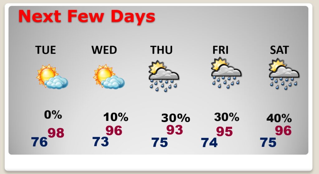
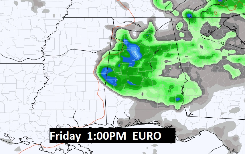
Humidity and random storms return Thursday and Friday along with Triple Digit Heat Indices.
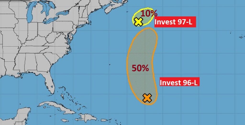
TROPICAL UPDATE: NHC Continues to monitor Invest 96-L , and Invest 97-L in the Atlantic. 96-L could still become a Depression in the next day or two, but the probability of development has come down.
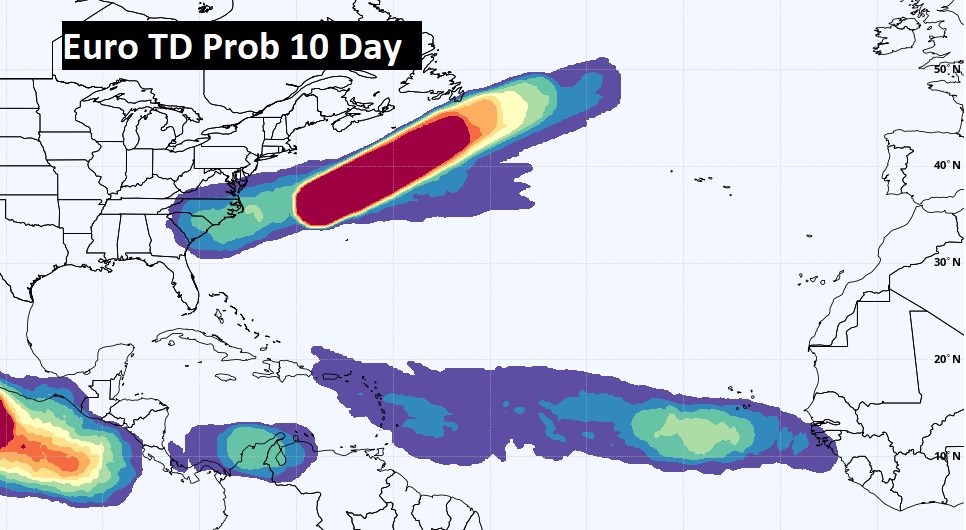
The EURO model also hints at another wave coming off the African coast could eventually develop.
FULL MOON: the Moon is Full officially today. The full Sturgeon moon.
Thanks for reading this Blog this morning! This morning we are LIVE on the radio from 6 to 9 on NewsTalk 93.1. Watch us on TV on CBS 8 and ABC 32. I’ll have another update for you in the morning. Have a nice day!
–Rich