Good Morning! After a freezing start this morning, we should see a quick turnaround today. Enjoy this last dry day. There’s lots of rain in our future. Rain and storms become likely by overnight tonight and Friday. Some storms could be Severe on Friday. That’s just part one of a two part storm system. There’s more rain & storms ahead beginning overnight Friday into Sunday. Total rainfall, through Sunday, could be significant. The wet forecast has already caused the cancellation of some outdoor Christmas season events. Here’s my brief forecast discussion.
TODAY: One final dry day. Partial sunshine, not as cool. High 62. Southeast wind 6 to 12 gusting to 17 mph. Mostly cloudy this evening but dry. Showers and thunderstorms begin in the overnight hours. Low 47.
Two Part storm system. First one arrives pre-dawn Friday. Part two pre-dawn Saturday.
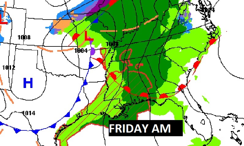
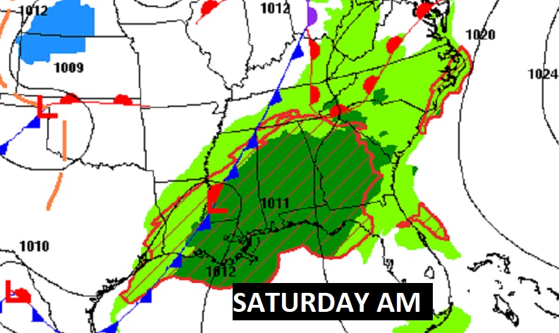
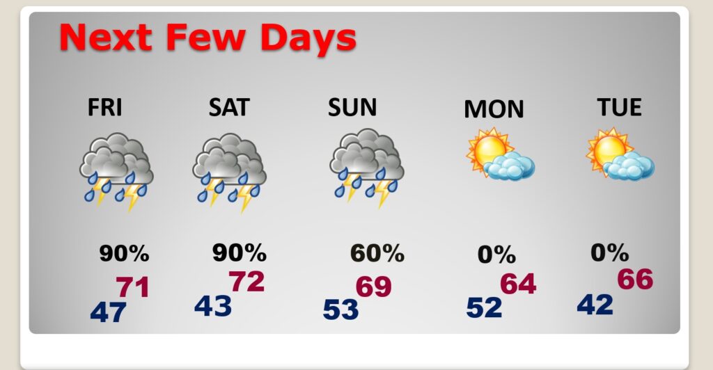
NEXT FEW DAYS: Rain and storms become likely Friday. Some storms could be Severe on Friday. That’s just part one of a two part storm system. The second storm system brings in a round of showers and storms staring overnight Friday through Saturday, with some leftover showers Sunday. Dry weather returns Monday and Tuesday.
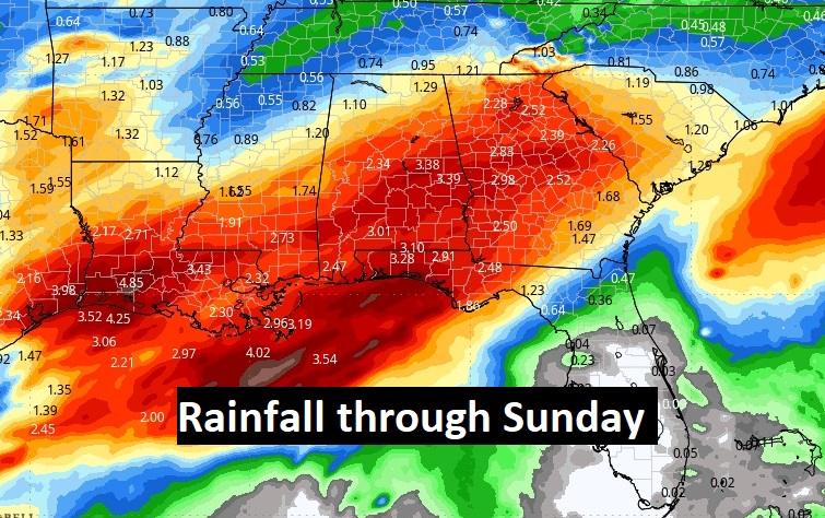
Total rainfall tonight through Sunday could be rather significant in spots, especially across the southern half of Alabama. For instance, the Montgomery model blend would be between 2.5 and 3”, heavier in south Alabama.
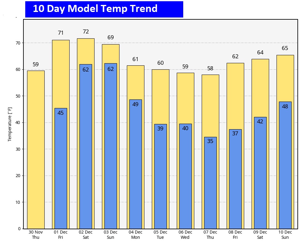
Here’s the 10 day model temp trend. I don’t see anything unusually cold in the next 10 days.
Thanks for reading this Blog this morning! This morning we are LIVE on the radio from 6 to 9 on NewsTalk 93.1. I’ll have another update for you in the morning. Have a nice day!
–Rich
