
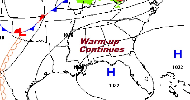
Good morning! It would be difficult to write a better script for the Easter Weekend forecast. There will be high cloudiness at times, but there will be a good bit of sunshine, too. We’ll be in the upper 70’s today. By Easter Sunday highs will reach the low to mid 80’s with a good bit of sun mixed with high clouds. Middle 80’s are a good bet Monday and Tuesday. Showers and storms return Tuesday as a cool front approaches. Parts of north Alabama could see strong to severe storms. Behind the front, expect much cooler temperatures with highs only in the 60’s by mid-week.
.
TODAY: Mostly cloudy early, sunshine later. Little warmer. High near 79. Wind: SW wind at 6 to 12 mph. Partly cloudy, not as cool tonight. Low 53.
.
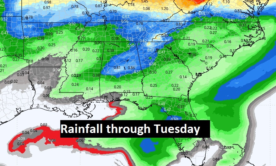
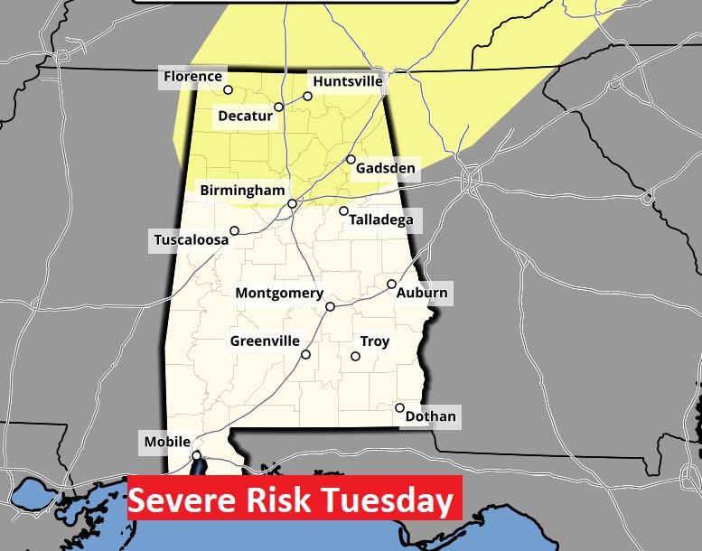
NEXT FEW DAYS: It’s a beautiful forecast for a few more days. It will be storm-free/Dry for several days through at least through Monday. Showers and storms return Tuesday. Parts of the state could see strong to severe storms. Behind the front, expect a periods of much cooler temperatures with highs only in the 60’s by mid-week.

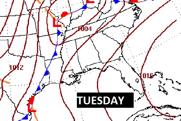
An approaching cold front on Tuesday is our next weather maker, bringing in a round of showers and thunderstorms.
So far, it appears the better threat for strong to severe storms will be across the northern counties.
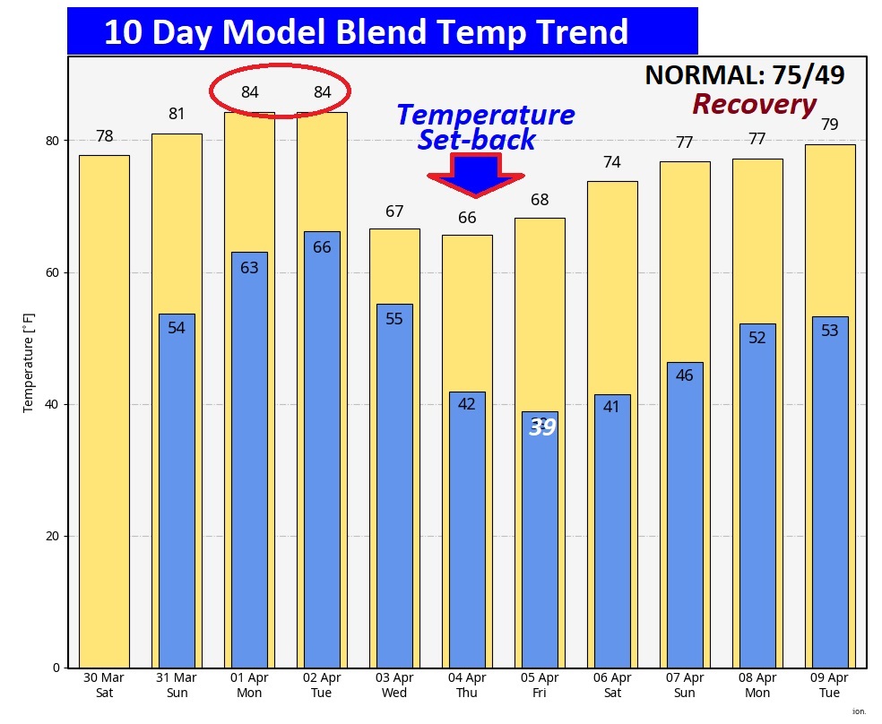
Here’s the 10 day temperature trend. Warm through Tuesday. Then, expect a temperature “set-back” middle of next week.
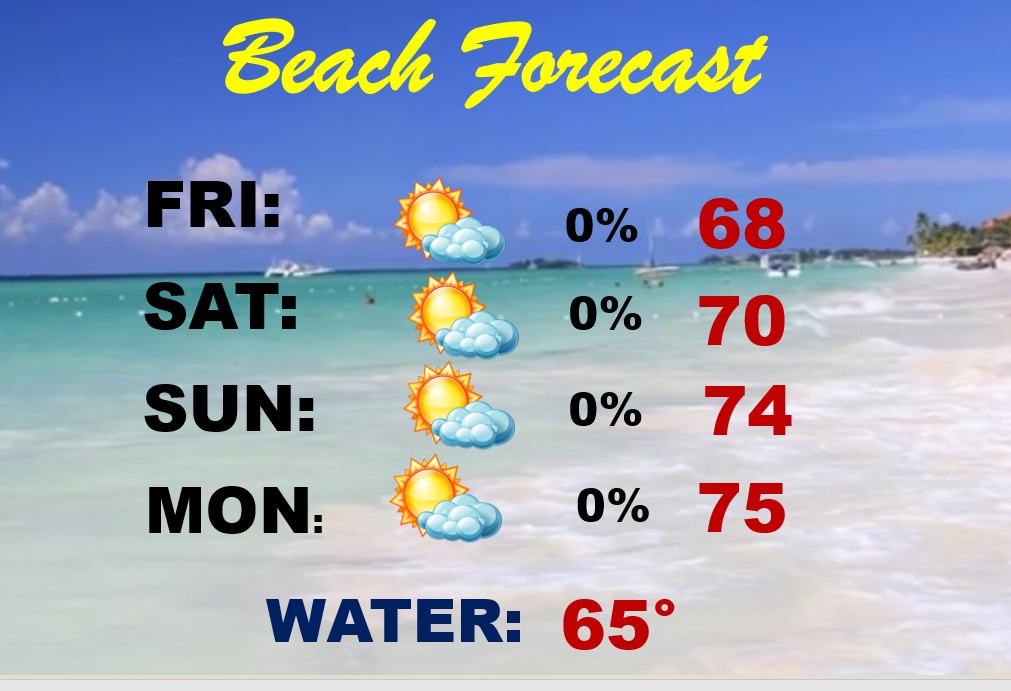
BEACH FORECAST: It’s a beautiful Easter Weekend forecast. A little cool today due to an onshore breeze off the cooler Gulf Water. Showers and storms return Tuesday. Moderate rip current risk today and Sunday.
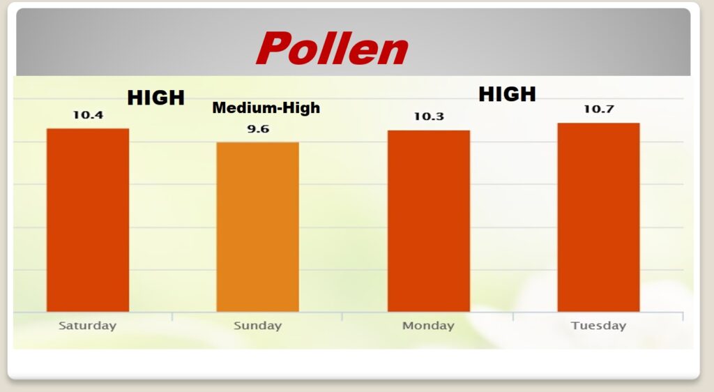
POLLEN: Here’s a look at the next 4 days. Still looking tough. Not good.
Thanks for reading the Blog this morning. The next scheduled Blog update and video will be Monday morning. Have a nice Easter weekend!
–Rich