
New updates on possible ice accumulation and sleet/snow accumulation on this update. Rain covers much of central/south Alabama now. Rain has been mixed with a little sleet/snow in Shelby county. Birmingham is at 31, but father south Montgomery is 42 with light rain falling. Temperatures will fall throughout the day as rain continues.
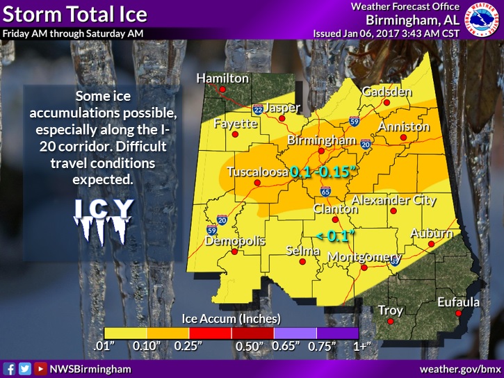
ICE ACCUMULATION: Concern is growing for icing accumulation from freezing rain/sleet. The greatest concern area has shifted northward to the I-20/I-59 corridor where .10 to .15” could accumulate. Father south in the I-85 corridor, accumulations of up to .10” ice is possible. This will lead to extremely hazardous travel.
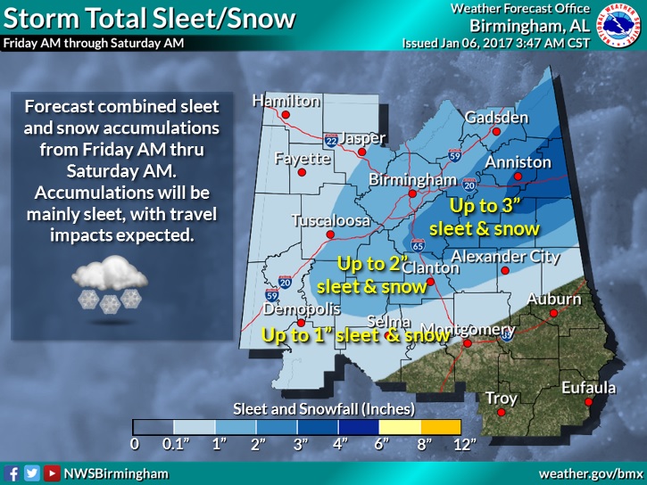
As for the accumulation of sleet & snow, which is totally different ballgame, the biggest accumulation is expected in the Winter Storm Warning area from Perry, Chilton, Coosa, Tallapoosa and Chambers county northward where 2-3” and in some cases 3+” are possible. Travel will become extremely hazardous.
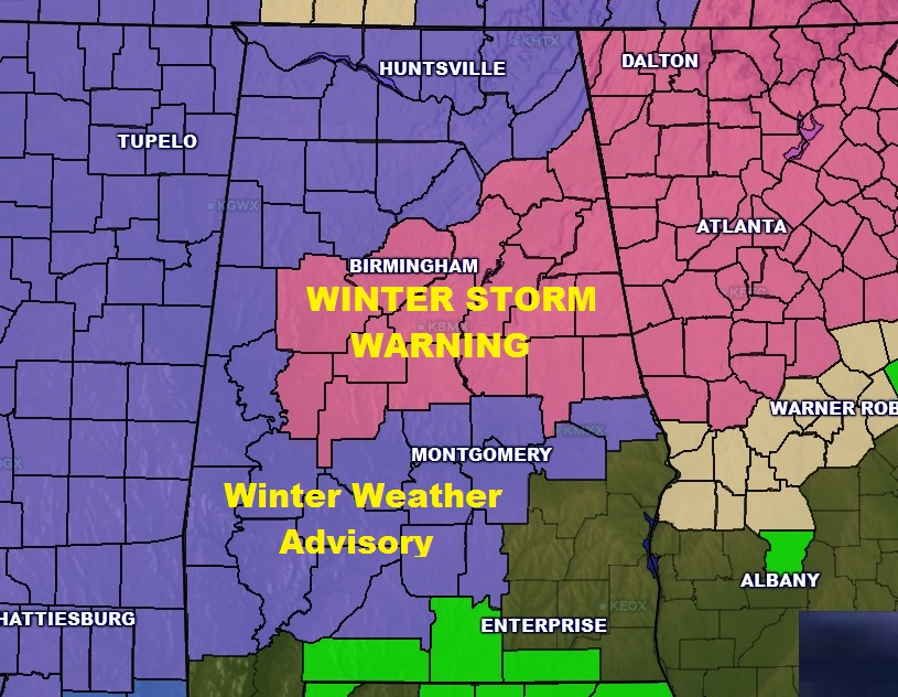
Here’s the updated Winter Weather Warning and Winter Weather Advisory Map
MONTGOMERY AREA FORECAST DETAILS: Winter Weather Advisory today until Saturday AM. Rain today. Temperatures falling to mid 30’s by 5PM. Tonight: Rain mixes with sleet. By Midnight a sleet/freezing rain mix likely. Then, in the wee hours a sleet/snow mix, before ending. Little or no snow/sleet accumulation, but ice accumulation of up to .10 possible. Low by Saturday morning 25. High Saturday 36 with Clearing skies. Low by Sunday morning 21, wind chill factor 10-12°. High Sunday 41.
STAY WEATHER AWARE: We will have additional Blog updates as needed today and tonight. They will appear on your Weather App, on Facebook and on Twitter. There will be a LIVE update from the Bluewater Weather Center at 11:00AM.