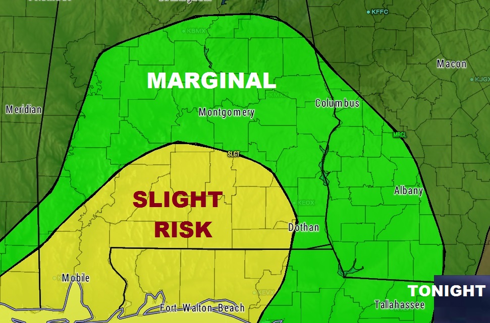
The threat for a few severe storms will continue through this evening until just past Midnight for most of us, and perhaps in the wee hours for extreme southeast Alabama. Greatest threat is in the yellow ‘slight’ risk on this map across south Alabama. In that area, a brief spin up tornado can’t be ruled out. A smaller severe risk exists farther north in the Marginal Risk area.

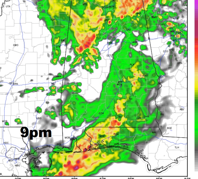
Here’s a Future radar snapshot at 9PM.

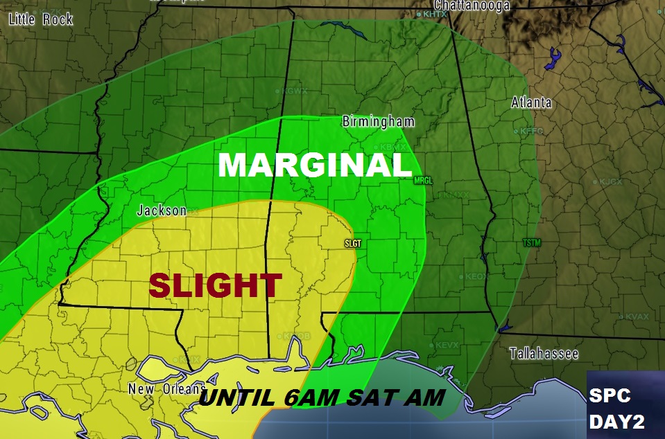
Beyond tonight, concern is growing for late Friday night into Saturday morning. All modes of severe weather are possible, including damaging winds and a few tornadoes. Here’s the threat outlook until 6am Saturday.

A more widespread severe threat will continue across a multi-state area on Saturday, Saturday night into early Sunday.

We will further examine the details of this growing weekend risk first thing tomorrow morning with your next video online by 5AM. In the meantime, stay weather aware tonight. If you have downloaded our new weather app, it will alerts you for any watch or warning in your location. If you haven’t
