Very active pattern this week, and in fact, for at least the next two weeks. We have 2 more storm systems on the menu this week. Both of these have potential severe weather implications for Alabama. Even next week, the active pattern continues with 2, possibly 3 storm systems in the pipeline. The main threat windows for Alabama this week are Monday night and again Thursday night.
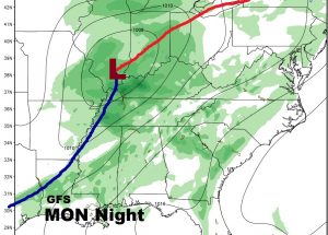
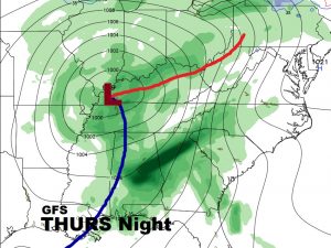
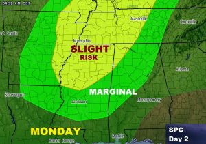
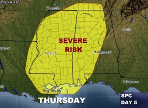
Both storm system could bring severe storms to parts of Alabama. Remember, these outlooks from the Storm Prediction Center are likely to change as we get closer to these events and the threat areas may expand. If fact they probably will. The most concerning severe weather threat will be the Thursday storm system appears to be the most concerning for the severe weather threat appears to be the Thursday storm system. All modes of severe weather are possible, including tornadoes.
TODAY: Partly sunny with risk for a spotty shower or two, perhaps a thunderstorm this afternoon. High 82. Tonight’s low 63.
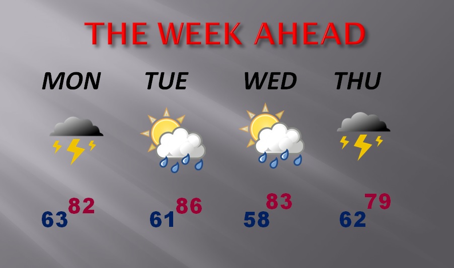
THE WEEK AHEAD: Should be a warm end to the month of March with highs in the low 80’s. Chance of showers each day, but the greatest risk of the stronger storms will be Monday night and Thursday night.
ABBY AWARDS LAST NIGHT: Big night for Bluewater Broadcasting last night in Hoover at the Alabama Broadcaster Association’s Abby Awards. I was honored to pick up my first 2 Abby’s in my 40 year Montgomery Broadcast career. We won for Best App and Emerging Technology for the Rich Thomas Weather Network. Jeff Blake was also honored for Radio Commercial. It was a great night at the Abby’s. I am thrilled and honored.

Have a great Sunday. I’ll see you in the morning for your next video as we get ready for a very busy week. My alarm goes off at 2. Your video will be online by 5.
Rich
