..Double severe Threat: Late Tonight & Wednesday. MODERATE Risk Wednesday. Enjoy a tranquil Tuesday. We are facing a significant risk Wednesday, including a elevated Tornado Threat by afternoon. This important video highlights the threats and breaks down the expected timeline.
LATE TONIGHT Severe Weather Threat – Round 1. Damaging winds and hail, main threat. Begins in the wee hours of the morning. This is ahead of a northward moving warm front.
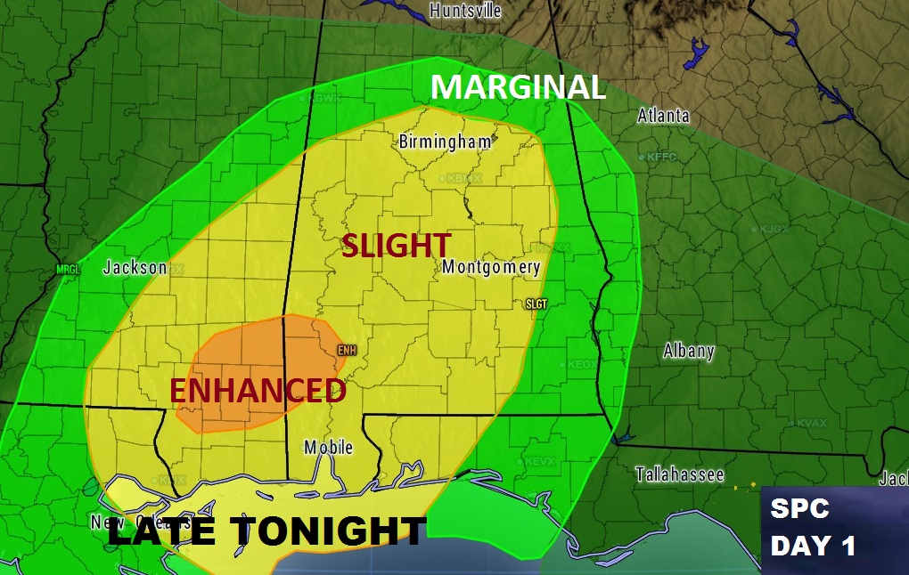
Once we get into the Warm Air Sector between the warm front and the Cold front, SPC has elevated the threat levels across Alabama. Particularly in south central, east and southeast Alabama where a Moderate Risk has been introduced. SPC says “strong and long-lived tornadoes are possible.
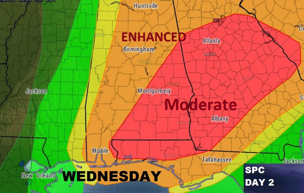
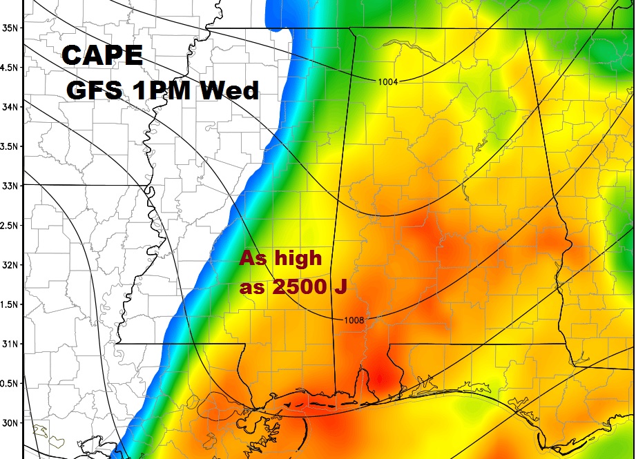
Complicated synoptic set-up tomorrow, with a powerful storm system over the mid-Mississippi valley and rich Gulf air racing northward causing a extremely high level of CAPE or instability.
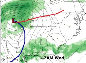
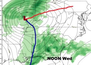
The amount of CAPE or available surface instability is extremely high and concerning. Here’s 1pm tomorrow on GFS
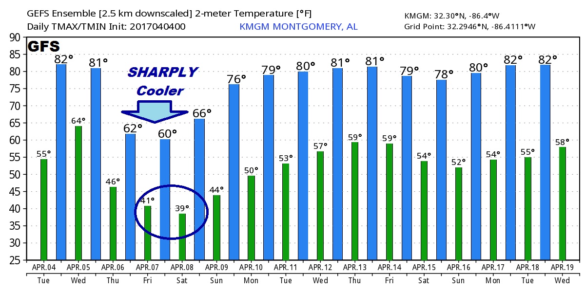
Much cooler air follows the storm system.
Special LIVE stream Briefing this morning at 10AM from the Bluewater Weather Center, and a very Special afternoon Blog update which will try to fill in the details we simply don’t know yet on this developing very complex situation.
For weather Geeks…here is the morning excellent discussion from NWS BMX written my Matt Grantham. Good reading. Well written. Very technical.
...Severe weather outbreak possible Wednesday...

A stalled front to our south will begin to return northward
tonight as a classic 500 mb trough takes shape over the Plains. A
surface low should intensify and track from eastern Oklahoma
tonight toward the Ohio Valley on Wednesday, eventually putting
Alabama in the warm sector. Before that occurs, a warm front will
move inland and accelerate northward early Wednesday morning across
the forecast area. Scattered storms are expected to develop
around 4 AM as warm/moisture advection occurs near the warm
front. Additional storms could also form along a trailing
confluence band which may extend from central Alabama to the
southwest. With MLCAPE possibly as high as 2500 J/kg in the warm
sector and strong wind shear already in place through the entire
column, any surface-based storms could produce long-track
tornadoes. It is unclear how widespread this activity will be and
if storms will become more organized. This is an important
question we cannot answer at this time, but the morning activity
will greatly impact what happens later in the day.

One possible outcome is storms becoming organized and moving into
Georgia, focusing the low-level jet to the east with veering
surface winds to the west across Alabama. This could somewhat
reduce instability and shear and the overall threat for the
afternoon. A threat for tornadoes, very large hail and damaging
winds would still exist in this scenario. Several models are
buying into this idea, but with the presence of a elevated mixed
layer, it is possible they are too bullish with morning
thunderstorm development.

If the warm sector remains preserved, very strong instability and
shear would develop across much of the area, possibly leading to
an outbreak of long-track, destructive tornadoes trough 9 PM. The
westward extent of the afternoon threat is in question due to
timing of initiation, but the greatest chance for supercells would
probably occur east of a line from Birmingham to Selma. We should
have a better handle on this situation 24 hours from now.

87/Grantham

.LONG TERM...
Thursday through Monday.

Thursday through Sunday remains a fairly benign timeframe with
high  pressure taking control and bringing in some chilly air for
this time of the year. Low temperatures on Friday and Saturday
morning will be in the upper 30s to low 40s for most of the area,
with a few mid 30s in the northeast and normally cooler spots.
Have increased the chance of a possible frost in the northeast and
included in the forecast for Saturday morning. This will continue
to be monitored over the next several days and more details will
be forthcoming. Make plans for protecting outdoor vegetation and
plants for the weekend. There will be a warming trend beginning
Saturday afternoon that will continue into Sunday and Monday. The
next chance of rain will be Monday afternoon with the next storm
system, but there is still some timing issues with this system so
expect many changes over the next few days.

16
