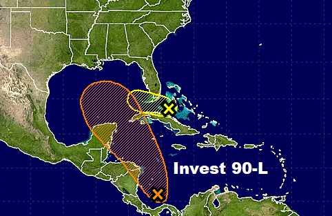
Just a heads up this afternoon… National Hurricane Center has named Invest 90-L in the west Caribbean. As I have been telling you for a couple of days, the global models continue to suggest 90-L will develop, at least into a depression and/or tropical storm, over the weekend as it moves northward in the Gulf. For us, this could have an effect on Alabama’s weather by Sunday or more likely late Sunday/Sunday night into Monday. Then, the tropical system will be quickly lifted to the northeast as a frontal system approaches. How much of an effect? We don’t know yet. But, it has our interest.

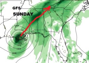
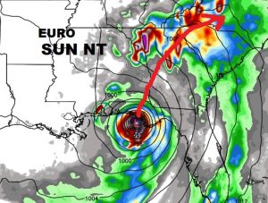
Three important questions: timing, strength and track. Here’s a little appetizer for you. (There will be an in dept briefing on your morning video online by 4:45AM.) The GFS is farther west, taking the system into Louisiana daytime Sunday and racing northeast quickly toward west Alabama Monday, then rapidly out of the state. That puts us on the “dirty” side of the storm. The Euro is stronger and slower on the arrival time. Shows the system south of Pensacola 7PM Sunday evening. Then moved to Dothan Monday morning, then into Georgia rapidly as it’s picked up by a cold front. More in the morning! This is a heads up and an appetizer.


See you in the morning.
–Rich
