Stand by. Here comes the important Cold Front we’ve been waiting for…and it’s right on time, now just hours away. Jackets ready? You will need them, especially in the evenings and mornings. It will be chilly at night and in the mornings. I’ll spell out the details below…keep reading. I’ve had to lower the expected temperatures.
TODAY: One more day in the 80’s. It think we will be mostly cloudy. I’m expecting a high around 86 in central Alabama. Maybe a degree or 2 warmer if we get more sun than expected. Scattered pop up showers and storms will be around, but widely scattered. Here’s a couple of Future Radar snapshots. Notice how the showers will be more numerous by 9 or 10PM.
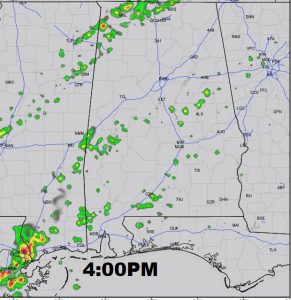
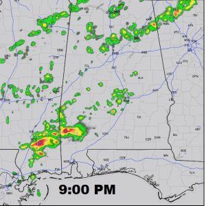
TIMING THE FRONT: The front should reach the I-20 corridor between 7 and 10PM, and the I-85 corridor around Midnight, then south to beyond Troy and into the Wiregrass.
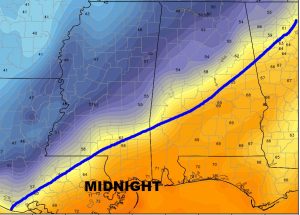
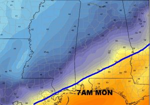
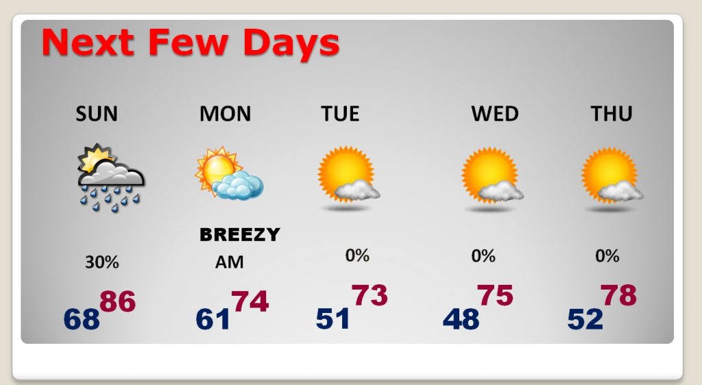
NEXT FEW DAYS: I’ve made some significant tweaks to the forecast, lowering the numbers. As I mentioned earlier, jackets will come in handy for the first time since last March.
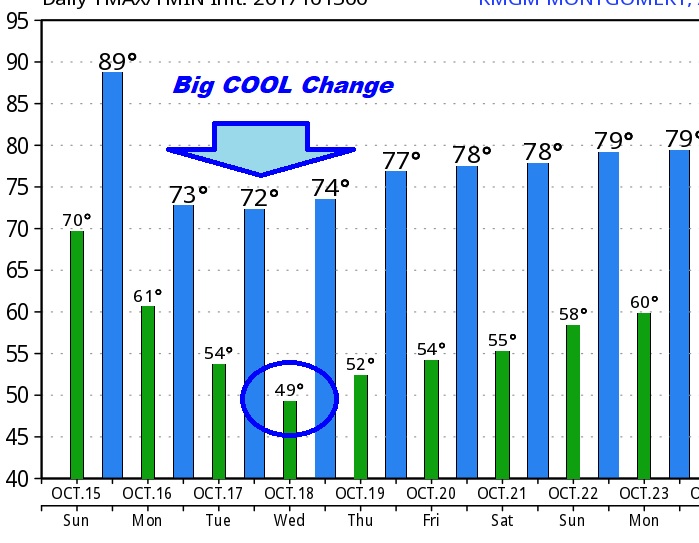
Monday will be a brisk, breezy day, with a high of only 73. Cloudy through mid morning, then gradual clearing. We will be in the low 50’s by Tuesday morning and upper 40’s on Wednesday morning.
The Raw GFS model numbers…
MONDAY MORNING VIDEO: I’ll be back in Montgomery for your early morning Monday morning complete video update online by about 4:45AM. Are you ready for the big cooldown? J Have a great Sunday. See you in the morning!
–Rich
