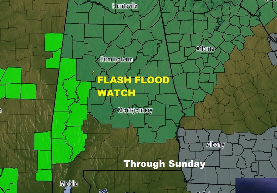
A stalled frontal system and series of disturbances will lead to a very wet weekend with locally heavy rainfall and at least a Marginal Severe weather risk today and tomorrow. A flash flood watch is in effect for much of the state.

FUTURE RADAR shows the evolution of of tonight’s heavy rainfall potential severe weather event, through the overnight hours and into Mid morning on Sunday
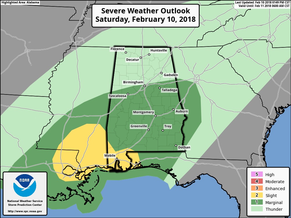
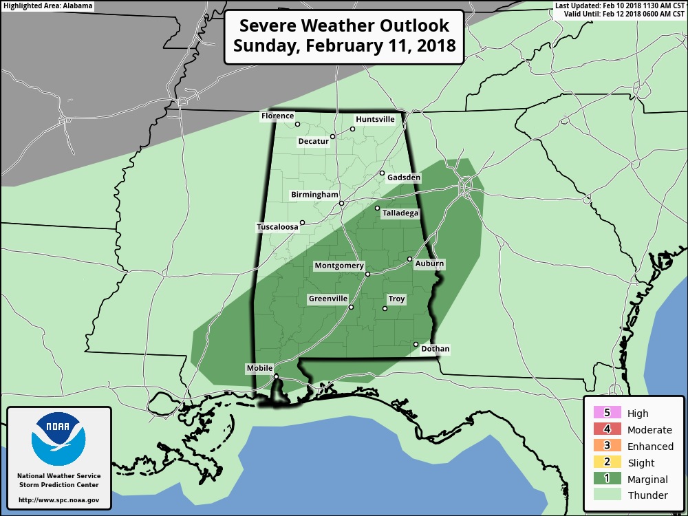
SEVERE WEATHER RISK: The Storm Prediction Center has much of central and south Alabama in a Marginal Severe Weather Risk for much of central & south Alabama today and again on Sunday. Damaging wind gusts appears to the main threat, but a spin up tornado can’t be ruled out.


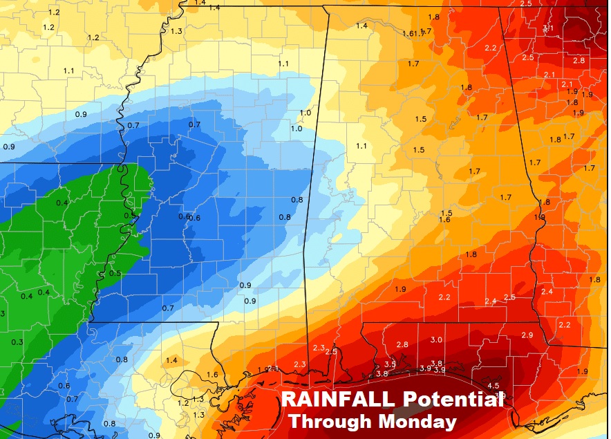
Meanwhile, some locally very heavy rainfall is possible in spots through Monday. Some places could easily see 1-3”+. The risk of rain will stick around through midweek.

Stay weather aware. Our weather App will alert you when there is a severe weather watch or warning for your area. I’ll have another blog update for you on Sunday morning. Keep in mind, on the road, I am on Pacific time. Stay weather aware.
–Rich
