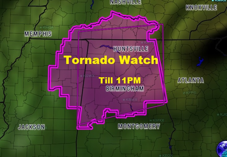
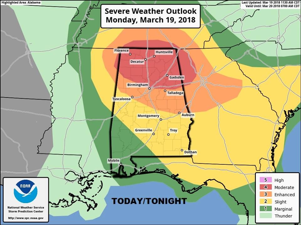
First tornado watch of the evening covers about the northern half of Alabama as far south at Chilton and Coosa county until 11PM tonight. This is a special PDS Tornado Watch. Particularly dangerous situation. Kind of rare. Only a handful a year if that many. Other tornado watches are a good bet later, farther south and east. We’re monitoring. Severe weather threat for all of us through the wee hours of the morning as a strong frontal system moves into and crosses the state. Threat of Large Hail, damaging winds to 70 mph, and tornadoes are possible even well south of the current watch area. Stay alert. Download our weather app. It will alert you instantly to a watch or warning for your location. Search Rich Thomas Weather in the App store. It will also give you access to our Live Stream.

FUTURE RADAR gives you an idea of the movement of the most dangerous band/line ofstorms tonight with embedded Super Cells capable of producing tornadoes, damaging winds and very large hail through late tonight and reaching SE Alabama in the wee hours of the morning,

