Some of you experienced a violent thunderstorm yesterday. Many of you didn’t get a drop of rain. It was routine summer day in Alabama. Big heat can produce big storms. Today will be no different. In fact, this pattern is here to stay for each of the next several days. On any typical summer day, rain chances will average about 30%. But, for the next few days, with deep tropical moisture in place, rain coverage will be closer to 50%.
TODAY: It will be hot and humid today, outside of thunderstorm areas. High will reach the lower 90’s, again. And, once again, the dewpoint will be at or above 70….very humid. This will be fuel for the fire. There will be a generous supply of thunderstorms around. Like yesterday, some storms will put on quite a show, with gusty winds, intense cloud to ground lightning, and very heavy rainfall. Some storms could even produce hail. And, yet, many towns will stay bone dry again.
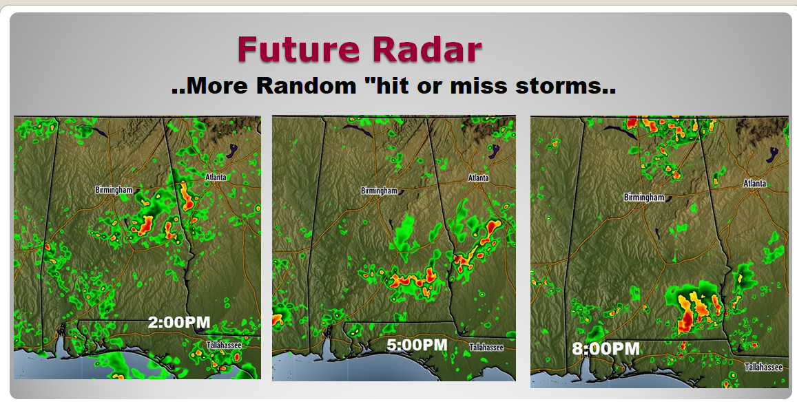
FUTURE RADAR: By lunchtime, radar will be quite active. Storms will be rather numerous during the afternoon. Like yesterday, movement will be slow and erratic. A couple of storms could reach severe limits, like yesterday, with 60+ mph wind gusts and maybe some hail. All of this very routine. It’s a typical summer day in Alabama and yet, we are still about 11 days until the first official day of summer. As you look at these future radar snapshots, remember, we are just looking at coverage, and not exactly where storms are shown. This is just a model idea.

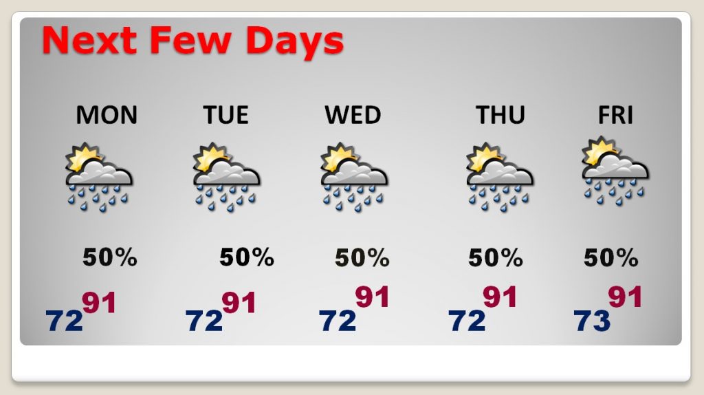
NEXT FEW DAYS: There will be a generous amount of those random storms around each day. Highs will be at or above 90 each day, with lows at night in the lower 70’s There will be little day to day change.

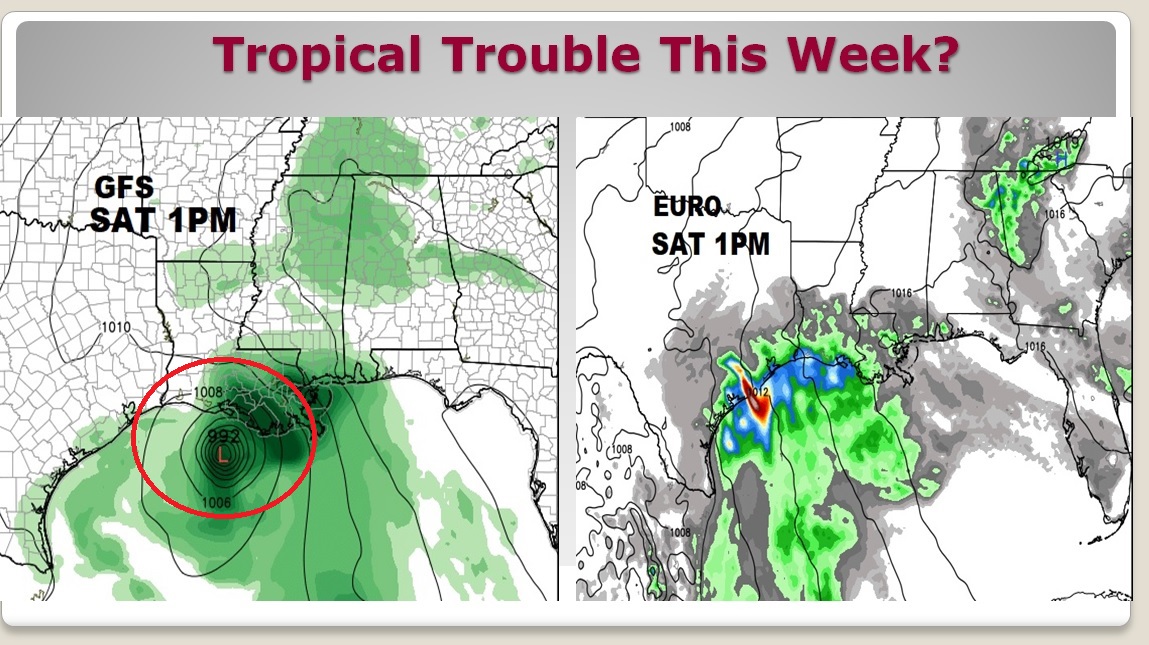
GULF TROPICAL TROUBLE THIS WEEK?: Once again, the GFS is the “odd man out” on projecting a tropical storm in the Gulf in the week ahead. It shows a healthy looking Tropical storm or Hurricane Beryl on the Louisiana coast Saturday. This appears highly unlikely. While the EURO does show deep tropical moisture off the Louisiana and Texas coast, it does now show and organized tropical system. We’ll watch, but the GFS solution seems very unlikely. Here’s a snapshot of the GFS and EURO on next Saturday at 1PM.
. 
—
I’ll have a complete video update for you first thing in the morning, online by 4:45AM. Have a nice Sunday!
Rich
