Big Heat produces Big Storms. Yesterday was a PERFECT example of that. That massive cluster if severe storms, produced widespread wind damage in a multi-county area. If you watched my video yesterday morning, you had a pretty good idea it was coming. Yesterday it was our turn. But, the powerful storms, also had a somewhat stabilizing affect on the atmosphere. Today, the best threat of concentrated “big boomers” shifts a little westward to primarily west Alabama and Mississippi, where the atmosphere is more primed.
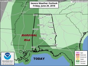
TODAY: Hot & humid again. After dense fog, in spots, in the morning, look for a sun and cloud, mix. Temperatures will soar into the mid 90’s again, but, the dewpoint is a little lower, so the heat index will be closer to the 100 to 103 range. Scattered afternoon and evening storms will be roaming around, at random. Some of the stronger storms could produce damaging wind gusts, especially over the western counties. The Storm Prediction Center targets much of west Alabama and Mississippi for a Marginal Severe Risk.
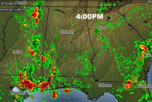
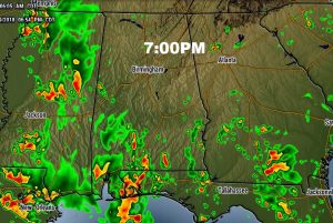
FUTURE RADAR: Briefly, I want to give you a little quick peak at possible future radar snapshots from later today. It appears the best chance of the more concentrated storms may be in the western and coastal counties today. This is just a general idea for guidance proposes.
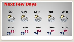
NEXT FEW DAYS: The weekend will not be a washout, but there will be a generous supply of showers and storms, especially Saturday, Sunday and Monday. Highs will be mostly in the lower 90’s. Storms will still be around next week, but they will thin out just a bit Tuesday and Wednesday for your 4th of July holiday plans.
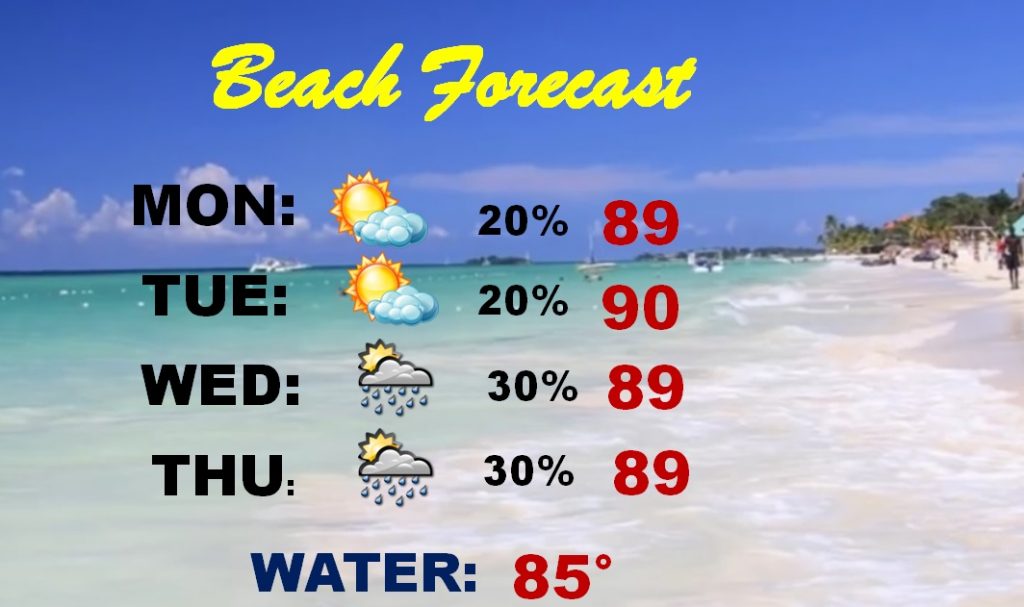
BEACH FORECAST: No doubt about it, you may have to dodge raindrops from time to time, this weekend, on your beach trips. It won’t rain all the time, but the rain chances are high.
—
I’ll have another blog update for you tomorrow and Sunday morning . Have a nice Weekend!
Rich
