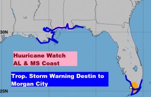
This is significant update from the National Hurricane Center on Tropical storm Gordon, officially named at 7:30AM this morning. Two important changes. The intensity forecast has increased to near 70 mph before landfall Tuesday evening. Therefore, a Hurricane Watch has been issued for the Alabama and Mississippi Gulf coast. The Tropical storm warning has been extended from the Okaloosa/Walton county line westward through the Alabama and Mississippi coast to Morgan City, LA.

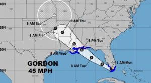
Here’s the new cone on Gordon, currently lashing south Florida with 45 mph winds and heavy rain.

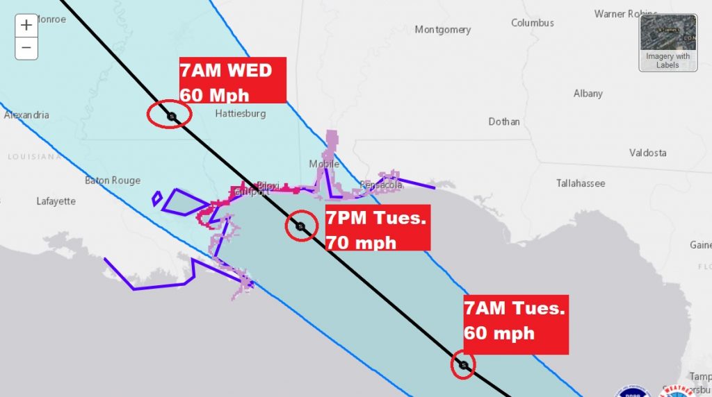
Close up on the cone showing a maximum intensity of 70 mph Tuesday evening prior to landfall on the Mississippi Gulf coast, moving northwestward. Still with 60 mph winds well inland on Wednesday morning. Keep in mind the right side of the storm is the stronger side.

Extremely heavy rain with a flooding potential will also be a good bet with Gordon, as well as the threat of tornadoes on the right side of the track Tuesday evening through Wednesday.
—
More blog updates as needed. A complete video will be out in the morning at about 4:45AM.
