There’s much to talk about. Cooler air is overspreading the state. The first of two cool fronts this week is moving through the state. But, even more important, there are more and more signs that rain chances will improve quite a bit next 4 days. In fact, there could be a significant rainfall even in our state Tuesday. A strong cold front in the middle of next week will usher in Much Cooler air. Jacket weather nights are in the future, later next week. Big changes are in store for our stagnant weather pattern. Early this morning, the weakening cool front is moving into southeast Alabama.
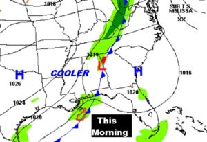
TODAY: The weak cool front moving through the state doesn’t even have showers associated with it. Today will be comfortable. Considerable cloudiness. High upper 70’s to near 80. Northwest wind 6 to 12. It will feel like Fall.
TONIGHT: There will be a big contrast across the state of Alabama. North Alabama will fall to the low to mid 40’s with clearing skies. South Alabama will be much warmer in the 60’s, due to cloudiness, and the position of the weak, stalled font. Low temperature in Montgomery 59. A few showers could start to pop up overnight in the southern and central counties.
SUNDAY: What’s called and “overrunning” situation is setting up. High level moisture rides up and over the front near the coast. With cool air next the surface, it sets up a perfect environment for patchy light rain to develop Sunday and Sunday night. Highs will be confined to the 70’s
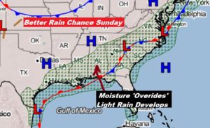
TALLADEGA SUNDAY: Take a jacket. High near 70. Patchy light rain is possible at times. The main cup race starts at 1PM.
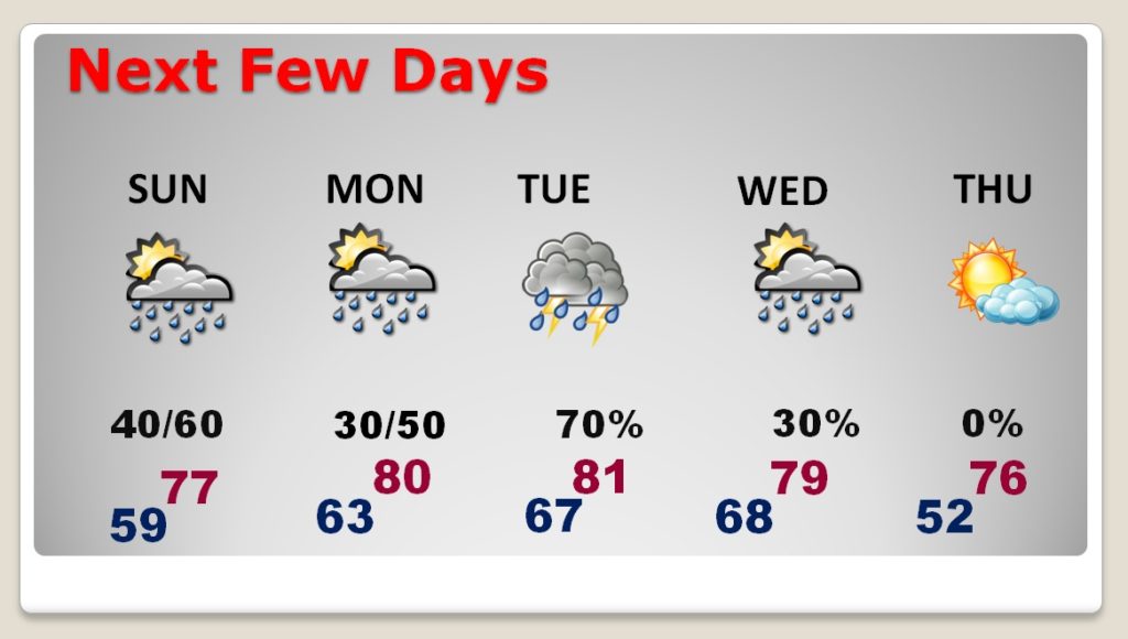
NEXT FEW DAYS: Scattered showers will be around on Columbus Day, Monday. The best chance of significant rain and thunderstorms will be Tuesday ahead of a strong cold front. Right now it appears the severe weather threat is small, but not zero. The front moves through Wednesday morning, shutting off the rain. Much cooler air overspreads the area by Wednesday afternoon and Wednesday night. The ‘REAL DEAL’ Fall Air will be in place for the rest of next weekend.
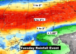
SIGNIFICANT RAINFALL TUESDAY?: We are in a significant drought. We desperately need raindrops. The BEST chance for significant rainfall will be Tuesday, along and ahead of a strong cold front. Many places could see 1 to 3”. Some spots in north central Alabama could see 3-4”+.
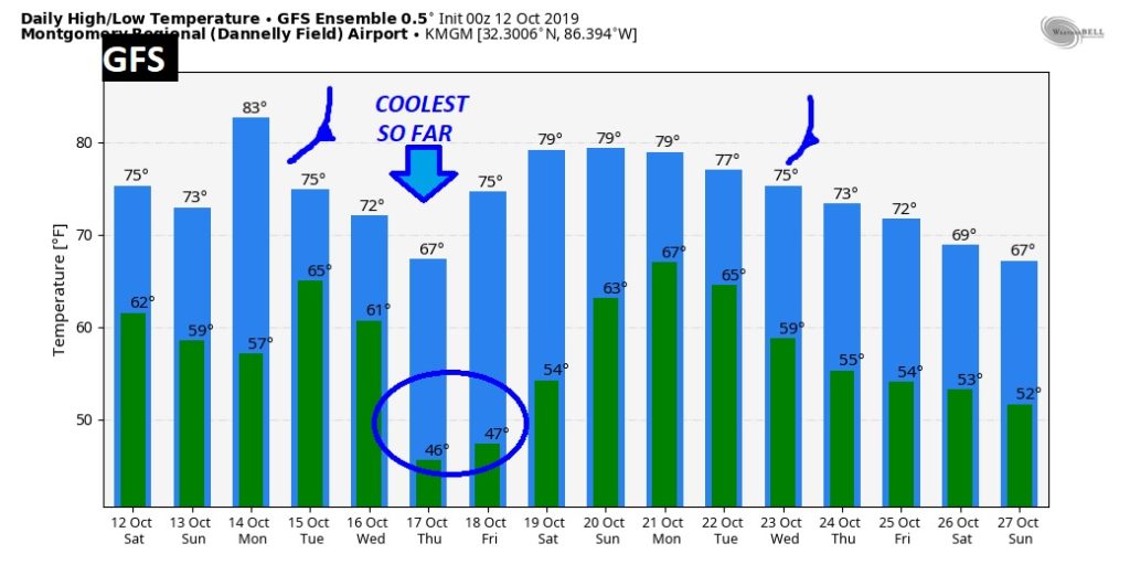
LONGER RANGE: Please remember…when I show you a graph like this….it is NOT a forecast. This is RAW temperature guidance from the United States Global Model Ensembles called the GFS. We never look at specific numbers. We only look at trends. The TREND this week, behind the Wednesday cold front, will be the coolest air we have seen this fall, by far. Looks like jacket weather nights and mornings.
—
I have Fair Duty today from 12 to 2 at the Alabama National Fair. After that, I’ll be watching football… I hope you have a great Saturday.
I will have another Blog update tomorrow morning. Have a nice weekend!
-Rich
