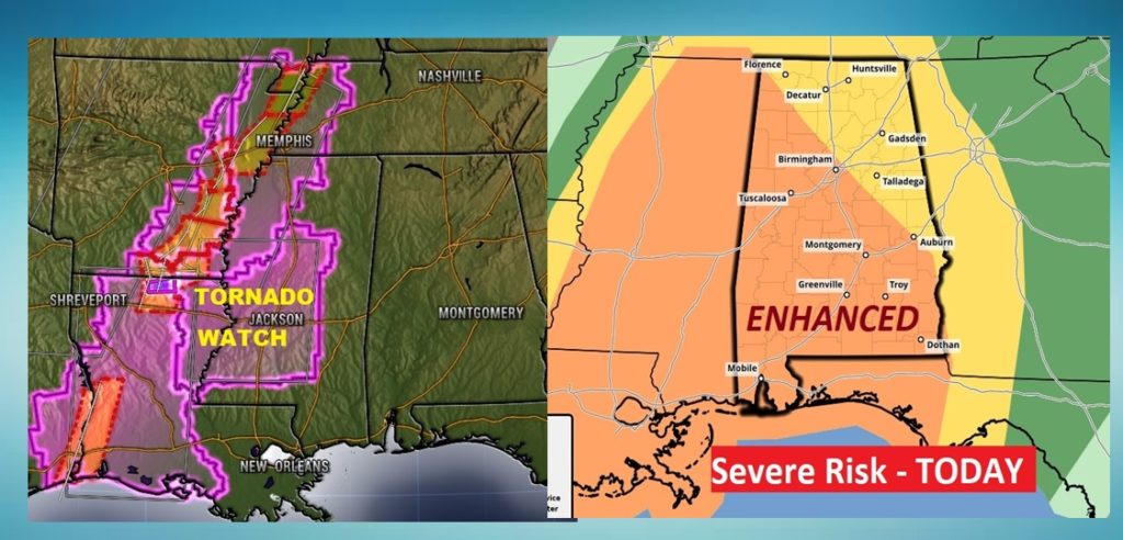
Consensus of latest guidance clearly indicates that previous
forecasts are on track with little changes needed other than minor
timing changes. Confidence continues to increase that an intense
QLCS producing widespread damaging winds with isolated gusts to 70
mph possible and embedded quickly developing tornadoes with a
couple strong tornadoes possible. Extensive pre-frontal severe
QLCS has developed as expected, extending from Illinois to the
Texas Coastal Waters with confirmed reports of damaging winds,
a recent TDS east of Shreveport, and a measured 70 mph wind gust
near Beaumont TX. This QLCS will continue to maintain itself
and/or intensify as it encounters a large area of 1500 J/kg of
SBCAPE over Louisiana and Mississippi and the upper trough becomes
more neutrally tilted. This potent shortwave trough will lift
northeastward to the Mid-South by this evening, taking on a
neutral tilt at mid-levels and a negative tilt at upper-levels.
It will be accompanied by a 120kt mid-level speed max behind the
QLCS, with 80-85kts of mid-level flow in closer proximity to the
line, and a 70kt southerly 850mb LLJ. A current broad area of low
pressure will consolidate into a 1000mb deepening surface low, and
the pre-frontal QLCS will continue to race eastward across
Alabama during the day today.
Regarding timing, did bump the start time up to 9 AM mainly for
the far northwest counties based on the current line orientation
and radar extrapolation, but most areas will see the threat hold
off until after 11 AM. Also changed the end time to 7 PM as the
line should be in Georgia at that time. Some argument could be
made for upgrading the risk to moderate, but don`t want to get too
caught up in risk levels as everyone should take this seriously
regardless. Severe thunderstorm warnings should also be treated
seriously given the strong wind potential and potential for
tornadoes to spin up with little lead time, and especially mobile
home residents and those with many trees near their home should
consider moving to a safe place even for severe thunderstorm
warnings. Brief heavy downpours along the line may cause minor
flooding of poor drainage areas, but short duration of heavy rain
at any one location should prevent much of a flooding threat. Have
already seen a couple 35 mph gradient wind gusts in our area,
with several sites recording 35-45 mph gusts across Mississippi
and Louisiana so the wind advisory remains on track.
