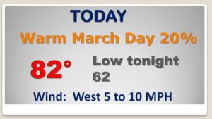
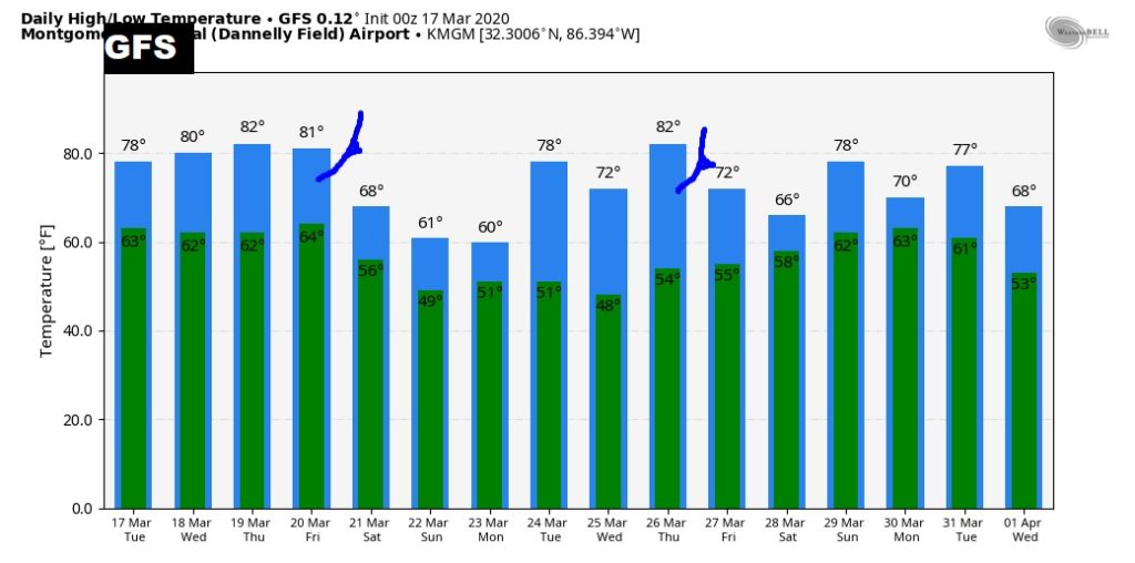
Happy St. Patrick’s Day! We have been in the 80’s for several days straight. Today will be day six, and this warm pattern will continue until the end of the week. Spotty showers, and perhaps some thunderstorms will dot the radar screen this afternoon and this evening. On this video, we’ll look ahead to a big change. A frontal system will approach the state Friday. Showers and storms will increase. Much cooler air will follow. How will that affect the weekend? How much will rain will fall? Plus, I have an update on the pollen. Spoiler alert: things will get worse before they get better.
A weak front in the state today will act as the focus for a few spotty showers…maybe a thunderstorm. Highs in the 80’s for the 6th day in a row
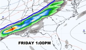
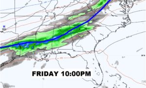
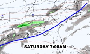
Our string of highs in the 80’s will continues until Friday. MUCH cooler air for the weekend. Showers and thunderstorms are most likely by late Friday into Friday night and early Saturday.
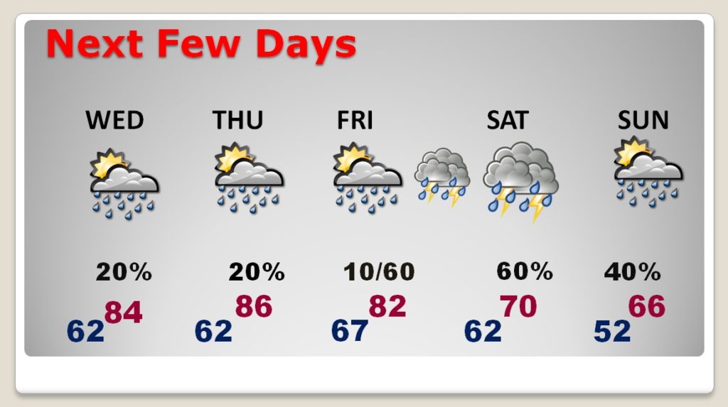
COLD FRONT will bring is a band of showers and thunderstorms during the day Friday and especially Friday night into Saturday morning. MUCH cooler air will follow.
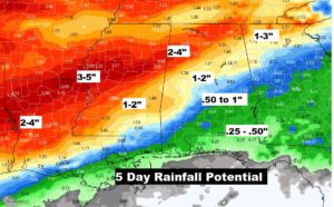
Rainfall over the next 5 days will be heavier across the northern counties of our state. Lighter amounts area expected in South Alabama.
Cold front number one brings a significnat temperature drop by the weekend. Another cold front is about a week away.
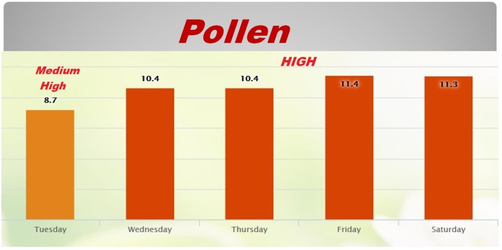
The pollen situation, unfortunately, will get worse before it gets better.