
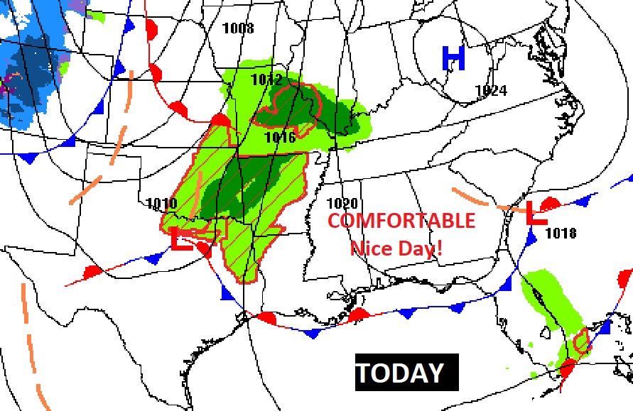
Good Morning! If you liked yesterday, you’re going to love today! It will be comfortable, and beautiful. Enjoy!
The next cool front sweeps through the state tomorrow. Tomorrow will be comfortable, with a sun and cloud mix and only a small chance of a stray shower, with the front.
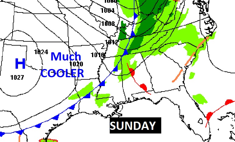
Much cooler air overspreads the state Sunday night, just in time for a new of week which will feature cool days and chilly, jacket nights.
TODAY: Sunny and nice. Low humidity. Comfortable. High 77. Winds will shift to the southeast this afternoon at 5 to 10 mph. Partly cloudy tonight. Patchy fog late low 56.
SUNDAY: Nice day. Sun & clouds mix. Rain chance tiny, but not zero. 20% risk of a stray shower. High 76-79. Mostly clear Sunday night. Colder. Low 45.
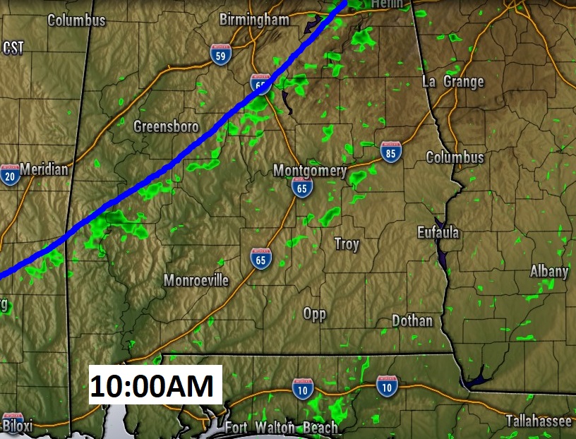
Here’s a future radar snapshot at 10:00AM Sunday, as the front sweeps through the state.
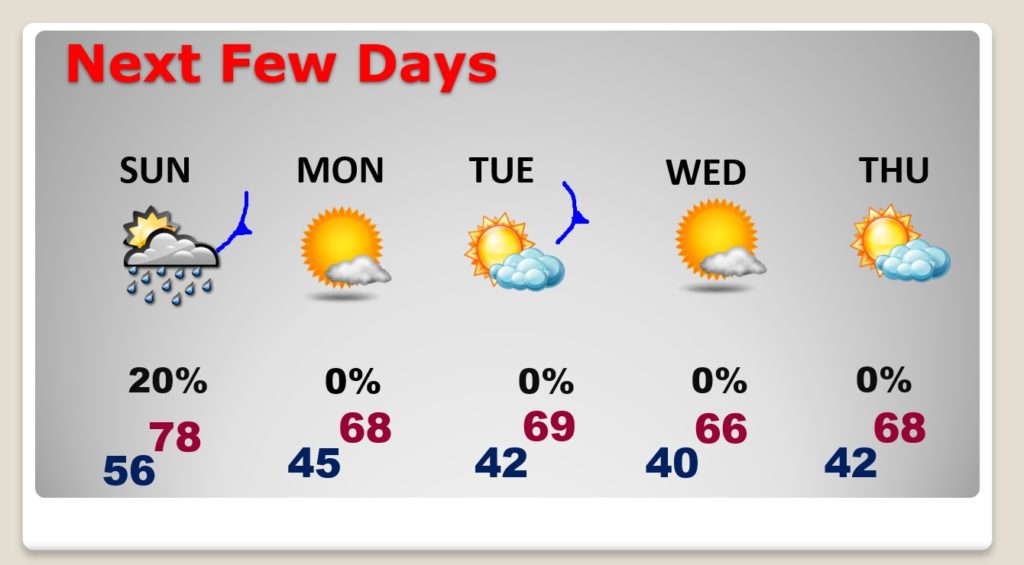
NEXT FEW DAYS: COOL week. Highs in the 60’s Monday through Thursday. Dry. Lots of sun. Cold nights. Another re-enforcing cold front moves through Tuesday. No rain this week.
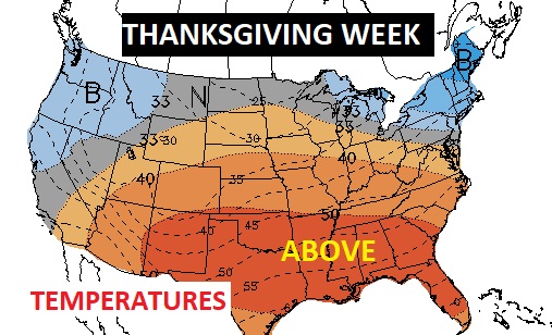
LONG RANGE: The Climate Prediction Center continues to advertise a Warmer than normal Thanksgiving week for much of the nation.
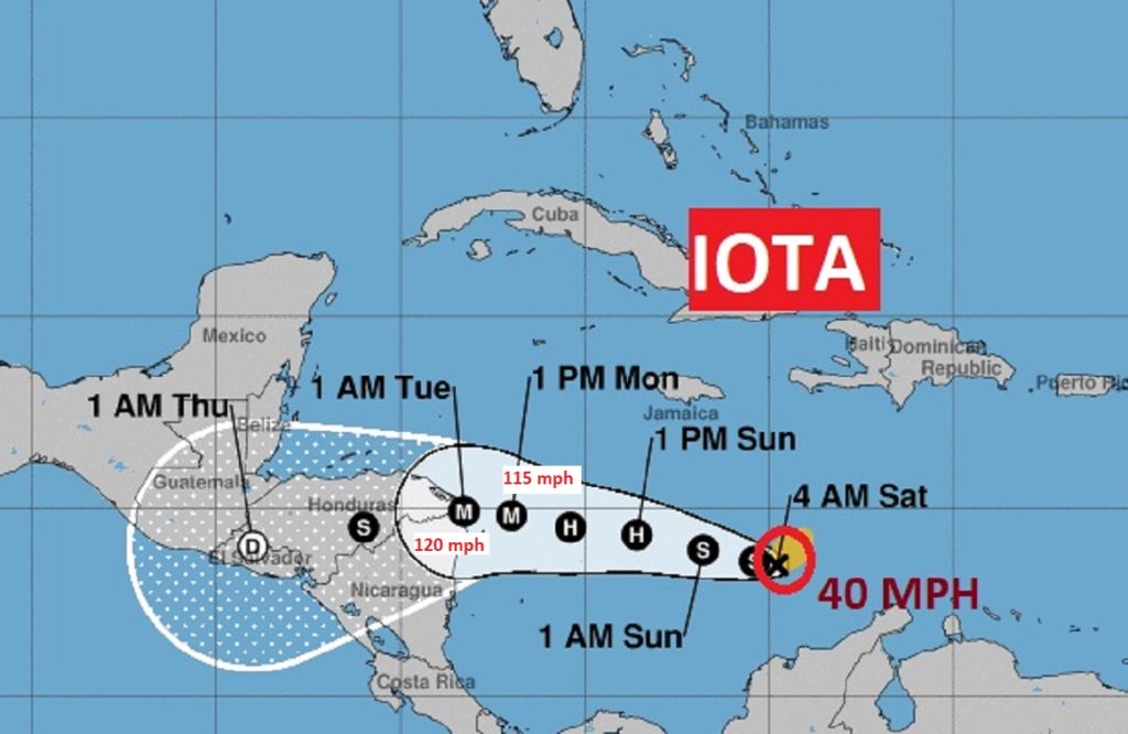
IOTA WILL BECOME A MAJOR HURRICANE: I’m sorry to say that Iota will unfortunately kill a lot of people. Only a few days after Eta killed hundreds due to flooding in Central America, Iota may do exactly the same thing. This morning, it is a minimal tropical storm with 40 mph winds. It could become and extremely dangerous Category 4 hurricane before Monday landfall. Iota has already made history, becoming the 30th named storm. An all-time record. Previous record was 27 storms in 2005.
THANK YOU FOR YOUR INPUT:
—
I hope you enjoy this comfortable first full weekend of November. I’ll have another Blog update early tomorrow morning. Stay safe and warm.
–Rich