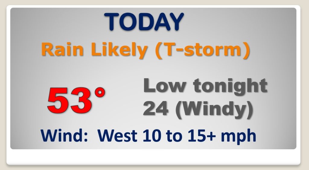
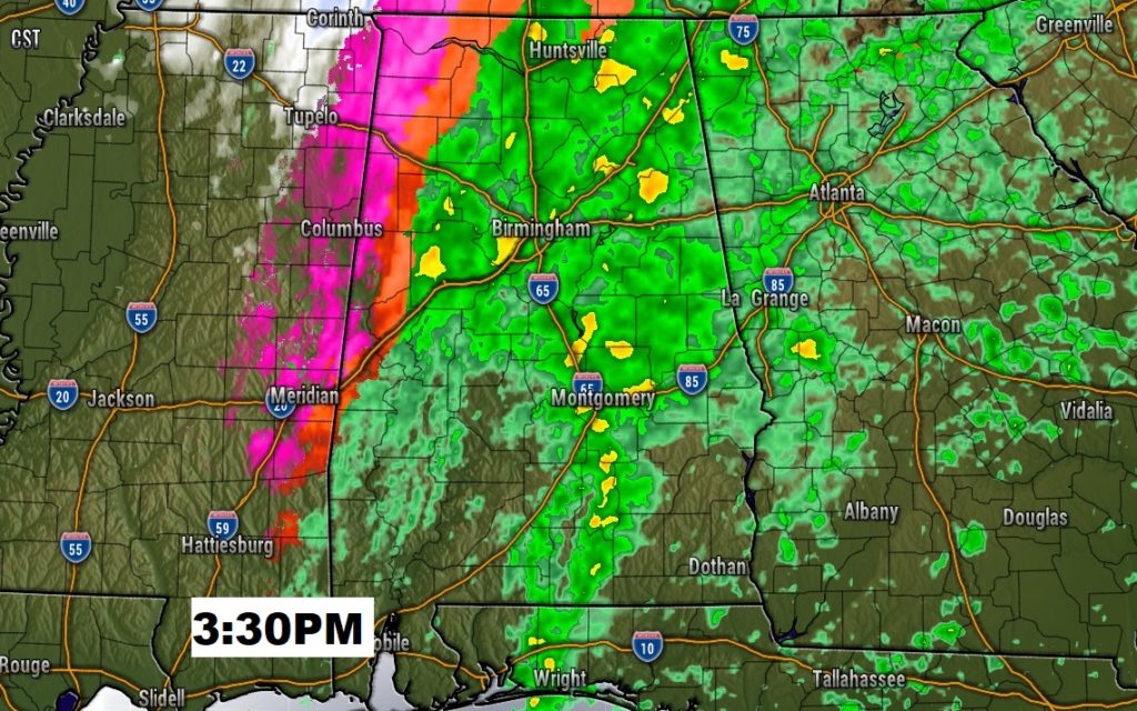
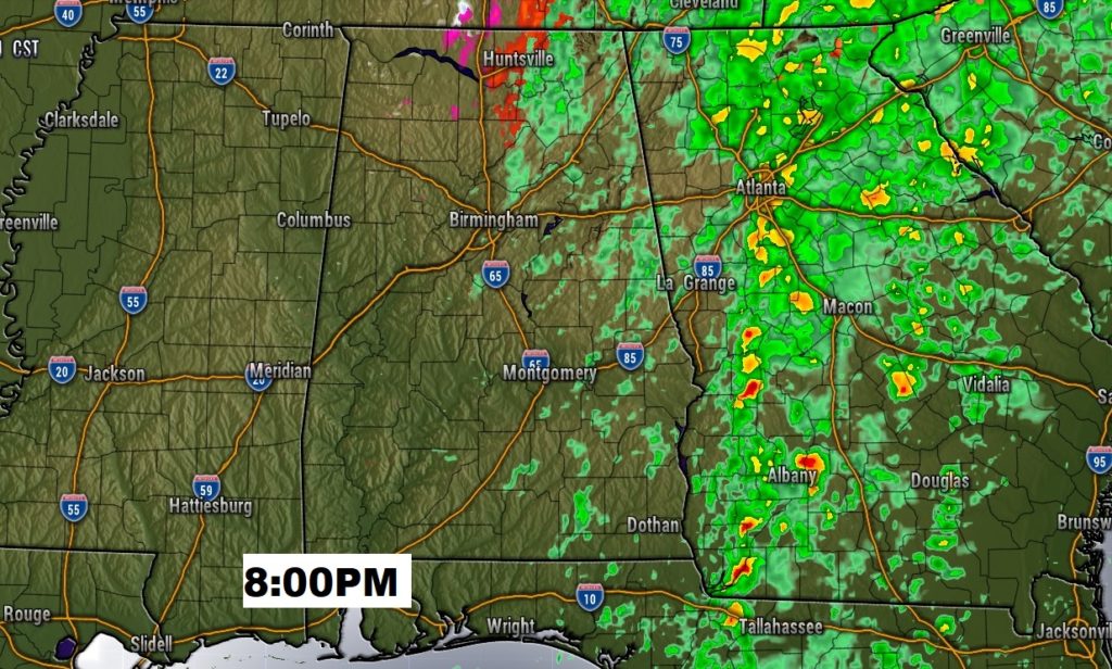
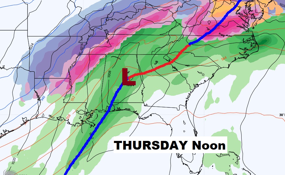
Good Morning! Historic Cold Arctic Air grips much of the nation. Winter precipitation impacts may cause significant travel impacts for parts of western and NW Alabama today and tonight. For the rest of us, rain today will end tonight. After the rain dramatically colder air will funnel in. But, hang on. There’s another storm system which needs to be watched. I’ll walk you through the details on today’s video.
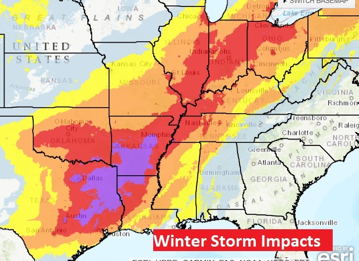
HISTORIC COLD Arctic Air dominates much f the nation. Some cities are seeing the coldest temperatures in 35-40 years. Some places in the Heartland are seeing their All-Time-Coldest readings. Making matters far worse — a band of snow and ice causing significant to extreme impacts from Texas to the Great Lakes, and into the northeast.
Even some parts of west and northwest Alabama will be effected by accumulating ice which could make travel nearly impossible. (Especially in northwest Alabama)
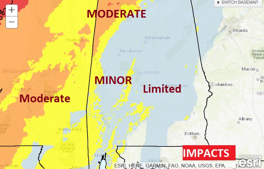
Fortunately for most of us in central and south Alabama, the precipitation will end before the temperature falls below freezing tonight.
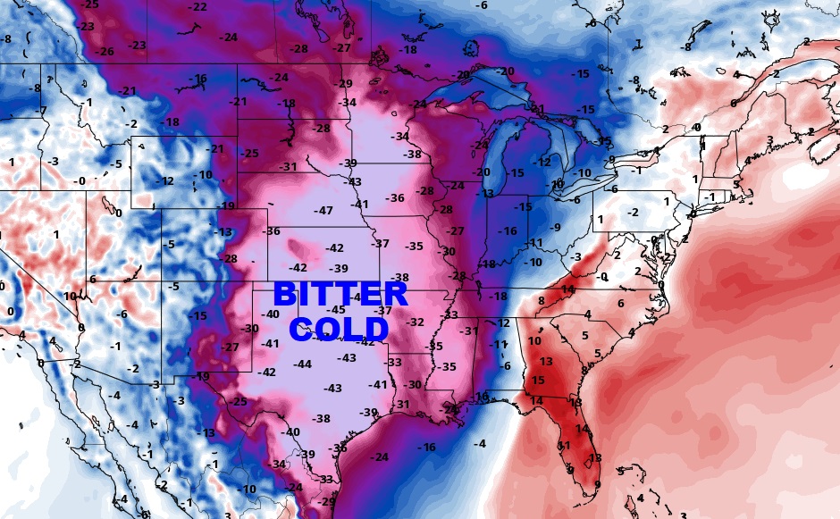
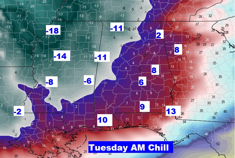
This map speaks for itself. This is Wind Chill tomorrow morning. Single digits in the River Region. Below zero in west Alabama.
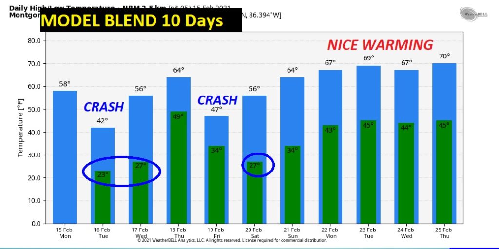
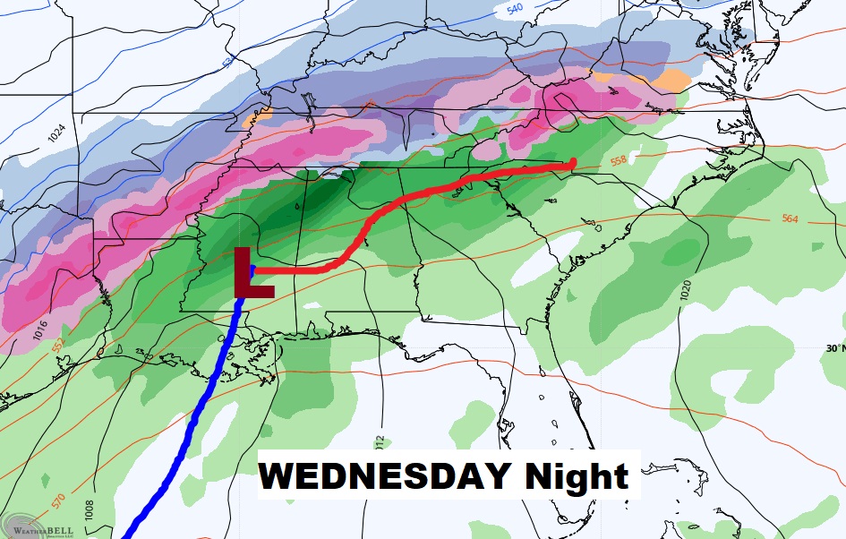
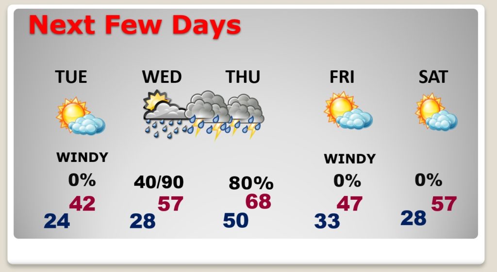
Windy and COLD Tuesday. 20’s Tuesday & Wednesday morning. Another storm system Wednesday night/Thursday. Showers and storms. Sharply colder Friday.
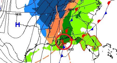
Another storm system Wednesday night/Thursday. Showers and storms. Possibly strong to severe storms, in the warm air sector in central and south Alabama.
Temperature crash tonight and Tuesday. Another crash Friday behind the Thursday storm system. NEXT week looks netter. Nice warming.
