Good Morning! A stalled front in south Alabama will be the focus for more rounds of showers and storms, at times, today, tonight and Wednesday. There could even be a few stronger storms toady mainly from I-85 southward. Thursday will be a day of transition. There could be some leftover showers. But, hang on. By Friday we should see some nice changes in our weather pattern
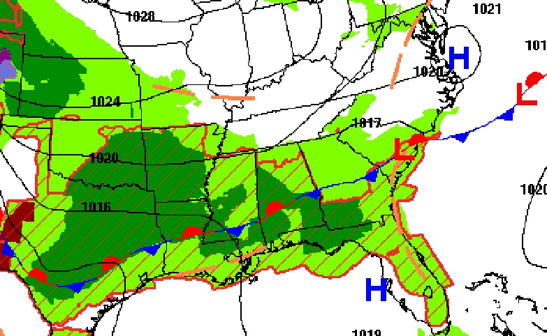
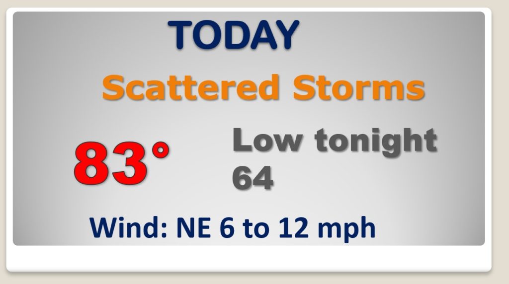
Wet at times today and tonight. A few stronger storms can’t be ruled out. A stalled front in south Alabama is the culprit.
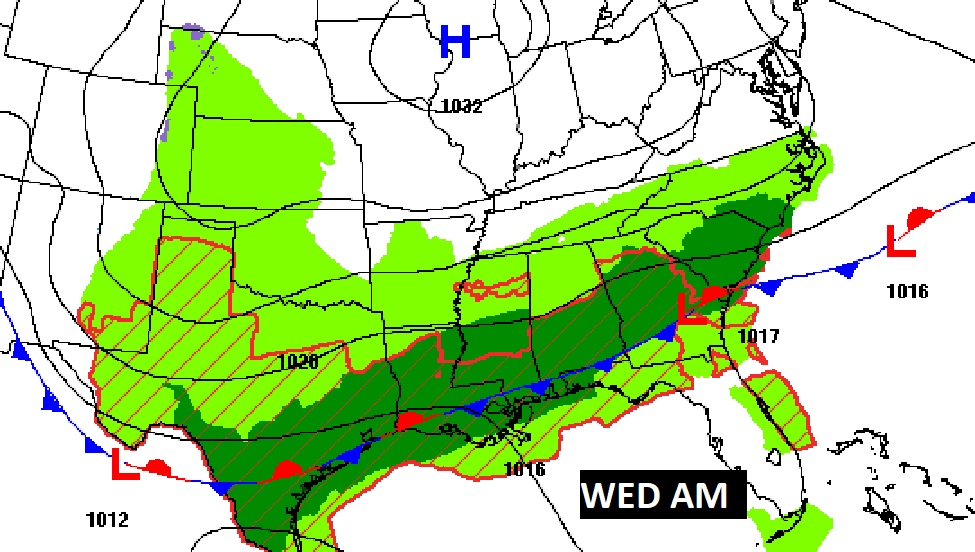
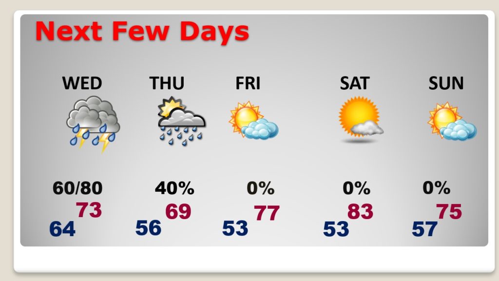
Our wet/active pattern continues Wednesday. Some leftover showers are possible Thursday. Friday starts a very nice pattern. Great Weekend.
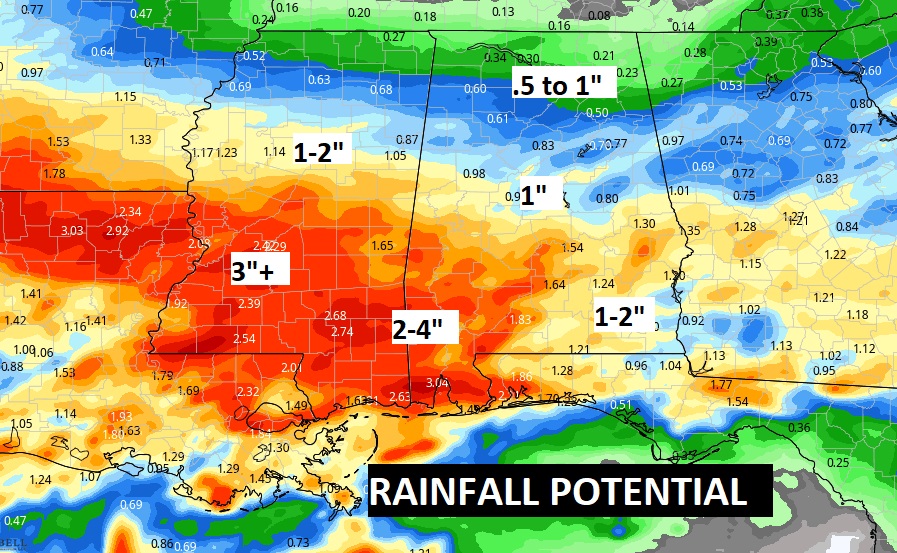
Heaviest rain over the next few days will be across south Alabama.
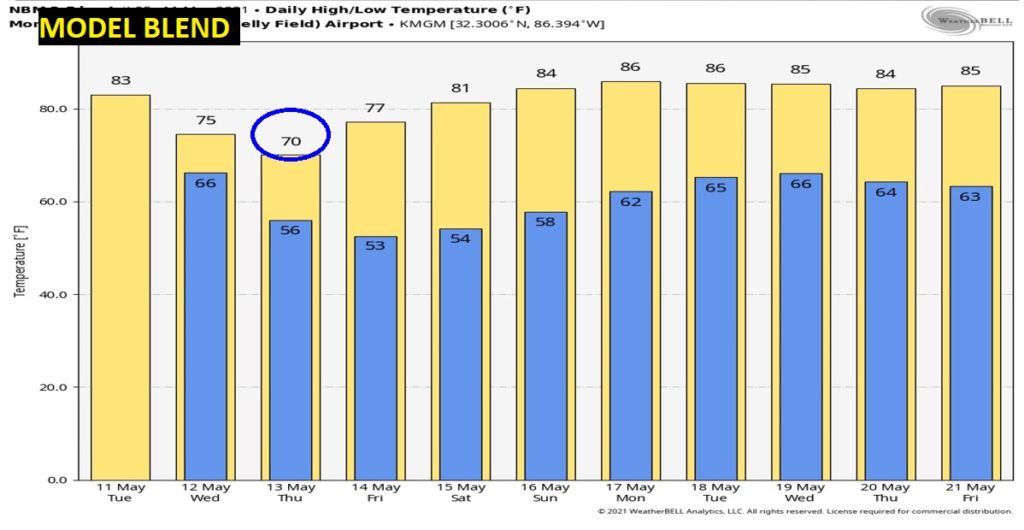
Warming trend begins Saturday and continues through next week.
