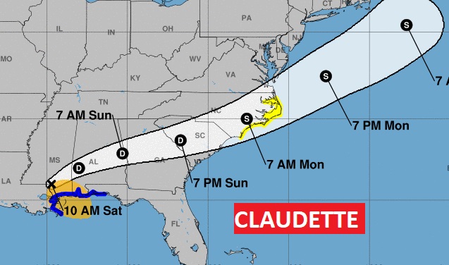
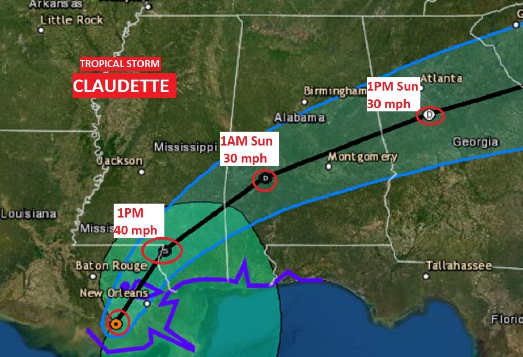
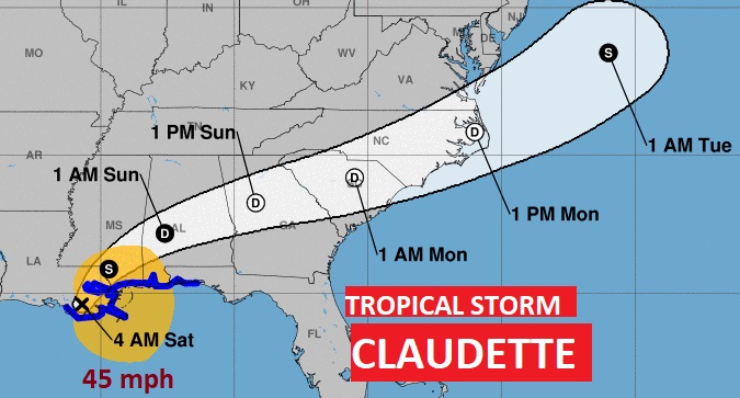
NHC still has Claudette as a minimal tropical storm with winds of 40 MPH, 75 miles NNE of New Orleans, moving NNE at 14 mph. Interesting. They have Claudette becoming a Trop. storm again over land in the Carolinas Monday morning before reaching the Atlantic.
9AM:
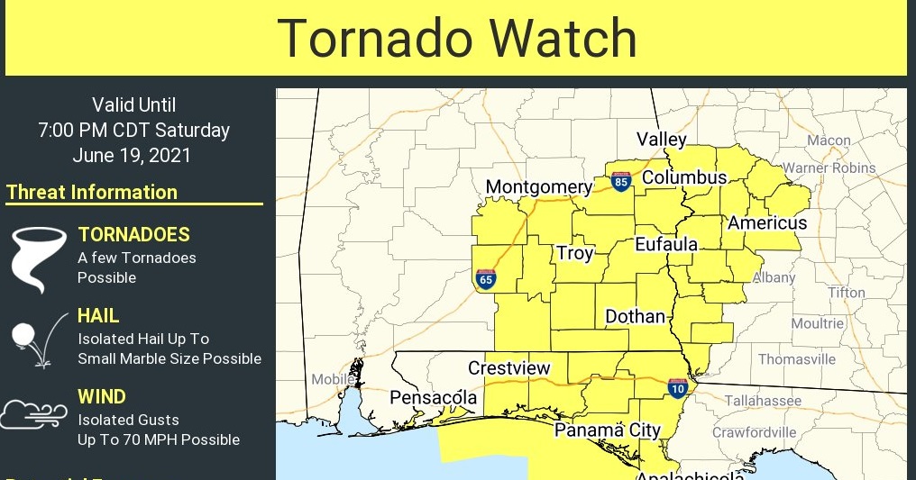
A new tornado watch has been issued for all of Southeast Alabama until 7PM tonight. The watch area goes as far north as Lowndes, Montgomery, Macon and Lee counties. A few tornadoes possible. Isolated wind gusts to 70 mph. Small hail possible. Associated with the rainbands around Tropical Storm Claudette.
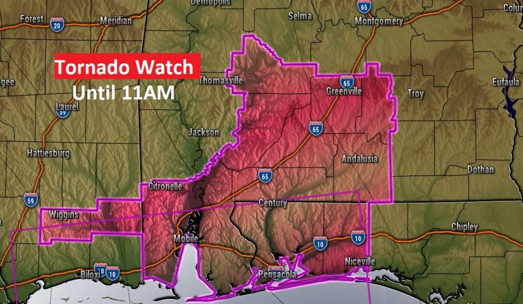
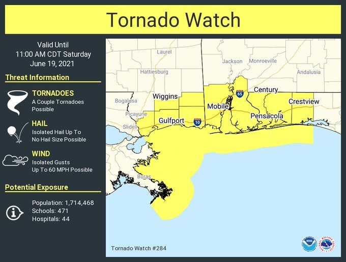
The South Alabama Tornado Watch, until 11AM, has been EXPANDED and now includes Butler, Crenshaw, Wilcox, and Monroe counties.
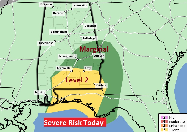
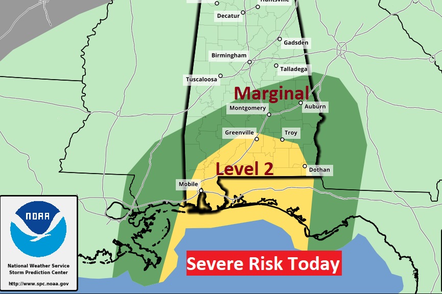
UPDATED SPC Severe Outlook for today. Notice how the Severe Risk is displaced so far EAST of where Claudette is located north of New Orleans. Greatest tropical tornado threat today is along and south of a Greenville/Troy line today. Marginal Risk as far as Montgomery. Quick spin up tornadoes.
Good morning! We now have a name. Tropical Storm Claudette is christened. Early this morning, the system is inland over southern Louisiana. It is going to be a big trouble maker for Alabama today. Expect bands of heavy tropical rainbands, which can and will produce locally flooding rainfall amounts today and tonight.
Central and south Alabama will be on the eastern side of the track, which also means, brief “spin up” tropical tornadoes are possible. Watches and warnings are certainly a good bet, particularly in south and southwest Alabama.
The heaviest downpours will occur today, tonight and Sunday morning. However, the risk of more scattered showers and storms will continue Sunday afternoon and Sunday evening, affecting some Father’s Day plans. And, more rounds of showers and storms will continue through Tuesday. There’s a lot of rain in our future over the next few days.
TROPICAL STORM CLAUDETTE: Finally, all the tropical characteristics came together, for NHC to name this system Claudette. Really, that’s the only thing that has changed. The scenario and expected impacts for Alabama have not changed. We will be on the active east side of this cone today. Tropical Storm Warnings continue from about Morgan City, LA. To near Destin, FL., including all of the Alabama coast. Take a look at the cone. Many of us are right in the heart of Claudette’s cone.
Interesting future for Claudette. After it’s trek across the south, it will emerge into the Atlantic, where it could become a tropical storm again.
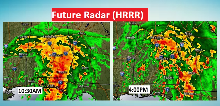
TODAY: Periods of showers and storms will produce some very heavy tropical downpours, as bands of rain rotate through the area. High today upper 70’s Low tonight 73.
Here’s just a couple of Future Radar samples. The system will produce some extremely heavy downpours.
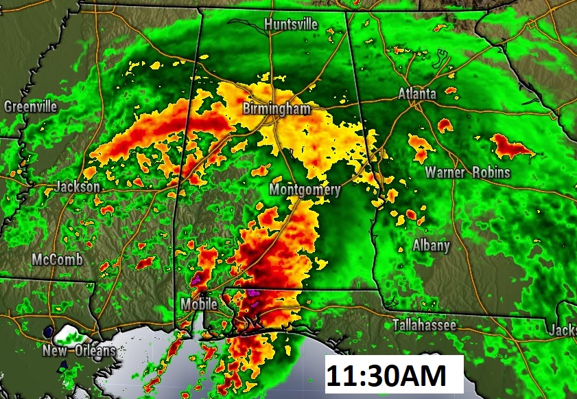
Here’s another model radar sample at 11:30. The NAM model clearly shows some heavier cells near the coast.
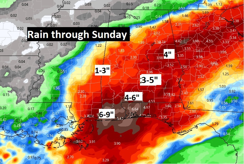
PROJECTED RAINFALL: Tropical downpours from this system will produce 3 to 5” between now and Sunday, and up to 6 to 9” on the coast. A Flash Flood Watch is in effect.
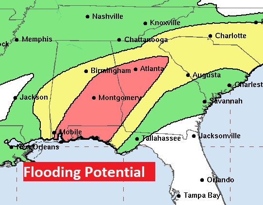
This map gets your attention. Check out the RED area where Flash Flooding is LIKEY today and tonight.
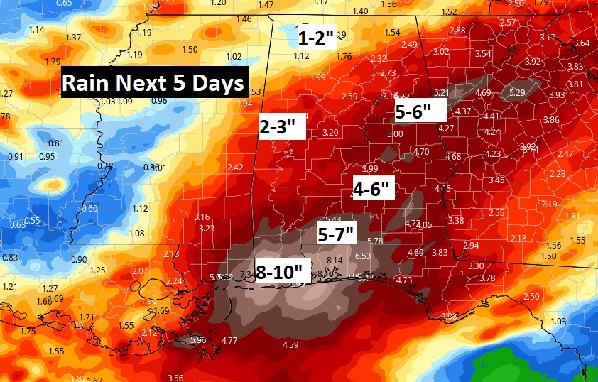
But even after the “Tropical” disturbance departs, the threat of showers and storms will continue through mid-week as a frontal system approaches the area. So, wet times will continue. Total rainfall in central Alabama could reach 4 to 6” and up to 8 to 10” near the coast. Showers and storms will start to thin out Thursday.
TROPICAL TORNADO THREAT: Claudette will cause other problems. On the east side of the track, there will be a threat of a few quick spin-up tornadoes. Frequently these tornadoes are brief, and some can occur with little advance notice. The better tornado threat would be in south and southwest Alabama in the Level 2 “slight risk” area. But, the Marginal Severe Risk covers a large chunk of the state, as far north as Chilton and Chambers counties.
Early this morning, a Tornado Watch extends from south Mississippi through coastal Alabama into NW Florida until 11AM.
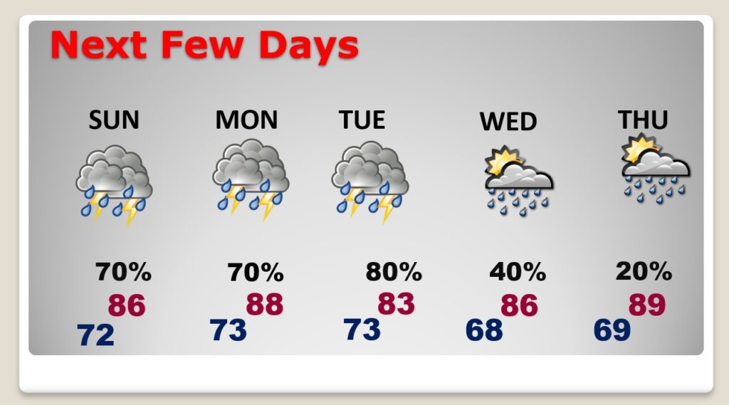
SUNDAY (Father’s Day): The most concentrated left-over bands of showers and storms will occur in the morning. However, the risk of scattered showers and storms will continue Sunday afternoon and Sunday evening. High in the mid 80’s. Low at night 73.
NEXT FEW DAYS: The higher than normal rain chance continues through Tuesday a frontal system approaches the state. The front will reach the coast Wednesday. The rain chances will decline Wednesday and especially Thursday.
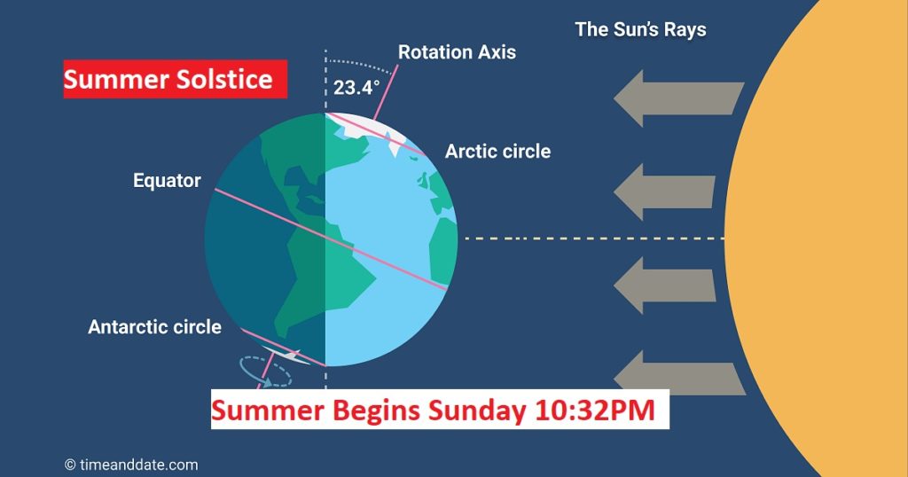
SUMMER SOLSTICE: Today is also the first day of summer, even though we’ve been in a summer pattern for several weeks. Summer officially begins at 10:32 PM tonight. Starting tomorrow, the days will gradually begin to get shorter. Official sunrise Sunday is 5:37 am. Sunset Sunday night is 7:56PM. It’s officially the longest day of the year. (a few seconds longer than Saturday)
.
I will have additional updates, as needed, through today and tonight. And, there will be another complete Blog Update Sunday morning. Our Weather App will instantly alert you for any severe weather watches or warnings for your area. Download it for your phone for free. Just search Rich Thomas Weather in the App store.
Stay Weather Aware!
–Rich
