Good Morning! Rain chances are getting better and better through Friday, at least. The rest of the holiday weekend, depends on a frontal system. Will the front make it all the way through the state or get hung up? I have made some changes in the weekend forecast for here and the Gulf coast. Meanwhile, the tropics are getting more and more interesting. Brand new Invest 97-L could have implications for the United States next week. But where?
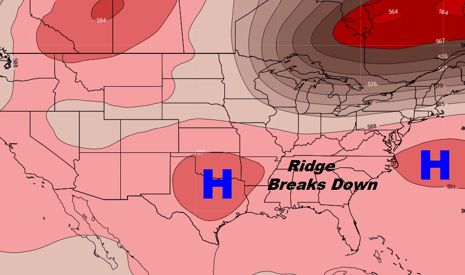
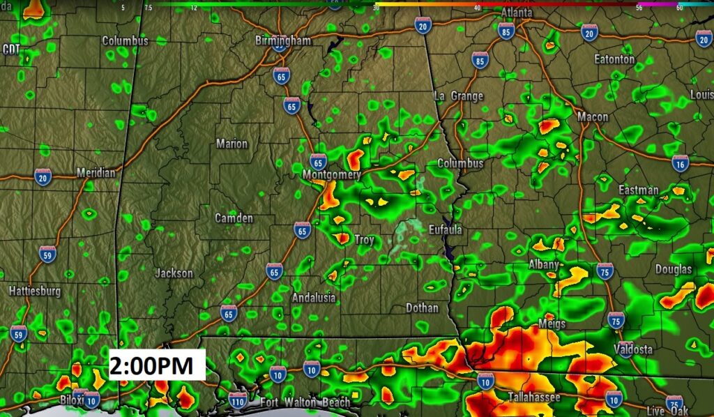
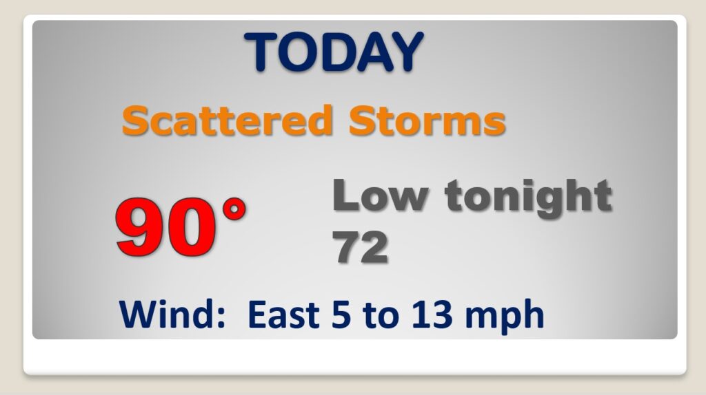
The upper High over us, is starting to break down. So the atmosphere will be more conducive to increased heat of the day showers and storms today and tomorrow.
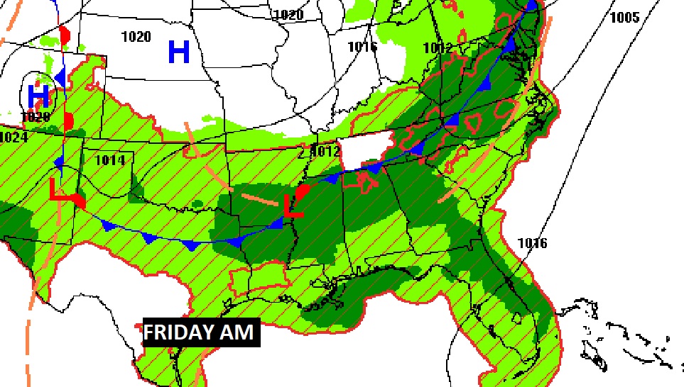
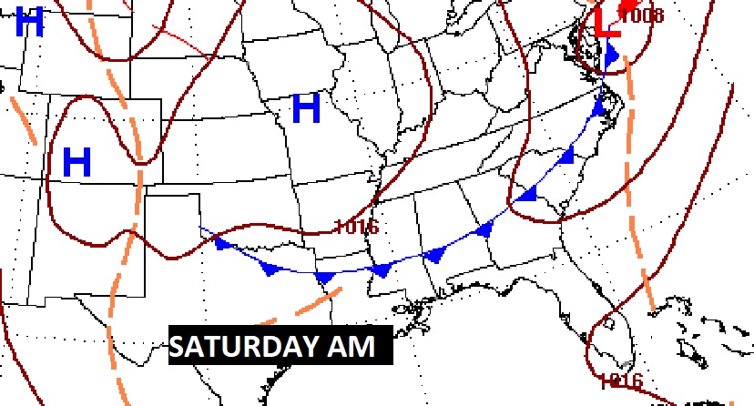
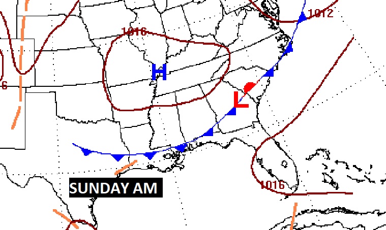
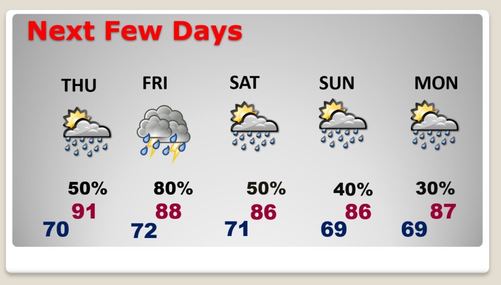
An approaching front will bring a lot of showers and storms to the state Friday, BUT, the exact movement of the front and timing will have HUGE implications for the day to to day rain chance over the Holiday Weekend.
The rain chances will be highest Friday. But the rain chance here in central Alabama for the rest of the weekend, has everything to do with the movement of that front. The weekend rain chances have been tweaked and are up for further review.
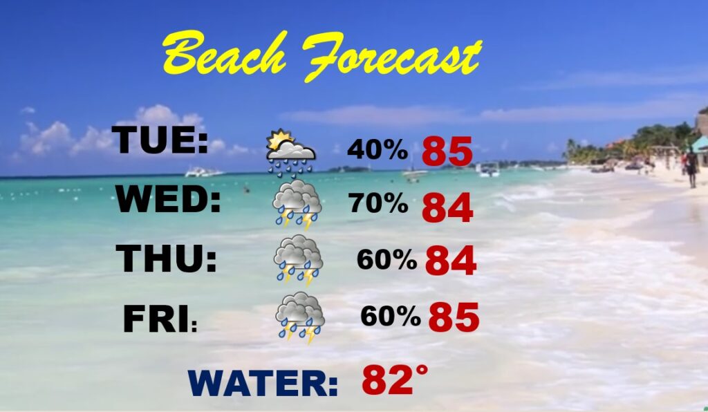
The rain chances down on the coast will be increasing over the next few days and will be quite high over the Holiday Weekend with that frontal system in the neighborhood.
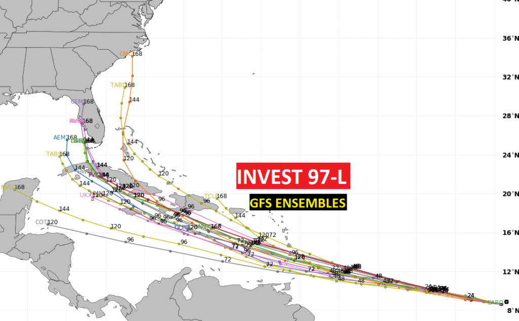
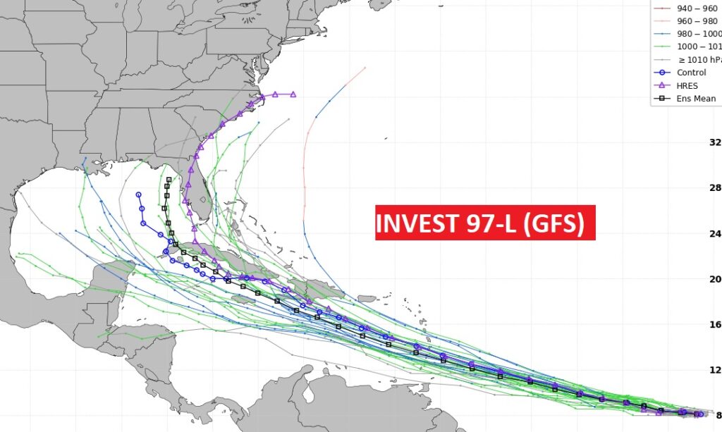
The Tropics are getting more interesting. Brand New Invest 97-L has a 70% chance of developing into a Depression or Tropical Storm Elsa.
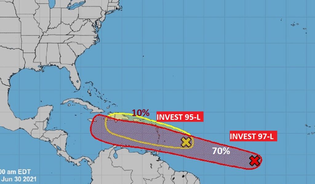
The models show this system could have implications for the United States next week. But where? Stay tuned.
