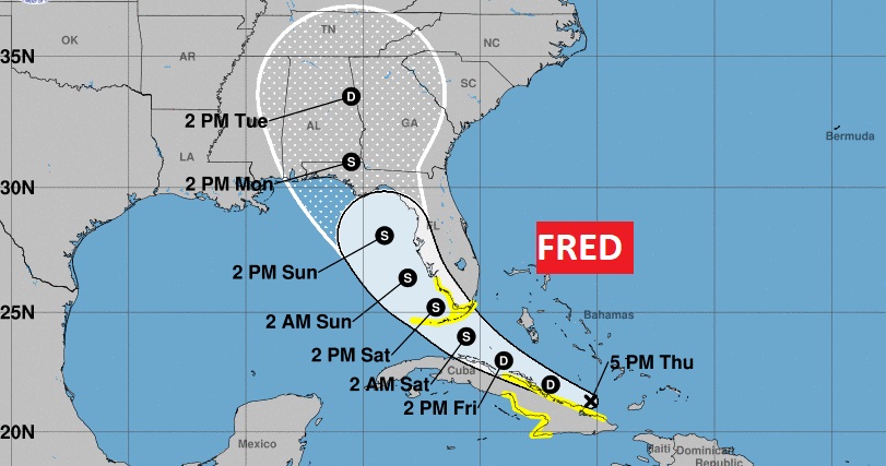
4:00PM NHC UPDATE: Nothing shocking on the new afternoon Fred Advisory from the Hurricane Center. Still a Tropical Depression, riding just north of the Cuba Coast, moving WNW at 12 with 35 mph wind. Expected to regain Tropical Storm Strength within 36 hours, then it will begin to curve Northwest toward the Florida Keys and eastern Gulf of Mexico. Expected to make landfall along the northern Gulf coast perhaps by Monday. Notice the large “Cone of Uncertainty” now engulfing every square inch of Alabama and most of Georgia, extending as far north as beyond Nashville. Still many question marks about Fred’s future intensification in the eastern Gulf. More in the morning on my morning video!
EARLY MORNING UPDATE:
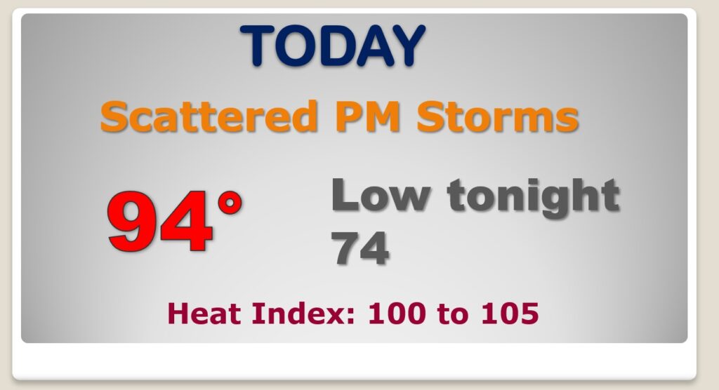
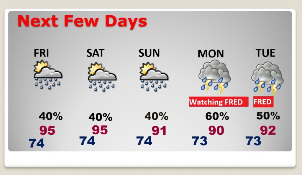
Good Morning! Although the Heat Advisory is gone, the heat & humidity will remain in place. The Heat Index will reach the 100 to 105 range each day through the weekend. Scattered daily storms will continue. Obviously, the concern on everybody’s mind is the future track and potential intensity of Fred. Nearly all of Alabama is now in the cone of uncertainty. Will the track stay east of us, or will the threat shift westward, as some models suggest. I’ll fill you in on what we do know and what we don’t know. Then, there’s Invest 95-L, the future Grace behind Fred. It could bring a similar threat to the United States in several days.
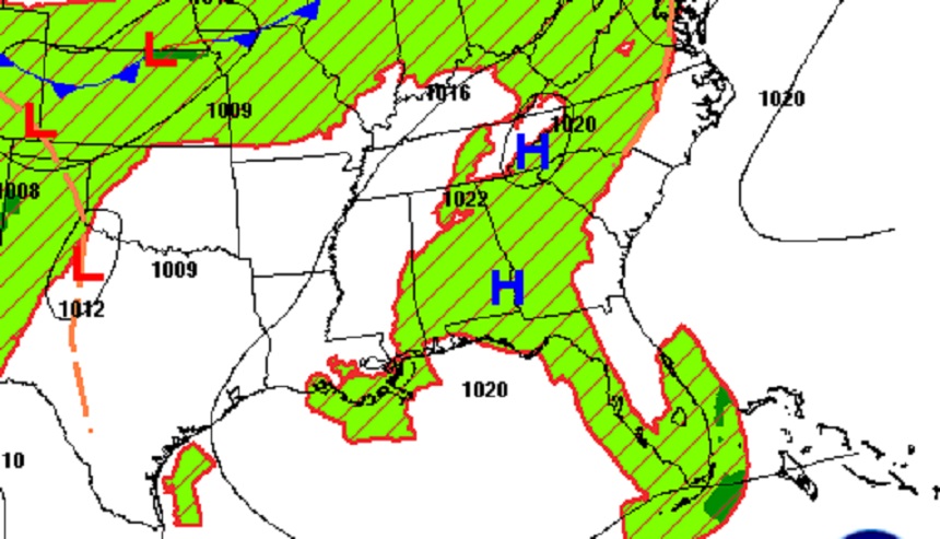
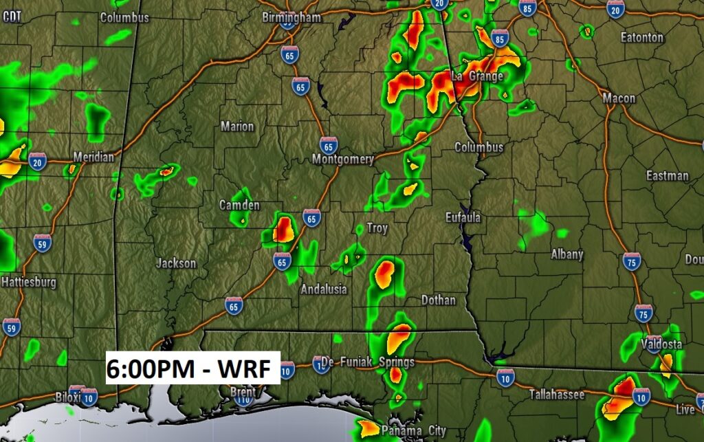
Hot & humid today with a heat index of 100 to 105. Scattered random storms, perhaps not as numerous as Wednesday.
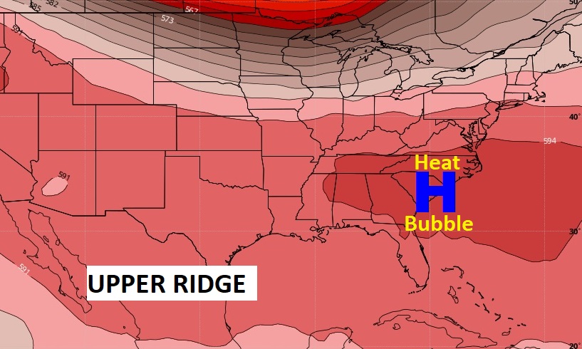
That Upper High Pressure Heat Bubble will continue to influence us through the weekend with excessive heat.
Tropical Depression Fred is a little disorganized this morning after it’s encounter with the mountains of Hispaniola. It will regain it’s tropical storm status Friday in the southeast Bahamas and make a right turn into the Florida keys by the weekend…then into the warm waters of the eastern Gulf. It’s headed for an encounter with the northern Gulf coast by the start of next week. ALL of Alabama, Georgia and Florida are in the cone of uncertainty. Although NHC has Fred as a Tropical Storm at landfall, it’s not totally out of the question that it could become a Hurricane. The forecast cone will shift with time. Which way? We just don’t know.
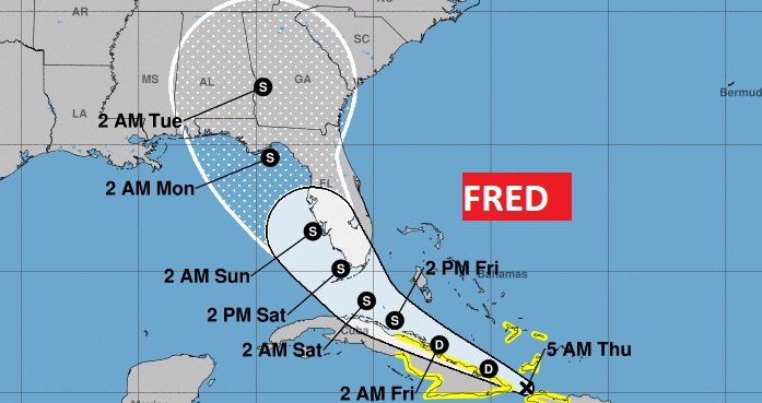
I just want to stress the CONE which cover a lot of real estate. All of us are potentially at risk from Fred.
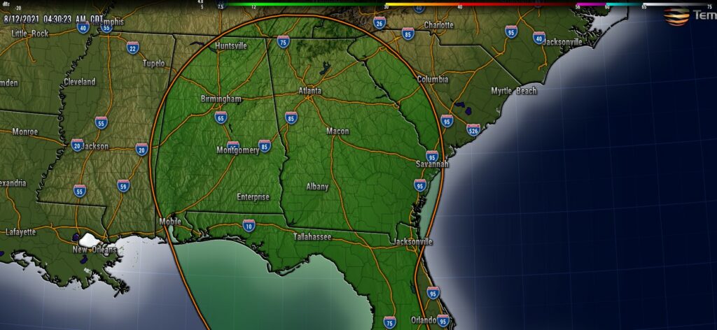
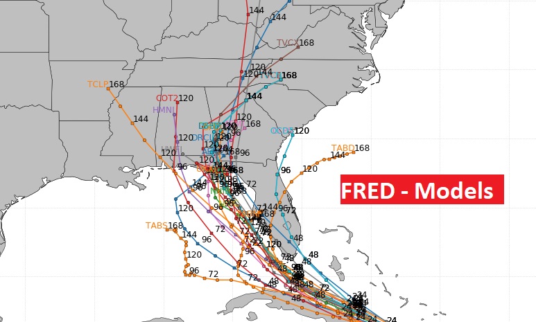
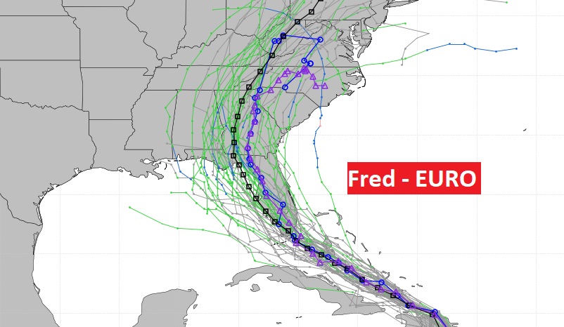
Just to give you a flavor of the diversity of the model tracks…I continue to worry that Fred’s track could shift west. Some models suggest that. We’ll see.
Little day to day change through Sunday. Highs in the mid 90’s. Random storms. After Sunday, everything depends of Fred.
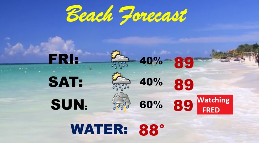
By late in the weekend, more cars will be leaving the coast than arriving, as the Fred threat looms. The entire beach area from Alabama through Florida is in Fred’s cone of uncertainty. Rip current risk will be rising.
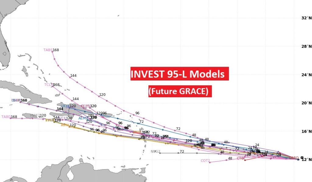
Besides FRED, there is the looming threat of Invest 95-L ….the future GRACE.
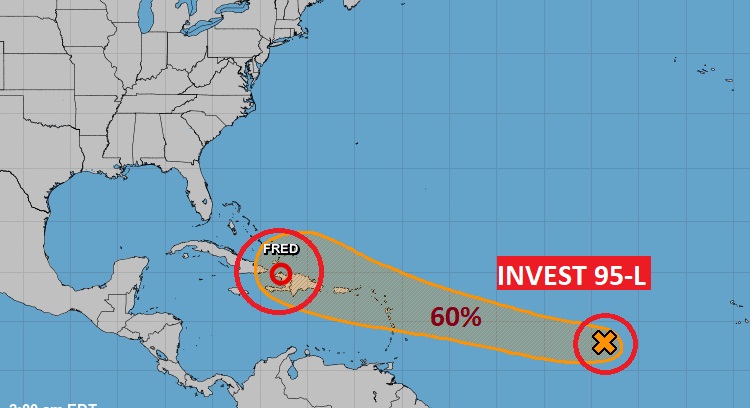
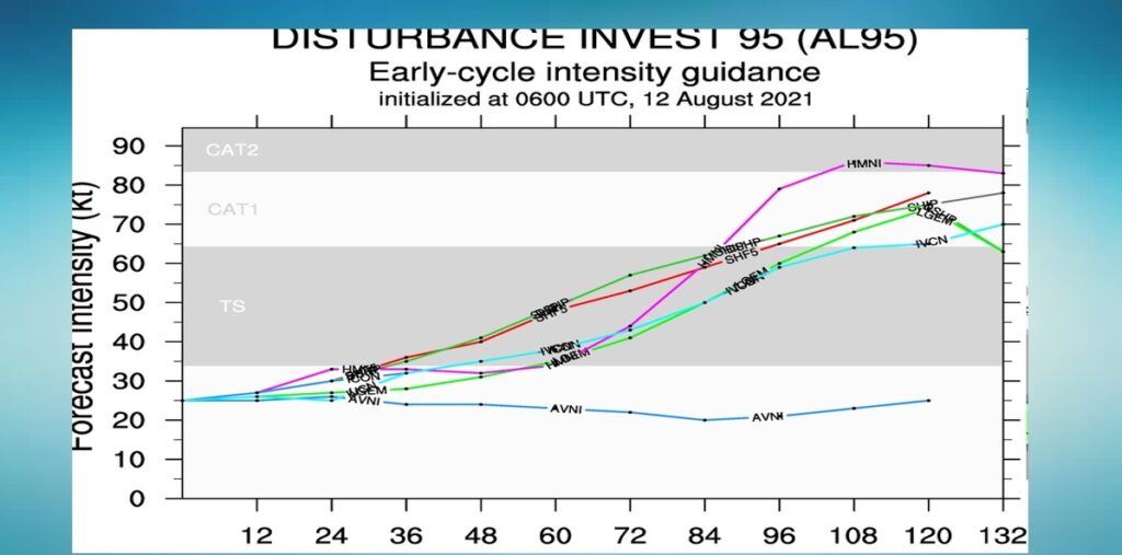
The models are already raising eyebrows about the future of this system…with the track and potential intensity. GRACE could become a big deal.

