4PM NHC Fred Advisory:
.
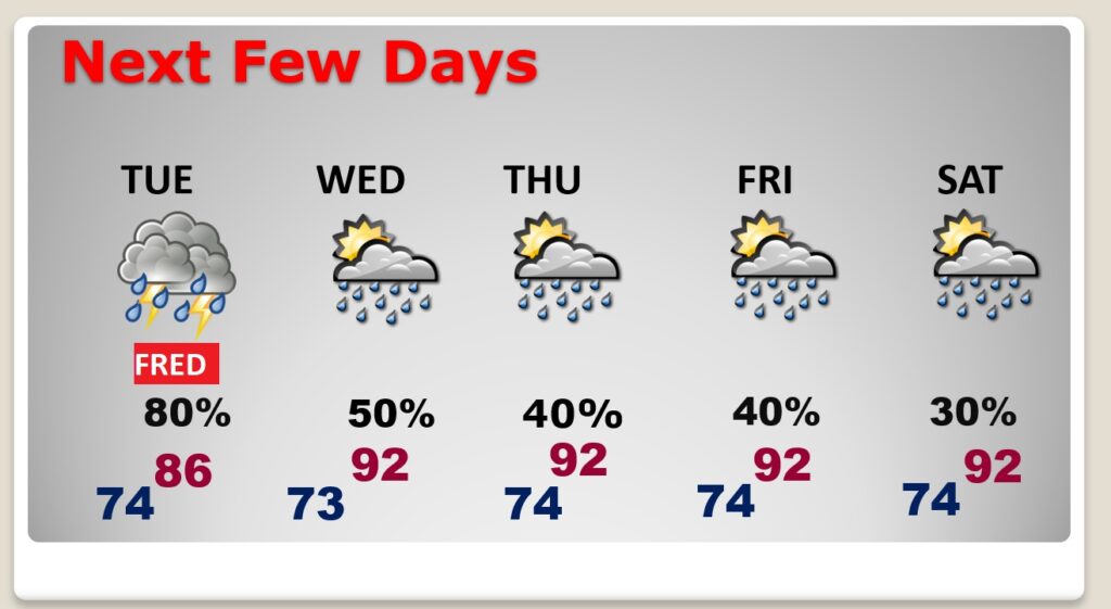
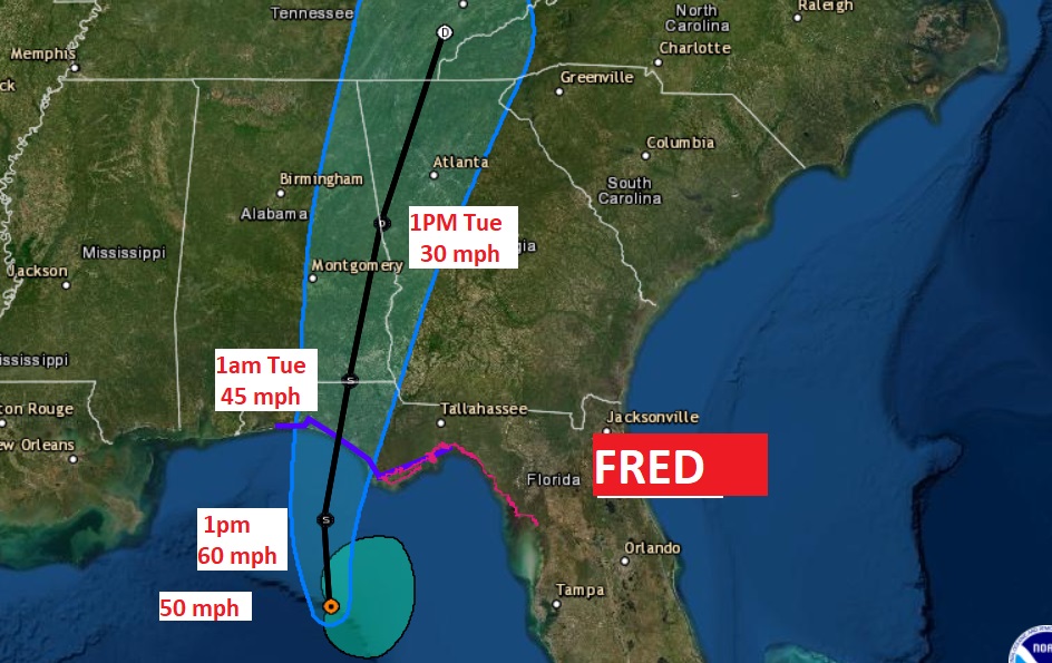
Fred’s winds at 4PM have decreased a bit to 60 mph. now located 25 miles NW of Appalachicola moving NNE at 9. The track of Fred has shifted even further to the east, easing the threat level for most of us. In fact, the new Fred forecast track almost bypasses Alabama altogether . The track of Fred will cuts across a sliver of extreme southeast Alabama, before moving into Georgia late tonight. We will see rain and thunderstorms from Fred tonight, here in central Alabama, but the main effects till be much farther east. Fred, it appears will largely spare Alabama. Our friends in Georgia and the Carolinas are in for boat-loads of rain and gusty winds, not to mention a tropical tornado risk.
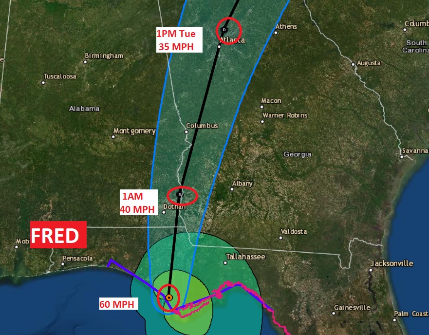
BULLETIN…2:15 pm CDT:
...FRED MAKES LANDFALL IN THE EASTERN FLORIDA PANHANDLE...

National Weather Service WSR-88D radar data indicate that the
center of Tropical Storm Fred has made landfall near Cape San
Blas, Florida.  Maximum sustained winds are estimated to be near
65 mph
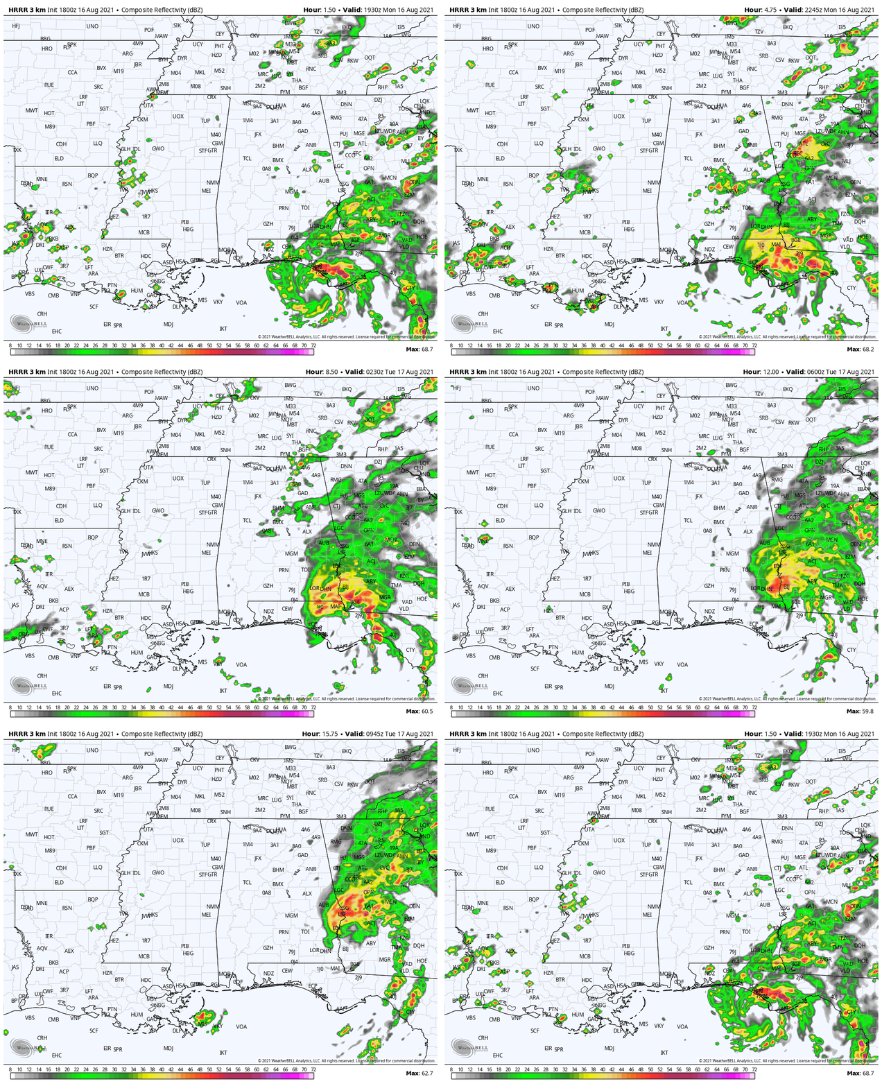
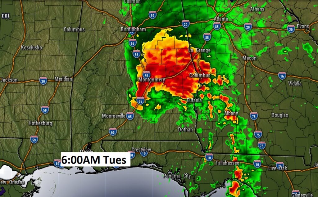
Future radar through 7am Tuesday…
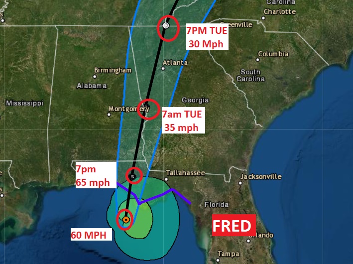
1PM NHC FRED UPDATE: Fred is a little stronger. Winds now 65 mph. Located 35 miles SW of Apalachicola, moving NNE at 9. Landfall within 2-3 hours. Not much more of a window to intensify. #alwx

10AM NHC Fred Advisory:
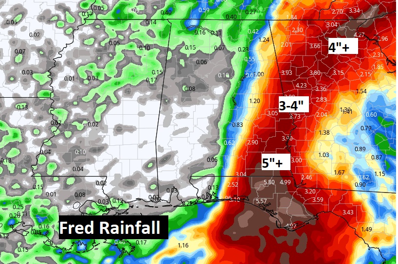
The track of Fred has shifted even further to the east, easing the threat level for many of us. Fred’s winds have increased to 60 mph at 10AM, 55 miles SW of Apalachicola, moving north at 10 mph. It is expected to make landfall along the Florida Panhandle coast by late this afternoon. Winds could increase just a bit more before landfall. Then the track of Fred will cut across extreme southeast and east Alabama tonight and Tuesday morning. West Alabama will see no Fred impacts. Even the I-65 corridor, will see much reduced impacts. The central impacts will be in far eastern and southeastern Alabama, Tropical downpours with 4-7” of rain possible in the Wiregrass with isolated amounts to 10”. Gusty winds. Small tropical tornado threat tonight and Tuesday morning in far east and SE Alabama.
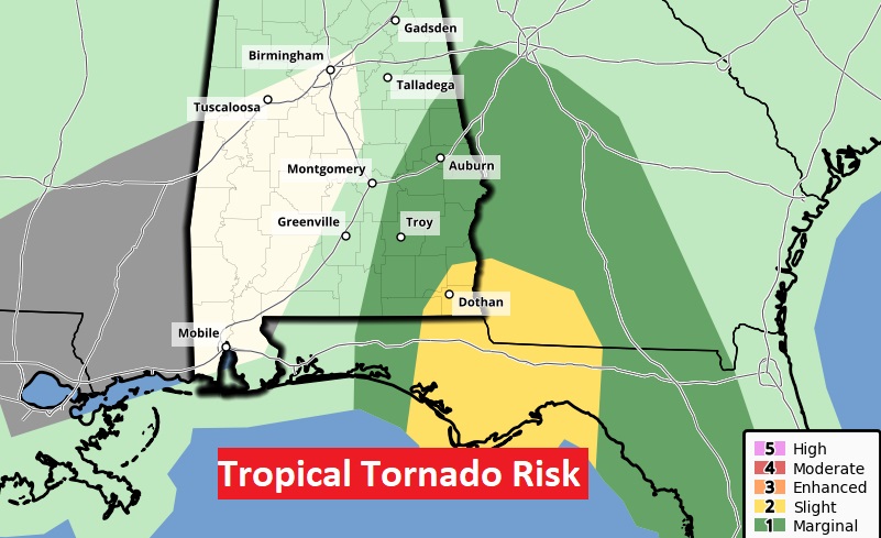
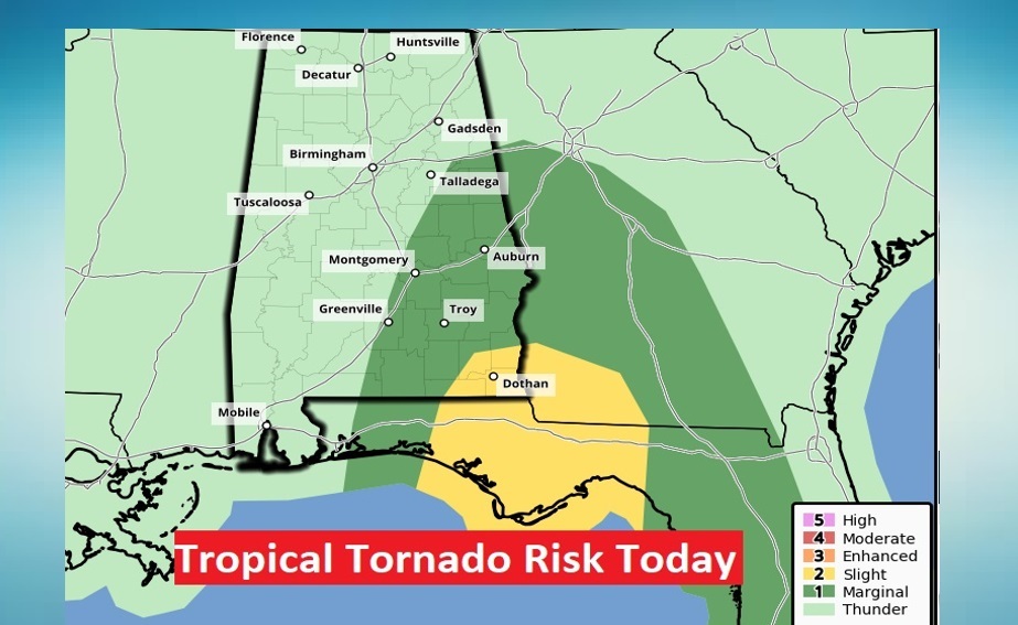
Tropical Tornado Risk has been shifted eastward and now includes mainly southeast and far eastern Alabama, because of the recent shift in Fred’s track.
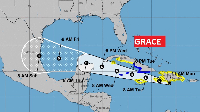
Here’s the UPDATED forecast cone on Grace, which will be in the Gulf later this week. It should pass far south of us, thank God.
EARLY MORNING UPDATE:
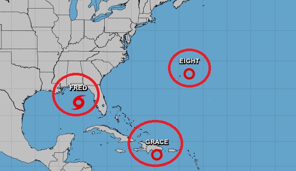
…Tropical Storm Fred will reach the northern Gulf Coast today and track northward into Alabama. On this video, I’ll update the various impacts we can expect, including the threat for flooding, tropical tornadoes and gusty winds. I have the latest on the timeline and track. And, then there’s Grace. Grace is also destined to be a Tropical Storm in the Gulf by later this week. Where is Grace headed. The forecast is shifting. And, there could be an Atlantic storm named Henri soon.
The tropics are very busy this morning. We are tracking three systems.
Fred will reach the northern Gulf coast later today and into Alabama tonight and Tuesday. Most of the Fred impacts will be along and east of I-65.
Small Tropical Tornado Risk many along and east of I-65, by later this afternoon, & tonight. This outlook extends until 7AM tomorrow morning.
The rainfall outlook is amazing. 5+ inches possible in southeast Alabama. West of I-65 little or no rain. Flash Flood Watch in effect.
Here’s a snapshot of Future radar at 6AM Tuesday.
Then there’s the issue of GRACE. GRACE is weak and disorganized now. It has a tough road ahead as it moves over Hispaniola and Cuba today and tomorrow, and part of Wednesday and into the Gulf of Mexico later in the week. Right now it appears Grace will take a more southerly track, and head toward the western Gulf as a Tropical Storm.
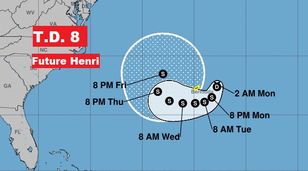
Then there’s one more system in the Atlantic. The Future Henri which will effect Bermuda.
Tuesday’s weather will be influenced by Fred of course, but the forecast will become more routine by Wednesday and late week.
