Good Morning, from the National Weather Association Conference in Tulsa, Oklahoma!
Yesterday the radar was quite active across central and south Alabama. Many towns had nice downpours, but not everybody. The Montgomery Airport had a healthy 1.15”. My rain gauge in East Montgomery recorded .05”. Some towns had not a drop.
The radar was colorful yesterday, and will be quite colorful again today. Heat and humidity will combine to produce a generous supply of showers and storms. Same thing Sunday. There’s more HOT weather in our future. Some of the hottest days will be Monday, Tuesday & Wednesday, with dangerous heat indices .
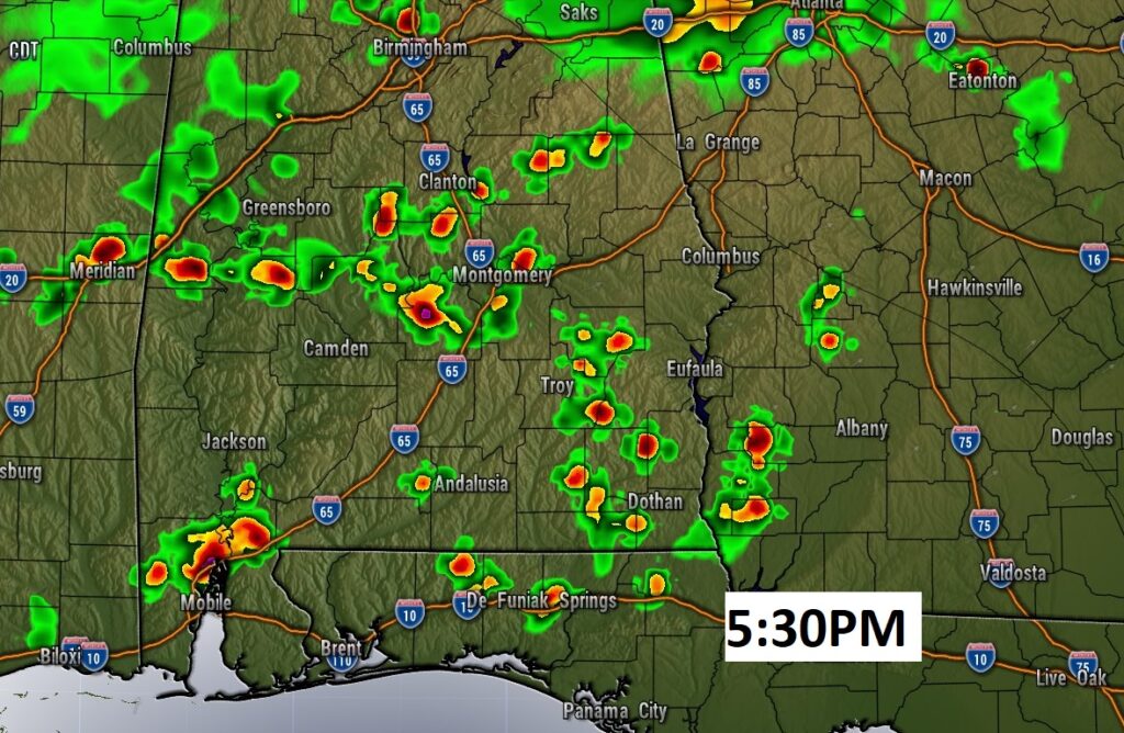
TODAY: Much of the morning is likely to be dry. Hot & humid today. High in the low to mid 90’s. By afternoon and evening, there will be a generous supply of random afternoon and evening showers and storms. Some will produce very heavy downpours, lots of lightning and gusty winds. Low tonight 74.
Here’s a Future Radar snapshot late this afternoon, just to give you a general idea on the coverage.
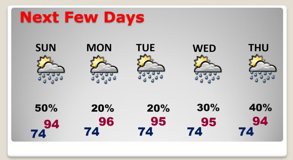
NEXT FEW DAYS: Sunday will be very similar to today. Decent coverage on the showers and storms. Hottest days will be Monday, Tuesday & Wednesday, with dangerous heat indices . Monday through Wednesday, showers and storms will be few and far between.
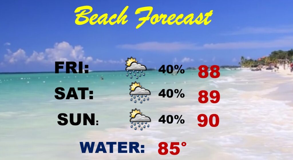
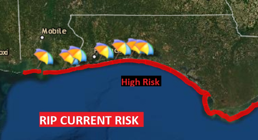
BEACH OUTLOOK: Yesterday showers and storms were quite numerous on the coast. I had to take the rain chances higher for the rest of the weekend. It won’t rain all the time. Unfortunately, RED FLAGS are flying on ALL the Beaches. You can thank Hurricane Grace for the High Surf and Dangerous Rip Current Risk. Please, stay out of the water.
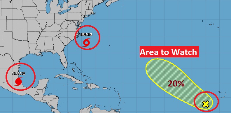
BUSY IN THE TROPICS: The Big story is Henri heading for the highly populated Northeast coast.
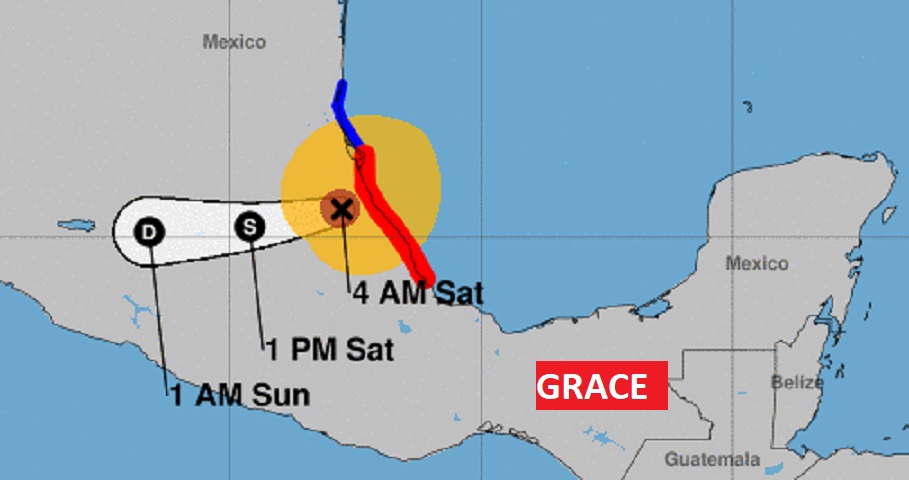
First, lets talk about Grace. Grace came ashore in Mexico last night as a major hurricane, in Mexico. It is still classified as a Hurricane with 110 mph winds this morning. It will quickly weaken and cause life threatening flooding and mud slides.
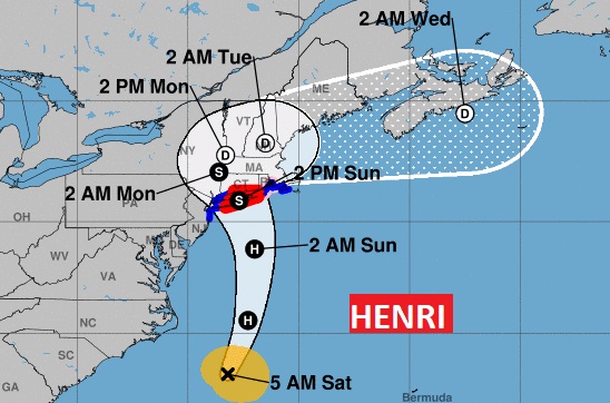
Henri is a strong Tropical Storm in the Atlantic, with 70 mph. Almost a hurricane, 195 miles SE of Cape Hatteras, moving NNE at 12, aiming for the an encounter with the heavily populated Northeastern coastline. Expected to become a hurricane later today. Hurricane Warning for Long Island through the Rhode Island coast. Henri is expected to curve well inland, taking a path through New England. This is historic. There has not been a threat quite like this for decades. Henri will effect millions of Americans in a BIG way.
And then, there’s also an Area to Watch out in the Tropical Atlantic. For US…we are enjoying a quiet next few days. Nothing for US to worry about anytime soon.
I’ll have another Blog update tomorrow morning, from Tulsa. Where ever I am in the world, you can always hear my forecast on the 8 Bluewater Radio stations. Enjoy your weekend!
–Rich
