4:00 PM NHC Update:
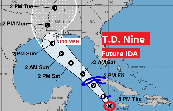
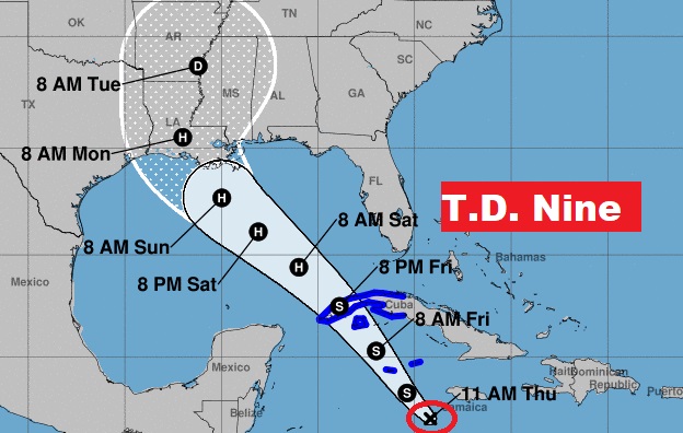
Tropical Depression Nine, is located in the Caribbean, 130 SE of the Cayman Islands. Moving NW at 14 mph. Winds 35 mph, expected to reach tropical storm very soon. It will get the name IDA.. The system is expected to reach Hurricane status in the Gulf by Saturday, in the Gulf. It could be close to Category 3 status with 110 mph winds by landfall along the north central Gulf coast by Sunday afternoon. (Cat. 3 starts at 111 mph). This, of course is a faster timeline. There is not many days to prepare Most models take the center to the Louisiana coast. That track could change. Air Force RECON is investigating the T.D. right now. This data will be very important in improving the future model forecasts.
(10:00AM 8/26/21)
Invest 99-L is now Tropical Depression Nine, in the Caribbean, southwest of Jamaica. Moving NW at 13 mph. Winds 35 mph, expected to reach tropical storm status by tonight. Next available name is IDA. The system is expected to reach Hurricane status in the Gulf by Saturday. It could be close to Category 3 status with 110 mph winds by landfall along the north central Gulf coast early Monday. (Cat. 3 starts at 111 mph) Tropical storm warnings have been issued for the Cayman islands and part of Cuba. Air Force RECON will investigate T.D. 9 this afternoon. This data will be very important in improving the future model forecasts.
EARLY MORNING UPDATE:
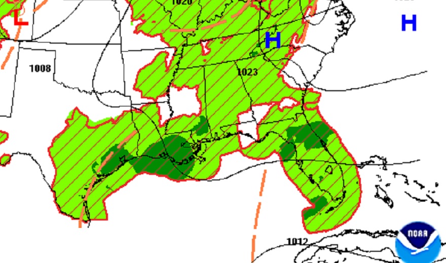
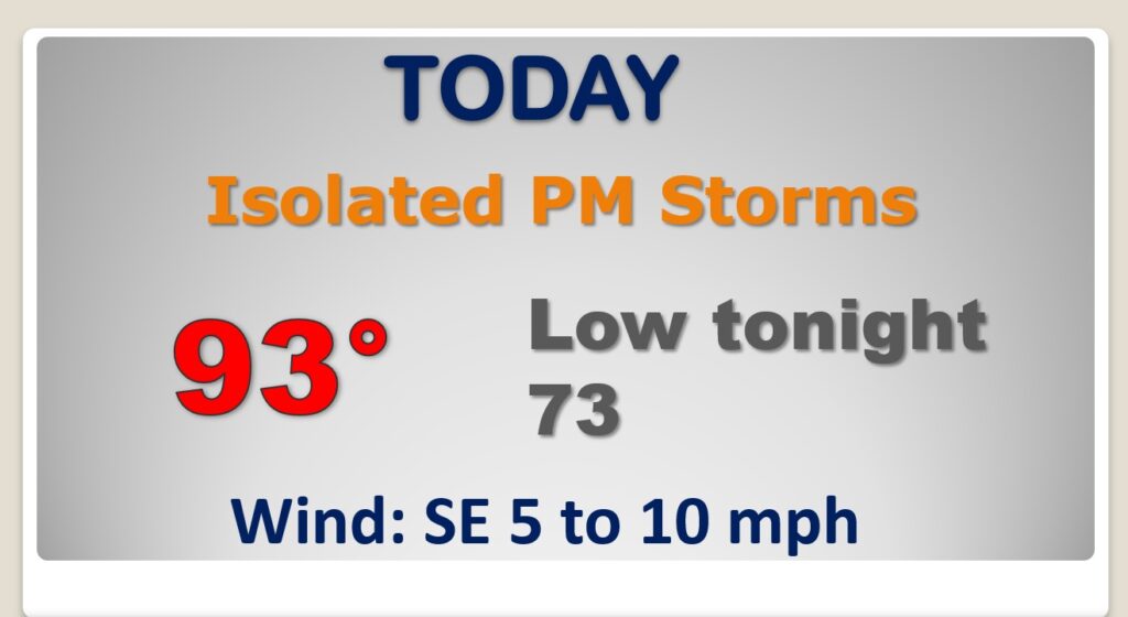
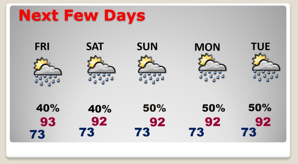
Good Morning! Today will be a routine late August day. By the weekend, random storms will be a little more numerous. But, the big story continues to be the future of Invest 99-L. The system will develop to a depression or tropical storm soon, probably today. It could become a Hurricane in the warm waters of the Gulf of Mexico. But, where will it make landfall and when. Potential model tracks are spread out from Texas to Mississippi. On this video, we’ll look at potential scenarios. The next two names available are Ida and Julian.
Routine forecast Friday and Saturday. Random scattered storms. Sunday and beyond….everything depends on the future of the Gulf Tropical System. Stay tuned.
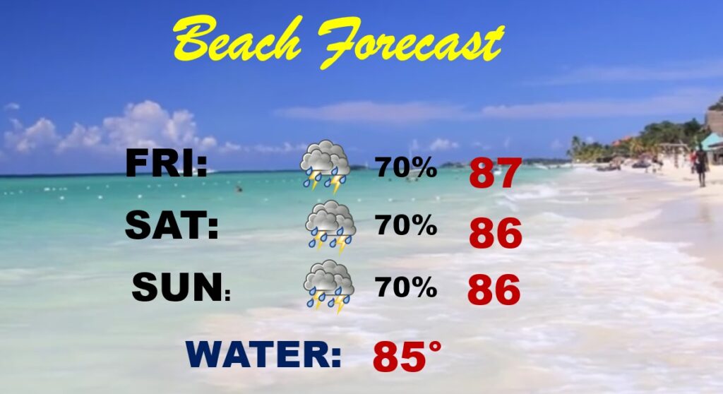
Rain chances are much higher at the Beach because of a series of tropical waves that will brush by near the coast.
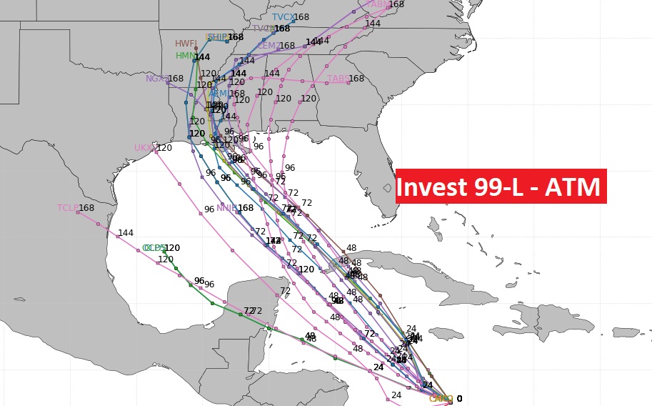
The models simply don’t know what to do with the developing Invest 99-L system, likely to become a hurricane over the weekend before making landfall somewhere. But where? The model tracks are spread out between Texas to Mississippi and beyond.
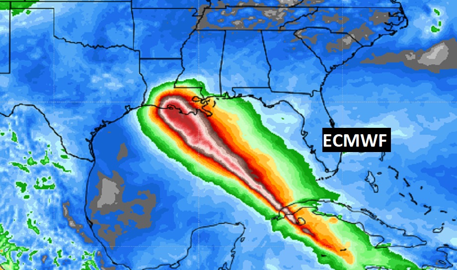
Here’s the EURO operational model run. (ECMWF) Major hurricane into LA.
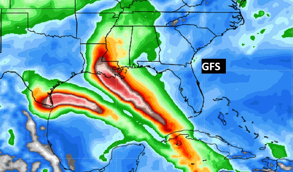
The operational GFS (American) does something really weir. It develops two prices of energy, sending one to Texas, and another to LA. Unlikely.
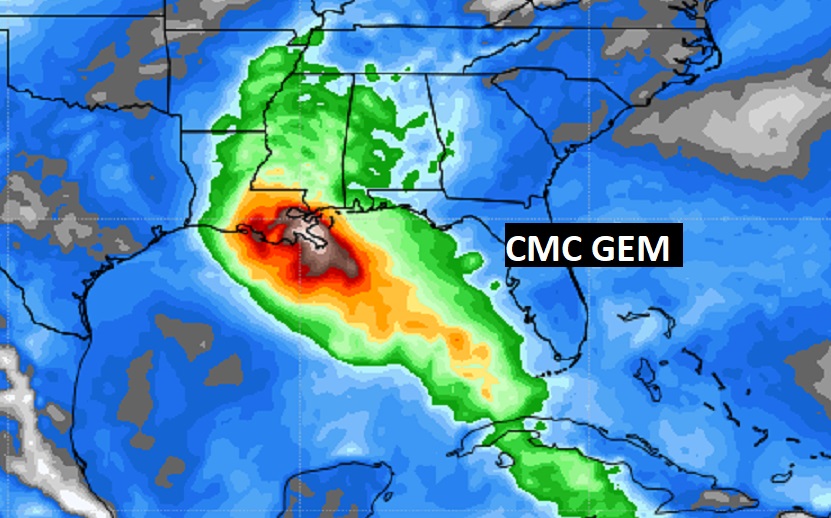
The operational Canadian (CMC GEM) takes a major hurricane to New Orleans.
