4:00pm (8/27/21) NHC IDA Update:
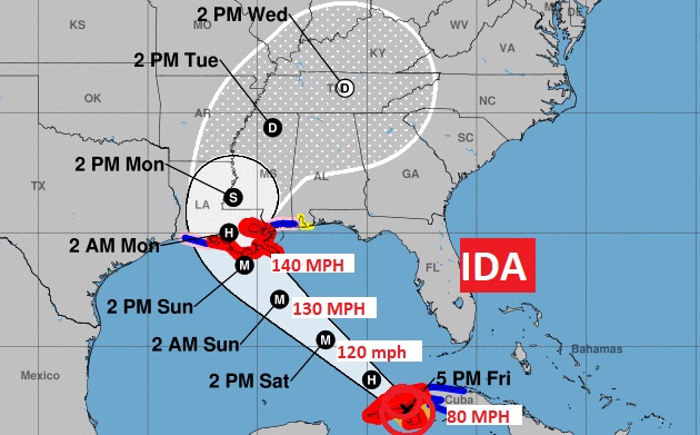
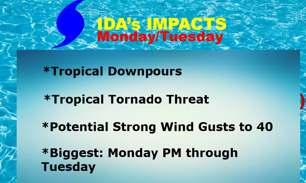
Hurricane Ida, is located near the western coast of Cuba, moving NW at 15. Winds increased to 80 mph. It will move into the Gulf tonight. “Steady or rapid intensification” is expected in the Gulf. NHC language: A significant hurricane will impact a large section of the U.S. Gulf coast late this weekend into early next week. Expected to be a major Category 4 hurricane with 140 mph winds by landfall along the north central Gulf coast on Sunday. A hurricane Warning covers the Louisiana coast to the mouth of the Pearl River, including New Orleans. Hurricane Watch as far east as the MS/AL line. Trop. Storm Watch as far east as the AL/FL line. For most of us, the main impacts will be tropical downpours, with locally heavy rainfall amounts, wind gusts up to 40+ mph, and most probably a significant tropical tornado threat, which could begin Monday morning. The greatest tornado risk will likely be Monday afternoon and evening, but we can rule out a lingering risk on Tuesday.
10:00AM (8/27/21) NHC IDA Update:
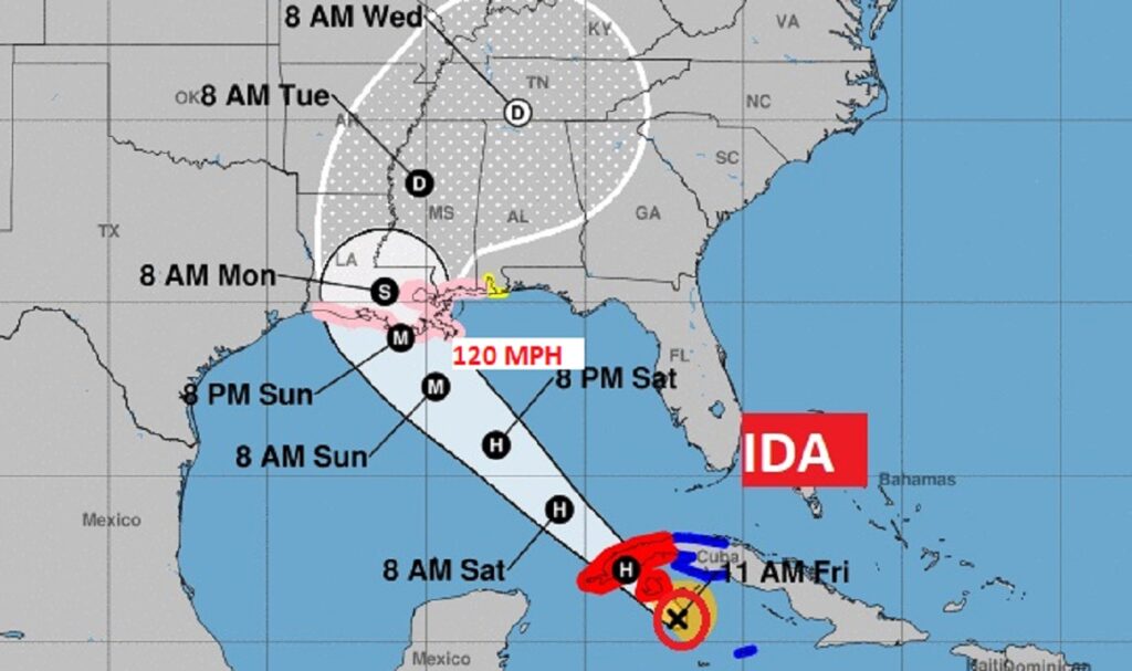
Tropical Storm Ida, is located in the Caribbean, 75 miles south of the coast of Cuba moving NW at 15. Winds increased to 65 mph. It will move a across western Cuba today and into the Gulf tonight. The system is expected to reach Hurricane status by tonight. “Steady or rapid intensification” is expected in the Gulf. NHC language: A significant hurricane will impact a large section of the U.S. Gulf coast late this weekend into early next week. Expected to be a major Category 3 hurricane with 120 mph winds by landfall along the north central Gulf coast on Sunday evening. Skills in Intensity forecasts are not good. It is possible that Ida could be stronger. For most of us, the main impacts will be tropical downpours, with locally heavy rainfall amounts, wind gusts up to 40 mph, and most probably a significant tropical tornado threat, which could begin Monday morning. The greatest tornado risk will likely be Monday afternoon and evening, but we can rule out a lingering risk on Tuesday.
EARLY MORNING UPDATE AND VIDEO:
IDA could be a Major Hurricane when it reaches the northern Gulf Coast Sunday evening. Although Louisiana is the most likely destination, Alabama will be on the strong eastern semi-circle of the Hurricane. For us, that could mean a significant tornado threat, tropical downpours and gusty winds. I have the very latest track data from the National Hurricane Center, and we will detail the potential impacts for the state of Alabama on this evolving threat scenario for Ida.
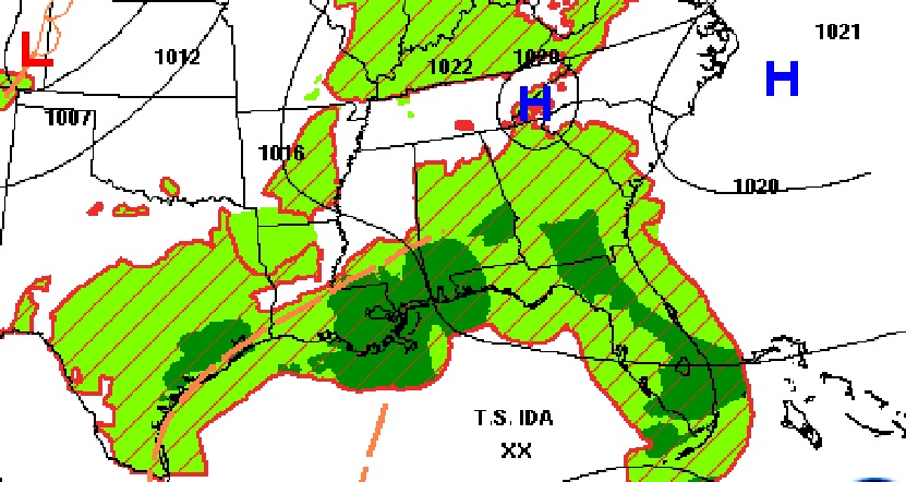
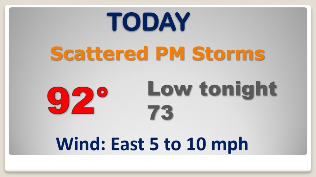
Today is just a routine late August day. Period.
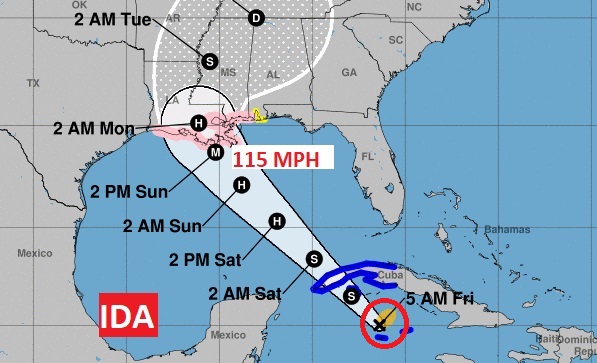
Ida is a Tropical Storm this morning aiming for western Cuba. It will enter the Gulf tonight and likely become a hurricane Saturday. It’s possible that Ida will be a major Category 3 hurricane with 115 mph winds, when it reaches the northern Gulf coast by Sunday evening. Hurricane Watch as far east as the MS/AL line. Tropical Storm watch as far east as the AL/FL line. Currently, the most likely scenario would be landfall somewhere in Louisiana. Here’s the 4AM NHC Update on IDA’s future track.
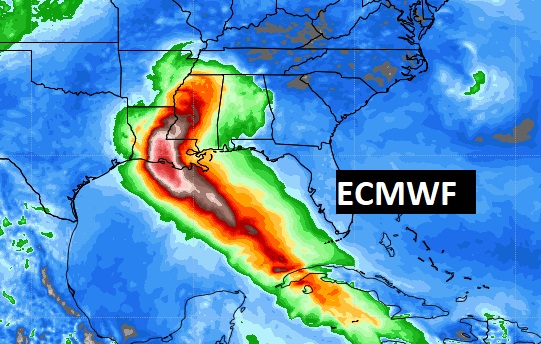
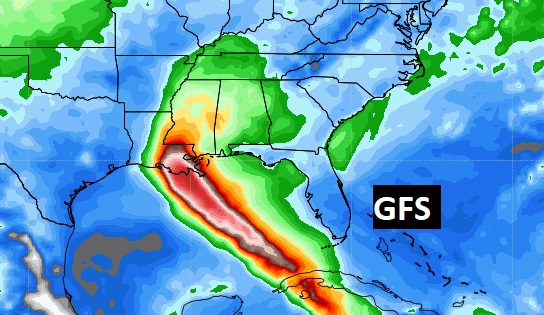
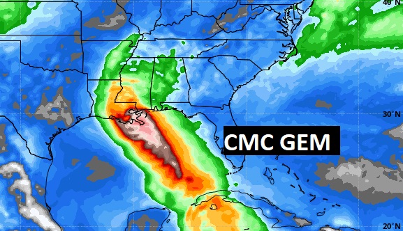
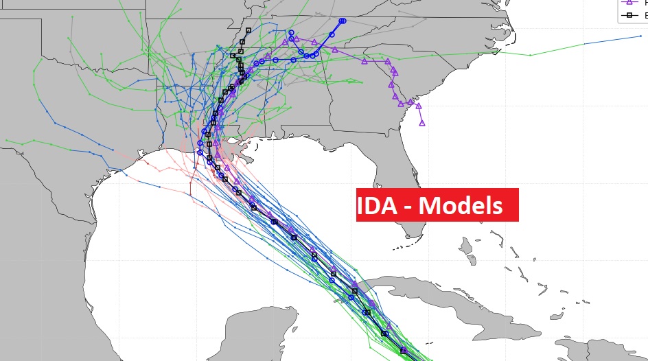
The Global models are in better agreement this morning, taking IDA into Louisiana. The Euro is farther west. The Canadian is father east. The American GFS splits the difference.
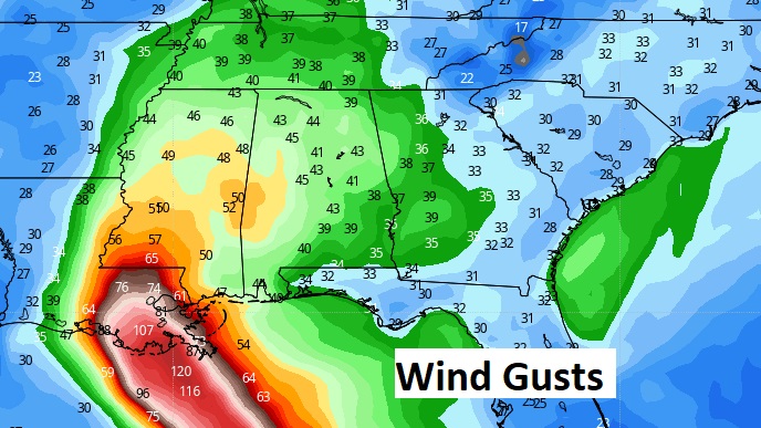
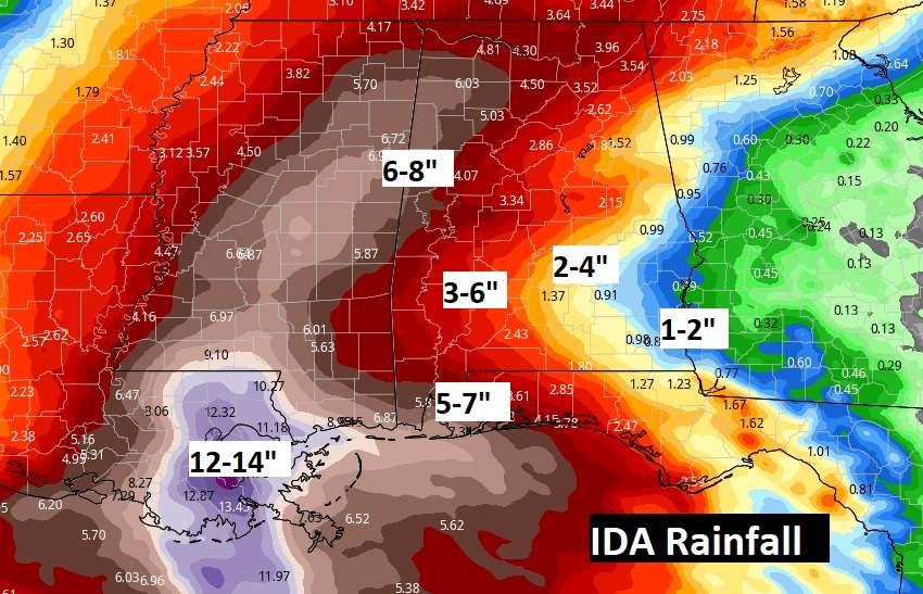
These maps detail the potential rainfall and wind speeds from Ida. This is a potential disaster in the making for New Orleans.
This list of potential impacts for us will change as we get closer to the event.
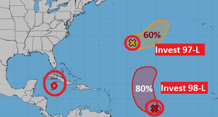
Elsewhere in the tropics there is Invest 97-L and Invest 98-L. Do we care? No…
Routine forecast for us through the weekend, then everything depends on Ida’s future track as far as our weather. I am NOT looking forward to Monday and Tuesday. Tropical tornado threat will be highest on those days.

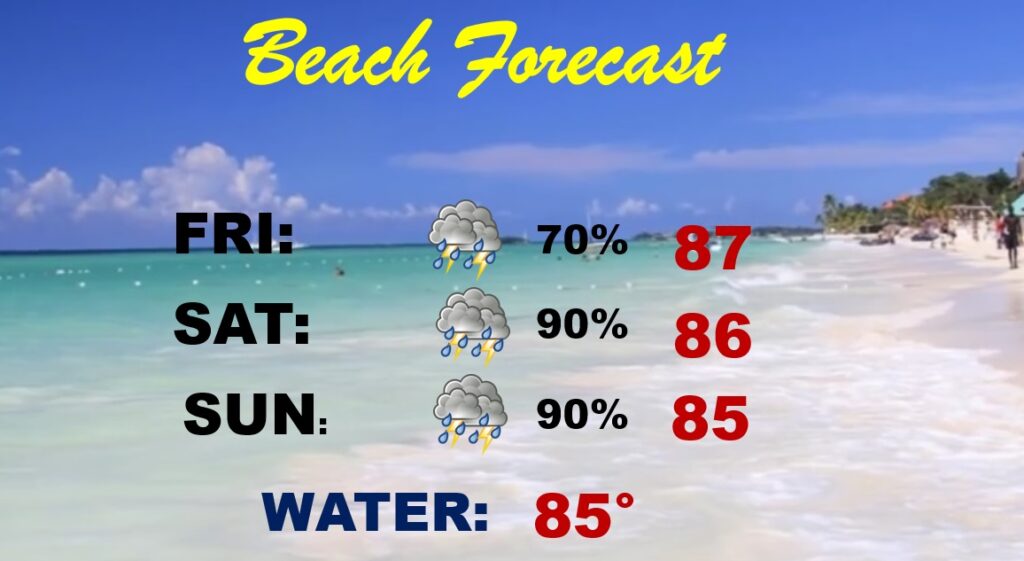
Don’t go to the Beach this weekend, Waste of time.
