1PM UPDATE:
Lots of lightning involved with the line of storms from Lake Martin to Pine Apple. Boaters on lakes and rivers head for safe harbor. #alwx
Early Morning Update:
Good Morning! An approaching weak front will bring showers and storms back to the forecast today. That could affect some of you Labor Day plans, at the Lake or maybe your backyard BBQ. The front will stall somewhere in central Alabama tonight. Scattered showers & storms will remain in the forecast at least through Wednesday. But, a stronger front will move trough Thursday. I’ll hang onto a small rain chance Thursday in central Alabama, but the better rain chance will be down south.
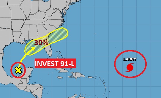
Drier air will bring another nice change late in the week with lower humidity. Invest 91-L in the Gulf will probably not have enough time to develop. Only one model takes it to tropical storm strength. But, that late week upper trough will tend to steer the tropical system away from us.
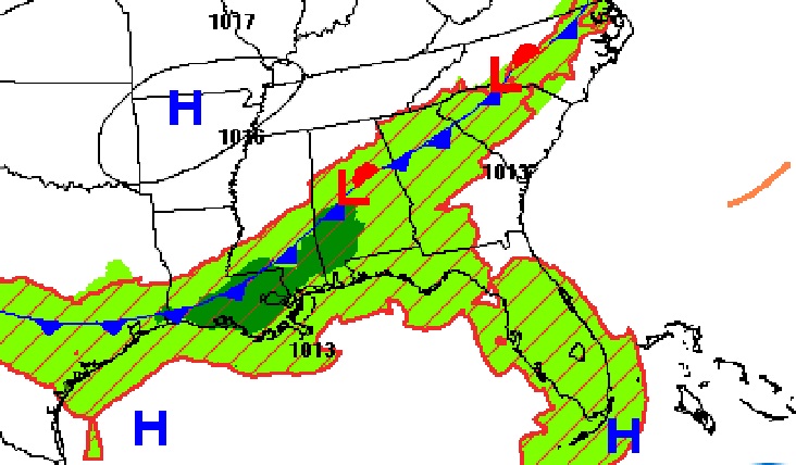
TODAY: Hot again today. A little more humid. High 90. (We had 90 yesterday in Montgomery.) Dry through the morning. Sun/cloud mix. Showers and storms will become rather numerous, but random, along a southward moving front by this afternoon and this evening. Low tonight 72. Here’s where the front will be around lunchtime today.
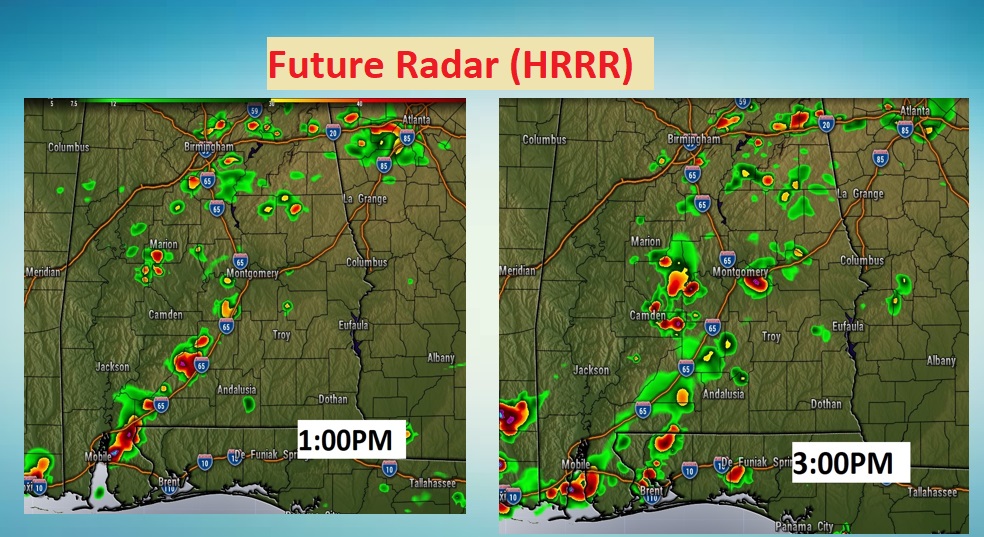
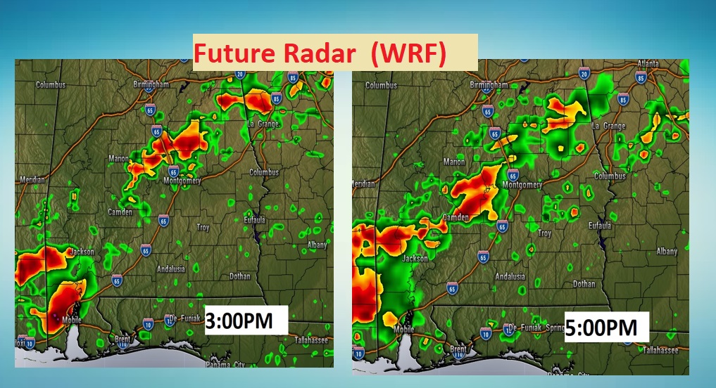
FUTURE RADAR: I wanted to give you a flavor of how the hi-resolution models differ. Here’s a few snapshots of a couple of different models this afternoon. The HRRR model and the WRF. The WRF is wetter, in this case. The truth probably lies in the middle. These are not the only two models. There are several more models I could have shown you.
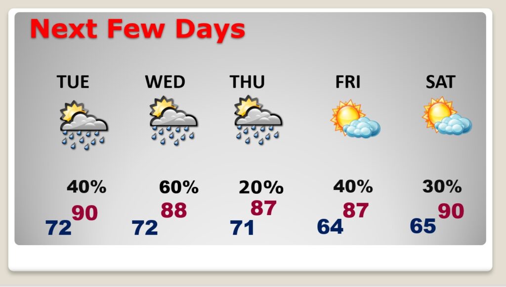
NEXT FEW DAYS: Scattered showers & storms will remain in the forecast at least through Wednesday. But, a stronger front will move through Thursday. I’ll hang onto a small rain chance Thursday in central Alabama, but the better rain chance will be down south. Much nicer air starting Thursday PM. Right now I have us dry next weekend.
TROPICAL UPDATE: As I mentioned earlier, we are monitoring the future of Invest 91-L in the Gulf. It’s in a somewhat hostile environment at the moment. The system will probably not have enough time to develop. Only one model takes it to tropical storm strength. But, that late week upper trough will tend to steer the tropical system away from us. Larry is a major hurricane in the Gulf with 120 mph winds. Eventually it will weaken and probably pass to the east of Bermuda later this week.
Chase and I have been enjoying this holiday weekend quite a bit. Lots of Park time.

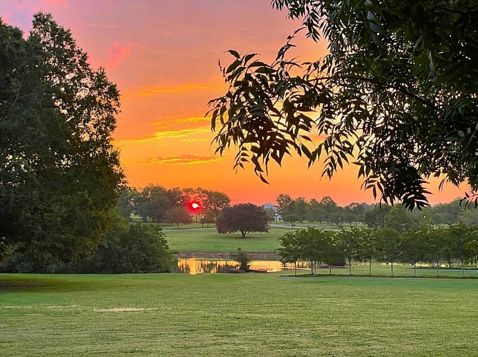
Have a Great Labor Day! I’ll have a complete video update in the morning..
–Rich
