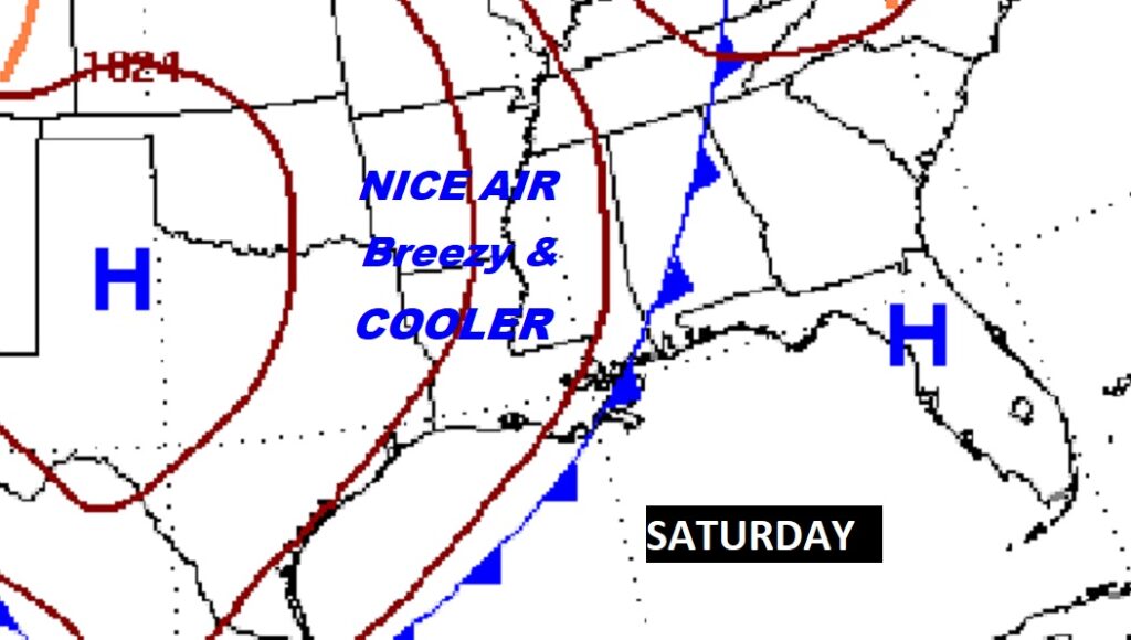
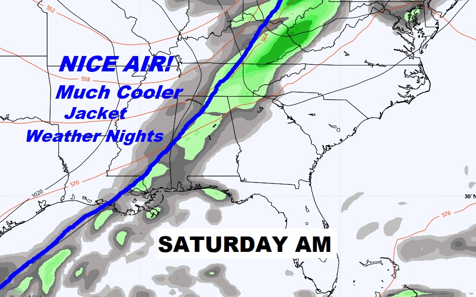
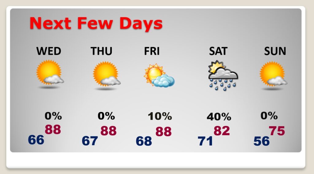
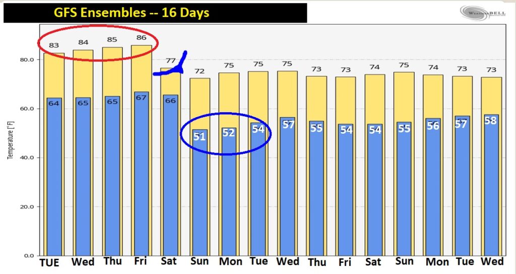
Good morning! It will continue to feel like Extended Summer through Friday. Our storm-free pattern rolls on. But, hang on. The cool front we have been anticipating for a long time arrives Saturday. A band of showers & thundershowers will precede the front. The front will usher in much cooler Fall air, on gusty northwesterly winds. A series of comfortably cool days, and Jacket Weather Nights will follow. Stand-by for a nice change. The countdown is on. How cool and how long? Details on this video.
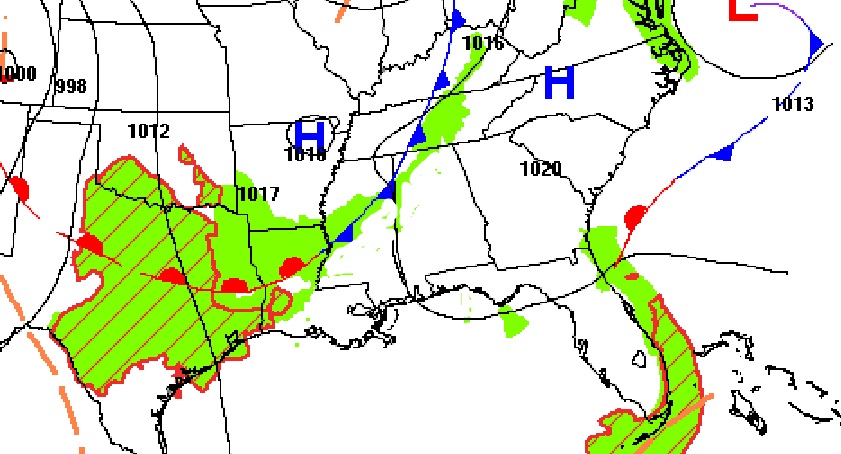
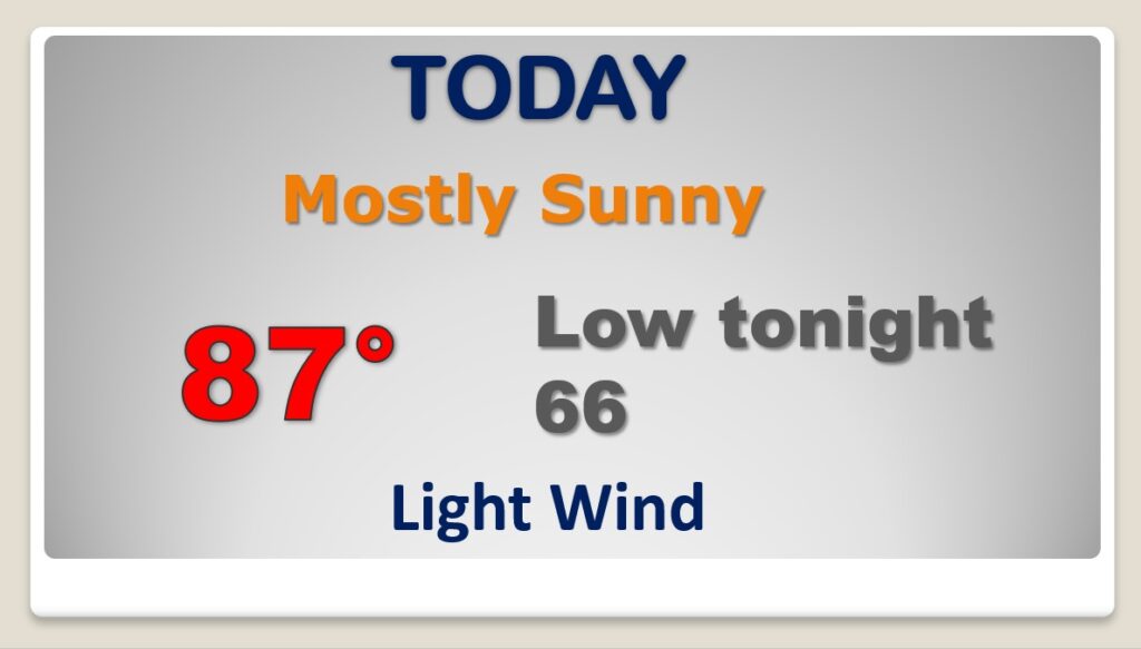
More of the same today. Abundant sunshine. TOO Warm for October. A weak front dissipates as it enters the state today. No effect.
Warm and DRY through Friday. Important cold front sweeps through the state Saturday. Showers and thunderstorms ahead of the front. Much cooler, drier, nicer air begins on Saturday night and Sunday on gusty northwest winds.
I’m pretty excited about this Nice Fall Air, now just a few days away. Looks like we could see some more rain around Thursday October 21st.

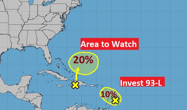
Tropics are kinda quiet for now. One Area to Watch….plus Invest 93-L. Both with a small chance of development in the next 5 days.
