Good Morning! Get ready for some weather changes. We have an active weather week in front of us. The first of two fronts will bring at least a small risk of showers and thundershowers today. A “bigger deal” storm system swings into the state late Wednesday and Wednesday night. The second front could bring a Severe Weather Risk to a large part of the Gulf South. Then, brisk, much cooler air will funnel in by late week, just in time for the weekend. On this video, I’ll bring you up to date on the details and timing.
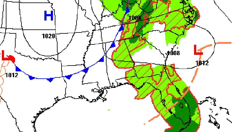
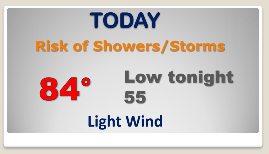
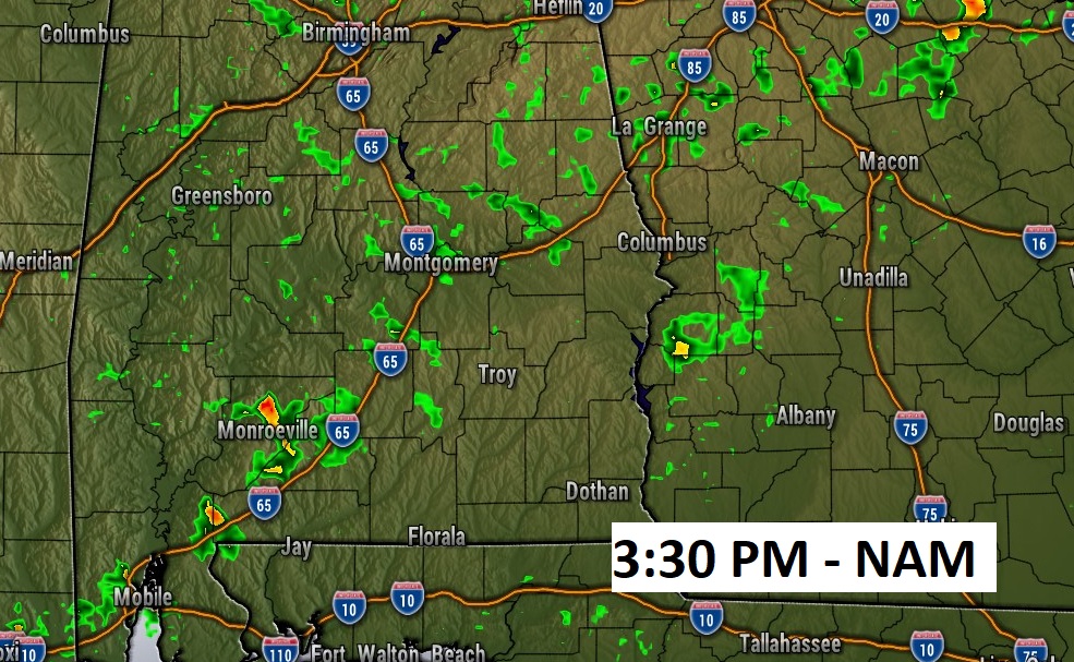
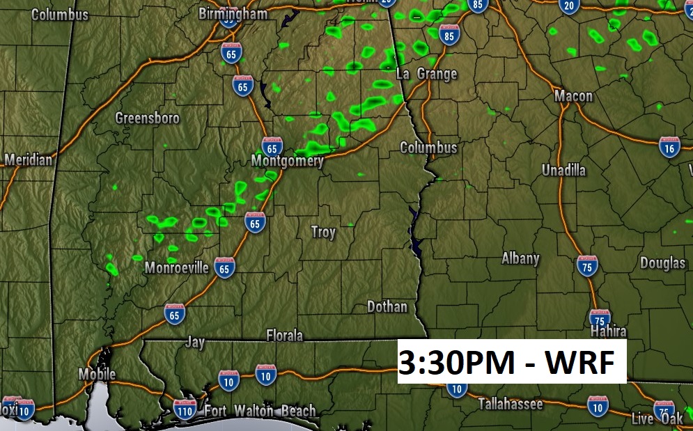
A weakening frontal system will bring at least a small risk of showers and thunderstorms today. 20-30% risk at best. Very warm for October today.
Here’s a couple of model Future Radar snapshots, showing the spotty nature of the showers today.
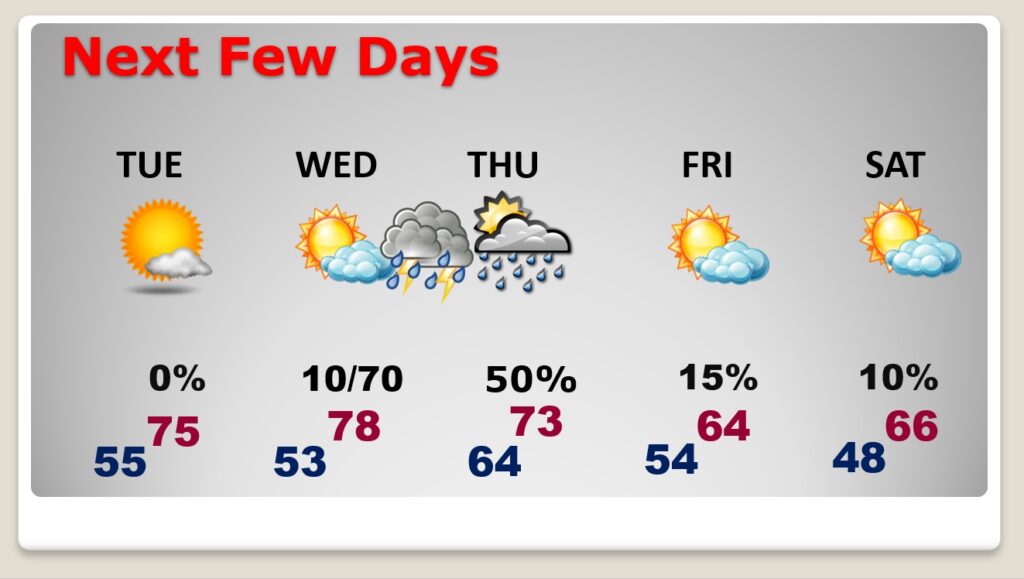
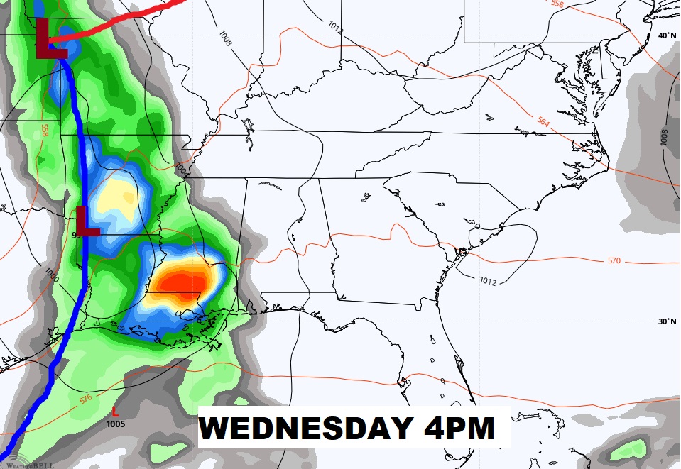
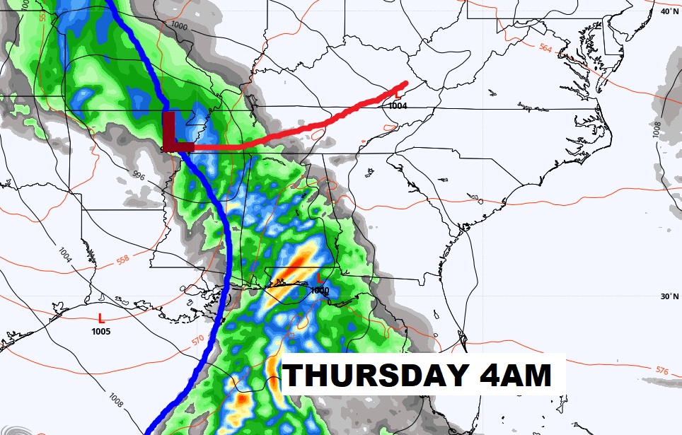
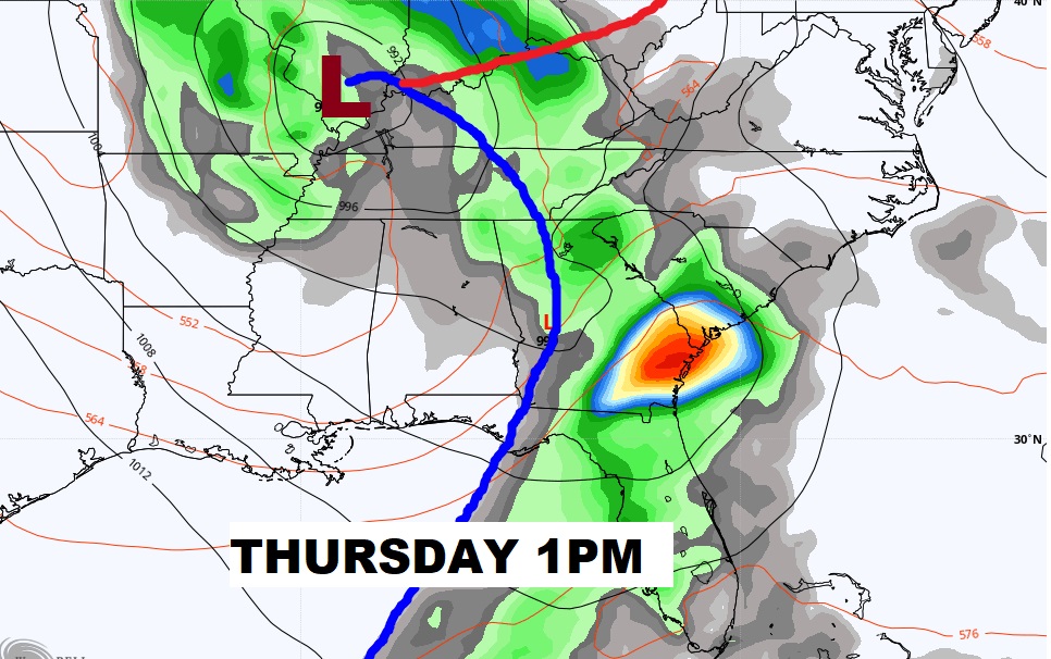
Significant mid week storm system will bring in showers and maybe some strong thunderstorms Wednesday night, through the overnight hours in through Thursday morning.
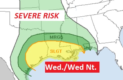
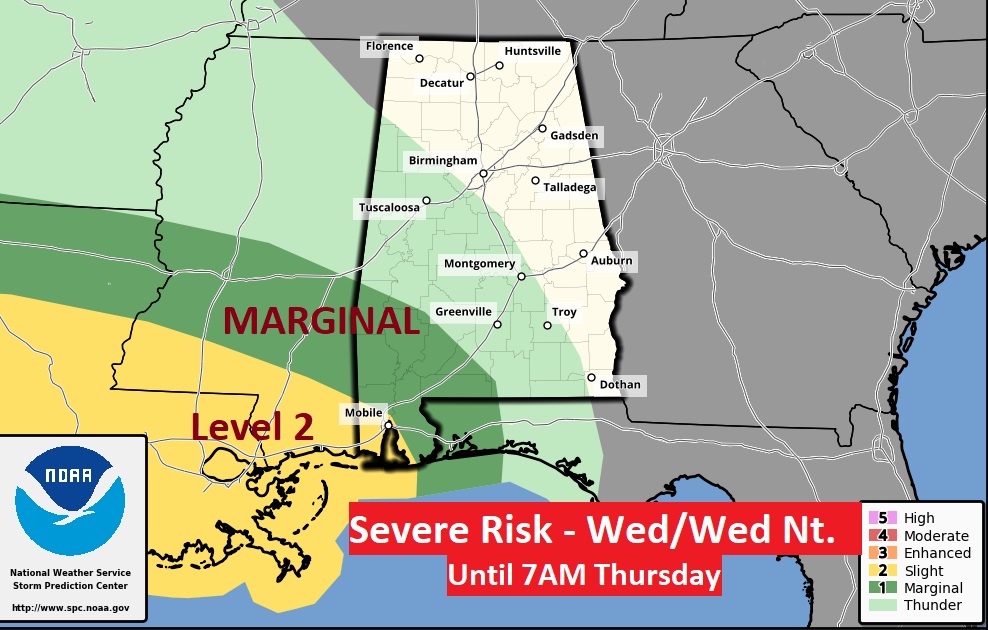
Here’s the current Severe Weather Risk area from the Storm Prediction Center through Wednesday night. I suspect this risk area may be expanded as we get closer to this event.
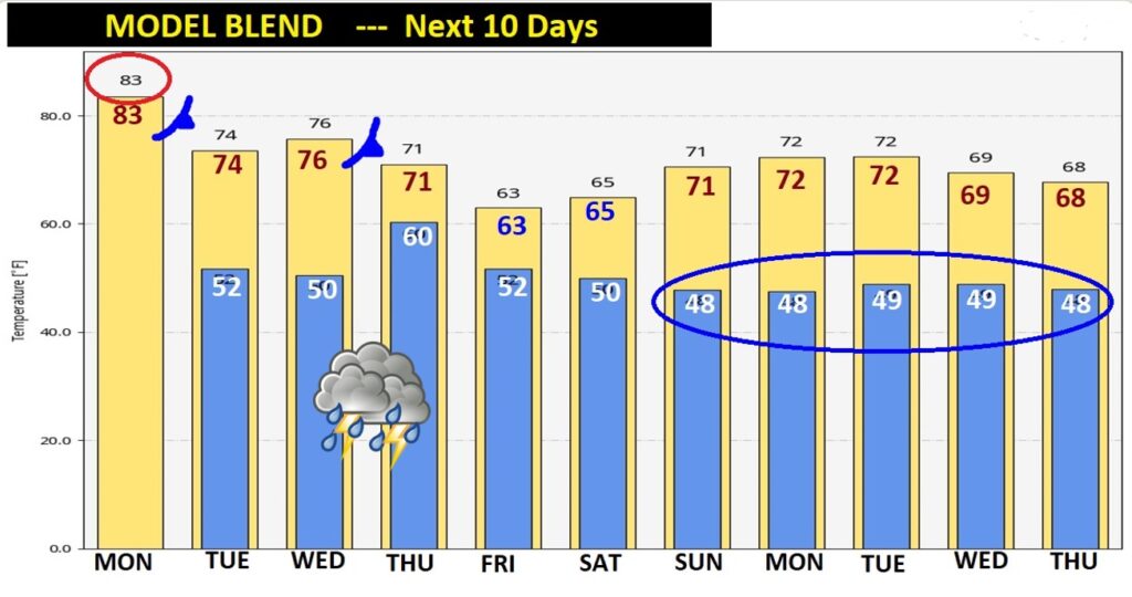
Tuesday is nice. Cooler. So the big deal storm system comes in Wed. Night/early Thursday. Then breezy and much cooler Thursday night and Friday. BRISK. Very cool days. Chilly nights follow.
