Good Morning! We have a series of quiet, tranquil, storm-free days in the week ahead. This week starts off cool, but get ready for a nice warming trend as November ends and December begins. The coolest day will be day today, and the coldest night tonight. We’ll tease the free-mark by dawn Tuesday. But, the first four days of December will feature highs 70 or above. When will showers return to the forecast? On this video, we’ll look ahead.
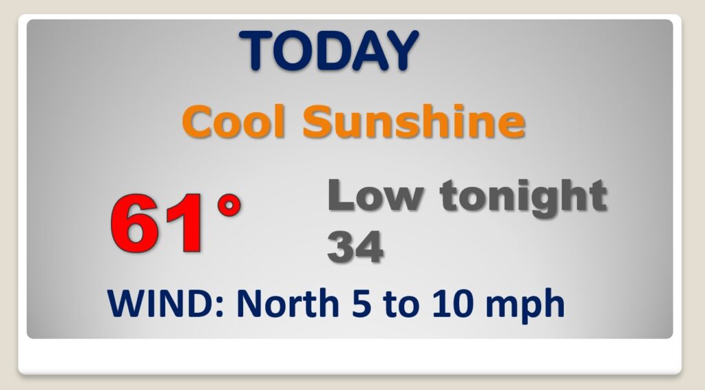
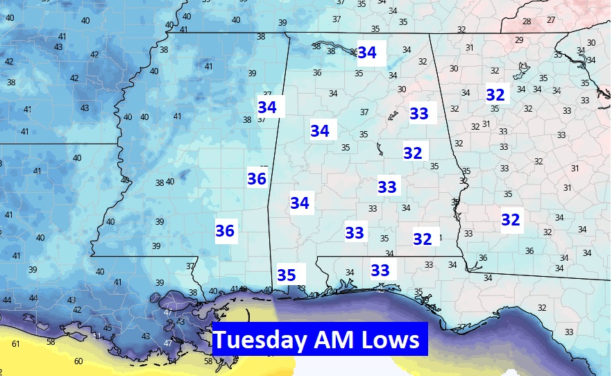
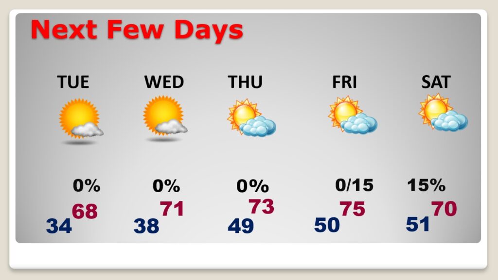
The sun returns today. It will be cool for late November. Our high will struggle to reach 60. We’ll be pretty close to the freeze mark by dawn Tuesday.
Many towns will be close to the freeze mark on Tuesday morning at Dawn.
A nice warming trend begins on the last day of November tomorrow. The first 4 days of December look pretty nice with highs 70 or above. Could there be a small rain chance by Friday night or Saturday? The jury is out right now. The models disagree on the details.
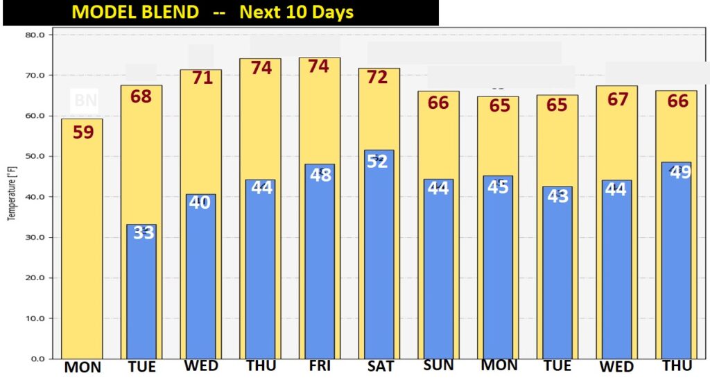
Here’s the next 10 days on the MODEL BLEND. Coolest daytime today. Coldest morning…Tuesday. But look at the 70’s Wednesday through Saturday.
Wednesday is the first day of Meteorological Winter. The Winter Solstice is 22 days away on 12/21/21 at 9:58AM CST.
