
Good Morning! Here’s my brief video forecast discussion.
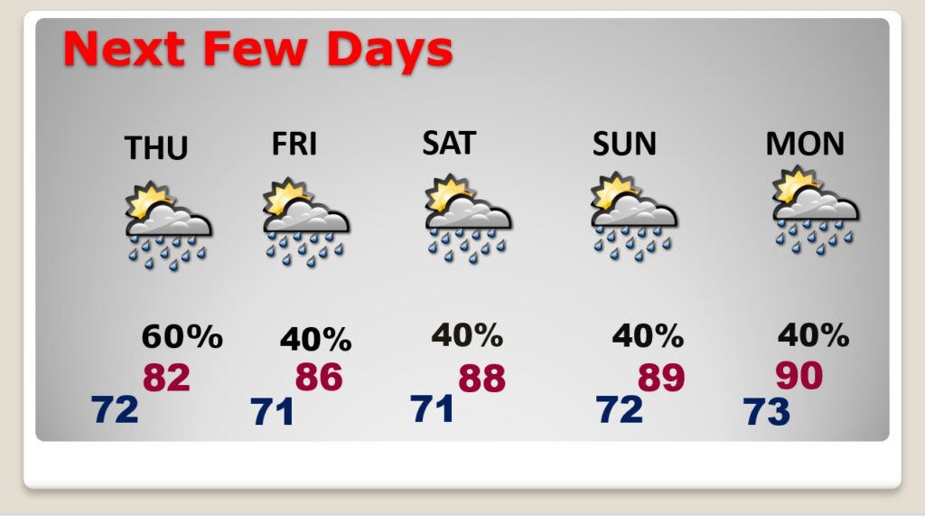
TODAY: Our very wet, dismal Pattern continues. Scattered to numerous showers & storms, just about anytime, but especially in the afternoon & evening. High 82. Low tonight 72.
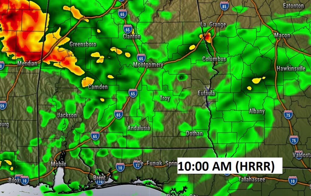
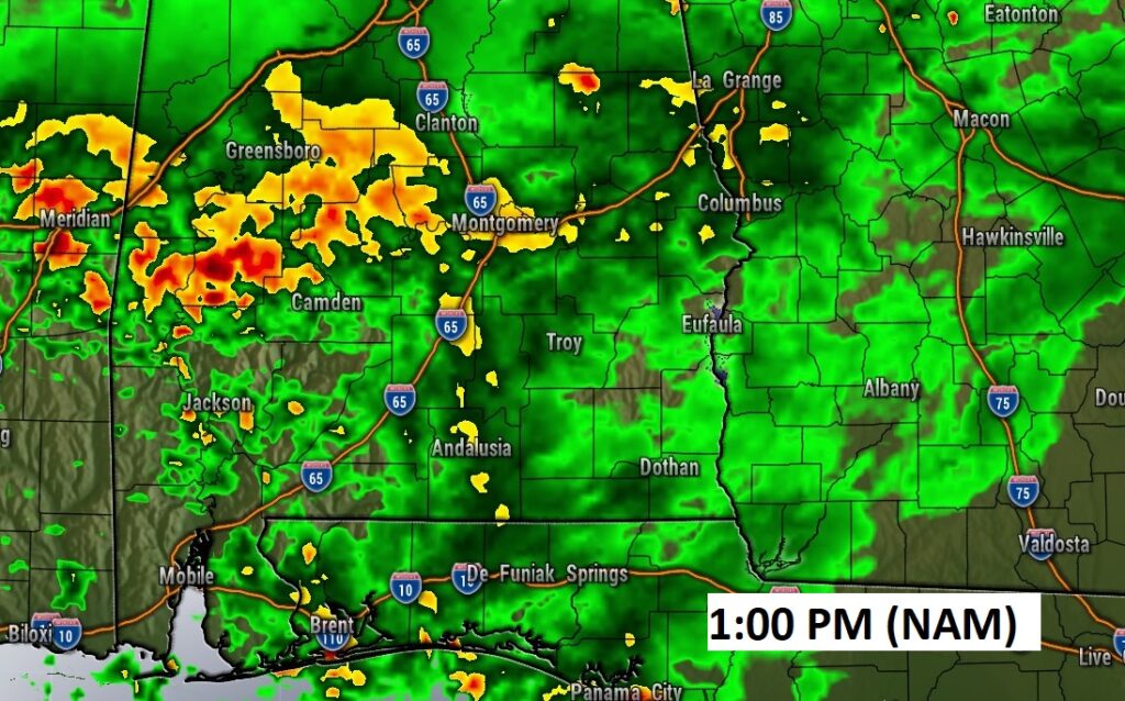
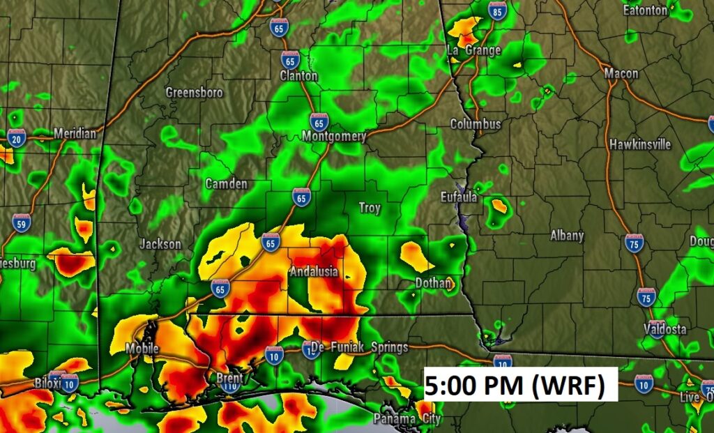
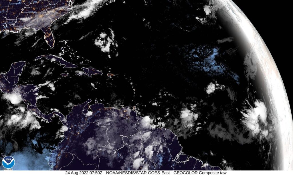
Here’s a flavor of various model Future Radar snapshots with clearly shows the “flavor” of the day ahead. Widespread rain and storms.
NEXT FEW DAYS: Scattered to numerous showers and storms will continue at least through Thursday. Storms perhaps slightly less numerous by Friday & Saturday. High temperatures will be held by clouds and showers. Highs mainly in the low to mid to Upper 80’s through Thursday. Lows at night in the low 70’s. Little day to day change.
.
TROPICAL OUTLOOK: Invest 90-L is being tracked in the far eastern Tropical Atlantic. NHC has a 20% chance this system will develop into a Tropical Cyclone in the next 5 days. Elsewhere, there is another Area to Watch coming into the Islands of the Caribbean. It also currently has a 20% chance of development.
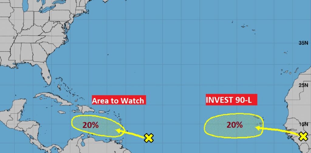
The rest of the Atlantic Basin is still quiet.
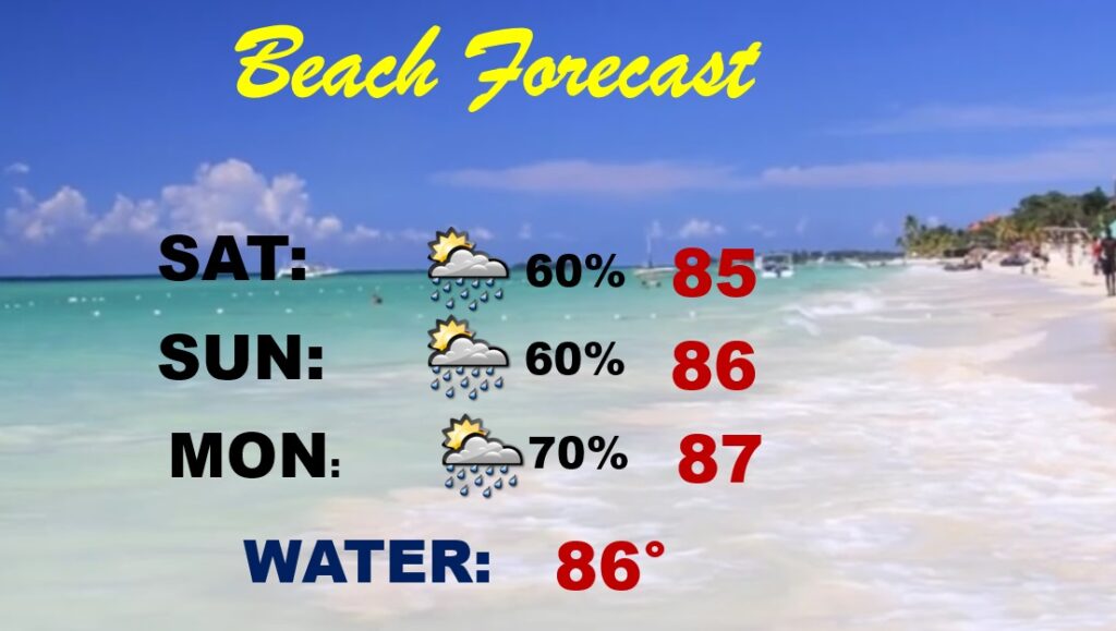
BEACH OUTLOOK: There is nothing nice or positive to say about the weekend Beach Forecast, unfortunately.
There will be another update for you tomorrow morning.
I’m back from the Weather Conference. But, I’m officially “OFF” today. Everything is back to normal tomorrow. Have a nice day today! Take the rain gear….
–Rich