
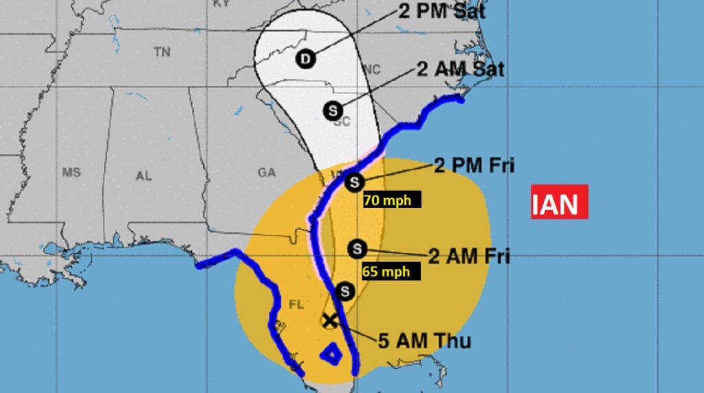
4PM Update – NHC: IAN BECOMES A HURRICANE AGAIN..Taking aim on Georgia and the Carolinas with life-threatening storm surge and strong winds. Max winds 75 mph. 240 miles south Charleston. Moving NNE at 10. Potential landfall on the south Carolina coast late Friday or Fri evening.
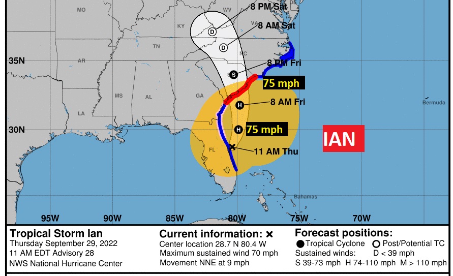
10am BREAKING: Ian is over the Atlantic now NNE of Cape Canaveral. Maximum sustained winds have increased to near 70 mph. Ian is expected to become a hurricane again This evening and make landfall as a hurricane on Friday. Hurricane warning for the entire South Carolina Coast.
Good Morning! Despite what is happening in Florida, for us, the news continues good. Here’s my brief video forecast discussion.
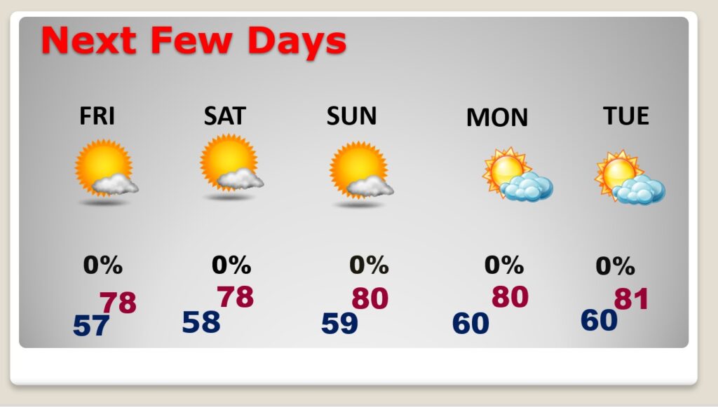
TODAY: Beautiful Fall Weather continues. Early this morning you’ll need a jacket. More Sunshine. Very breezy again. Low humidity. High in the upper 70’s. NE wind 10 to 15 mph, gusting as high as 30. Clear and pleasantly cool again tonight. Low 57.
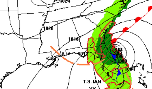
The pressure difference between us and the center of Ian will cause another breezy day here today.
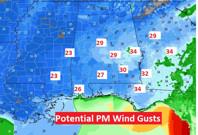
Once again today, it should be quite breezy at times. Max wind gusts could reach 25 to 30 mph, especially by afternoon. Combined with the low humidity, this should create a high wind fire threat again. Don’t burn.
NEXT FEW DAYS: Our great fall Weather continues through for the next few days. Still, breezy at times, because of the outer pressure gradient winds associated with Ian. We should stay dry based on Ian’s projected future movement. This dry, storm-free pattern for us will continue through next week. We’ll be in the upper 70’s to near 80 through the weekend. Nights will be pleasantly cool.
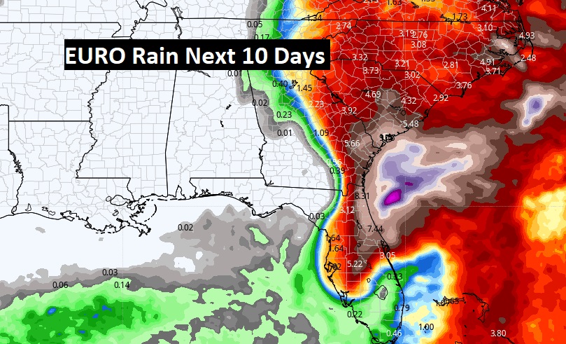
Rain from Ian should miss most of Alabama. For many of us it looks like an extended dry pattern for several days. Here’s The EURO projected rainfall through 10 days.
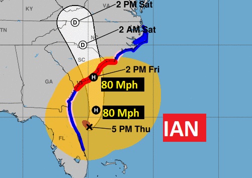
TROPICAL OUTLOOK: Ian is still pounding Florida this morning with very strong winds, storm surge and extremely heavy rain. Some areas have had as much as 20 inches of rain. The center of Ian should reach the NE coast of Florida this evening and then exit into the Atlantic. It is likely to make another landfall somewhere on the southeast US coastline by Friday evening, perhaps near the Georgia, South Carolina border. A hurricane Watch is in effect for the South Carolina coast. Ian will continue to pound the United states for a few more days at least.
This morning, Ian is now a Tropical Storm 40 miles SE or Orlando, moving northeast at 8. Winds now 65 mph. Pressure 986 mbs.
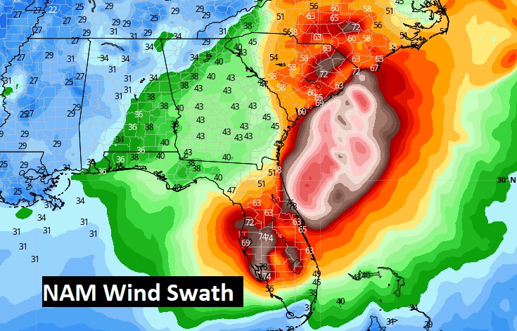
Here’s the high-res NAM model. It’s bullish of the idea that Ian could a Hurricane again in the Atlantic before that next landfall along the Southeast Coast.
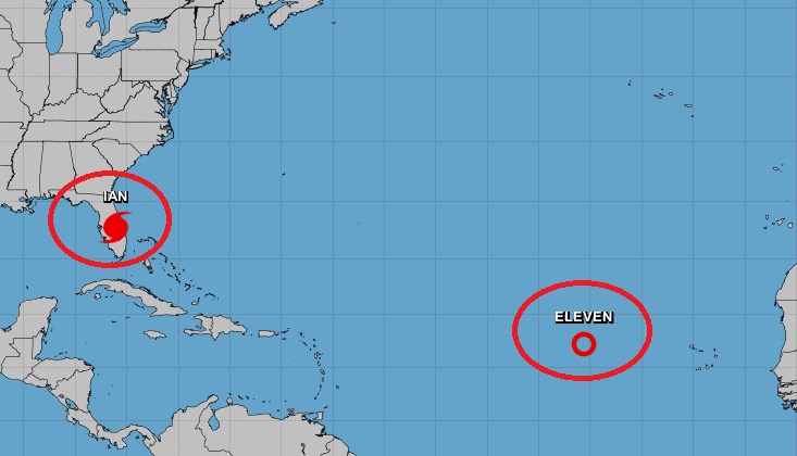
Elsewhere in the Tropics, Tropical Depression Eleven in the far eastern Atlantic is in a hostile environment for development. It may or may not become a named storm. Meanwhile, it will stay in the far east Atalantic.
Thanks for reading this Blog this morning! This morning we are LIVE on the radio from 6 to 9 on NewsTalk 93.1. Watch us on TV on CBS 8 and ABC 32. I’ll have another update for you in the morning. Have a nice day!
–Rich