
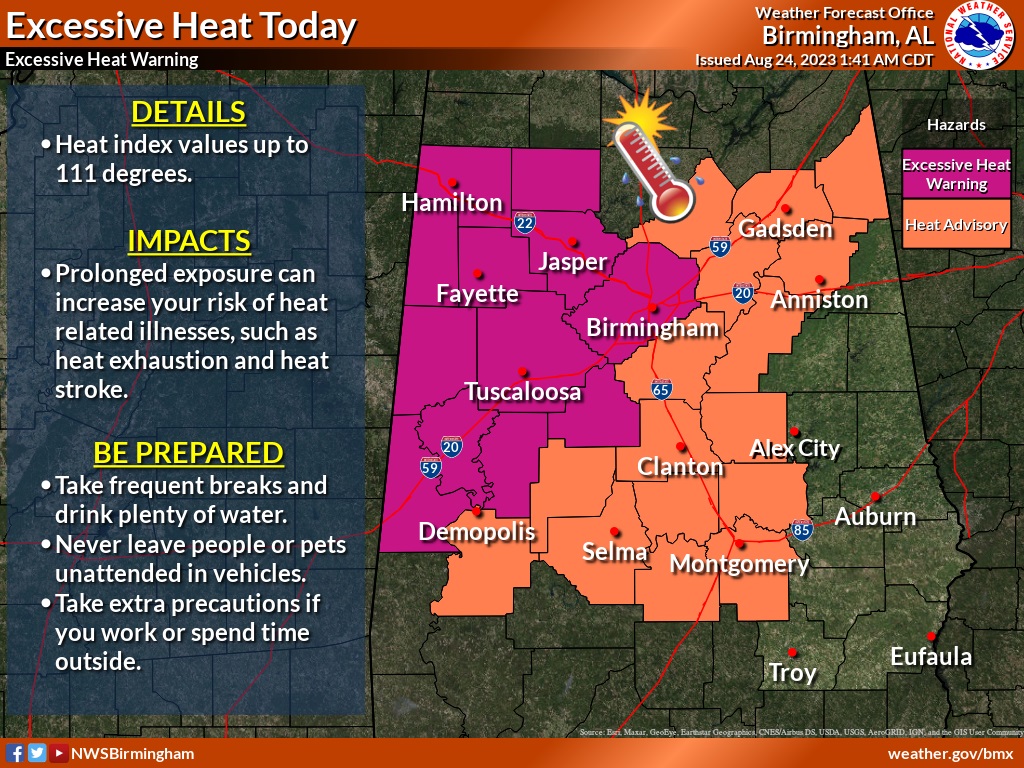
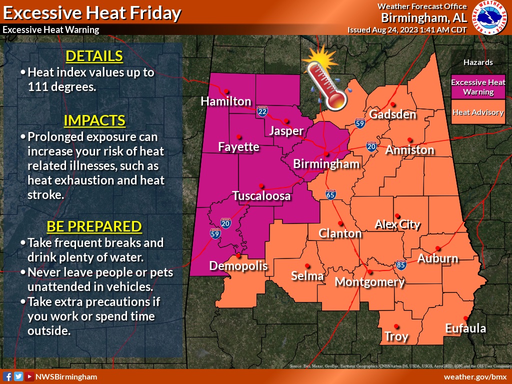
Good Morning! The intense, dangerous widespread August heatwave continues. Most of us are at least under a Heat Advisory through Friday. West of I-65 there is an Excessive Heat Warning. Heat indices will be close to 108+ today and perhaps 110+ Friday. (Yesterday 112 at MGM). Even over the weekend we’ll be in the low 100’s for highs, with excessive numbers on the heat index. Our dry forecast continues thrlugh Saturday. Isolated PM storms may start to pop up Sunday. Scattered storms will be around Monday and Tuesday. There are 4 features being tracked in the Tropics. But, there is a new Area to Watch in OUR backyard. Interesting. We’re watching. Here’s my brief forecast discussion.
TODAY : Heat Advisory through Friday. Sunshine. Very Hot. High 98-100. Max Heat index to 108. Mostly clear tonight. Low 79. Light wind.
The American Heartland continues to experience widespread extreme heat. Relentless. Excessive Heat Warning.
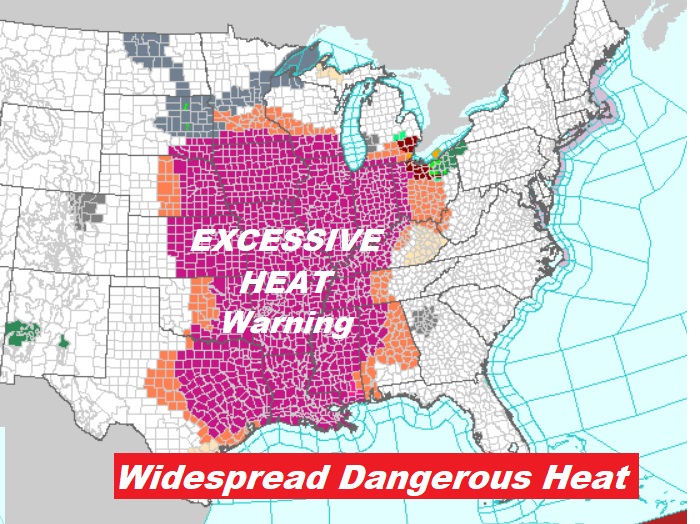
All of Alabama is under various Heat Alerts today & Friday. West Alabama is under an Excessive Heat Warning. Most of the rest of us continue under a Heat Advisory.
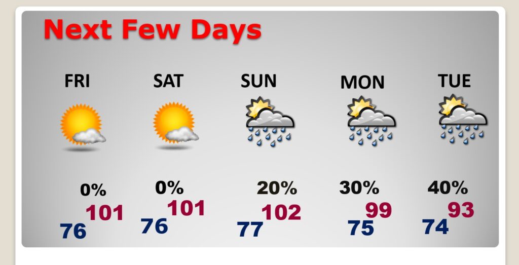
NEXT FEW DAYS: Intense Heat. Close to or exceeding record highs today through Saturday. Sunny days. Lower 100’s Tuesday through Saturday. Heat index 106 to 112. Still dry/storm-free at least through Saturday. Small rain chance returns Sunday and Monday.
TROPICAL UPDATE: NHC is tracking four features. In the far east Atlantic there is the Remnants of Emily and Invest 92-L.
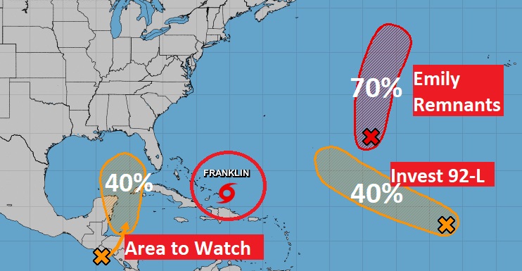
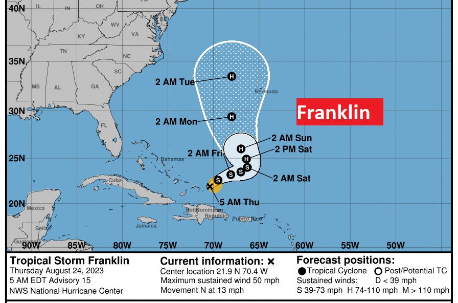
Tropical Storm Franklin is now north of Hispaniola, not too far from Grand Turk Island with 50 mph winds. After surviing its trip over some tall mountains, it now has the chance to become a hurricane in the Atlantic this weekend. It will LIKELY get picked up by a trough, sparing the US mainland threat.
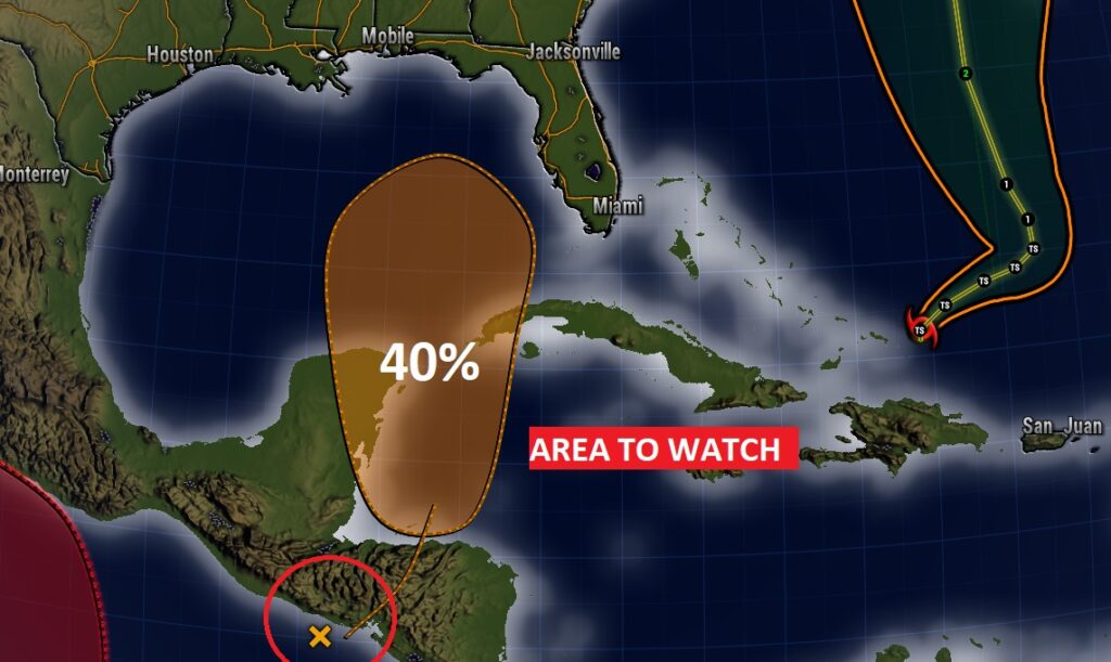
But there’s something new and interesting in the tropics. Area to watch now in the western Caribbean pointing toward the Gulf. It’s actually a Pacific disturbance which is likely to migrate into the Caribbean. NHC now gives this system a 40% chance of development in the next 7 days. There’s much uncertainty on this system, but this is our backyard and we’re watching carefully.
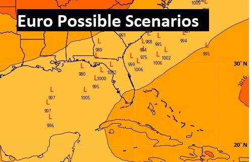
The Euro model suggests a tropical cyclone in the Eastern Gulf middle of next week.
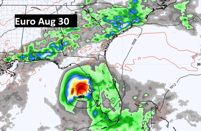
This map is interesting. This is the EURO Ensembles of possible Low Pressure positions through the next seven days. Hmmm. Very interesting. Stay tuned.
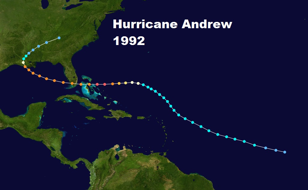
This is the anniversary of one of the most famous Florida hurricanes. 31 years ago today. Hurricane Andrew.
Thanks for reading this Blog this morning! This morning we are LIVE on the radio from 6 to 9 on NewsTalk 93.1. I’ll have another update for you in the morning. Have a nice day!
–Rich