
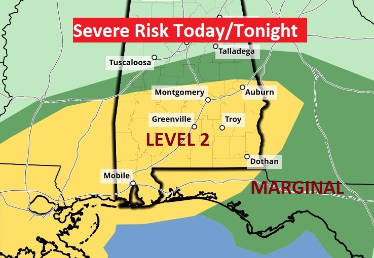
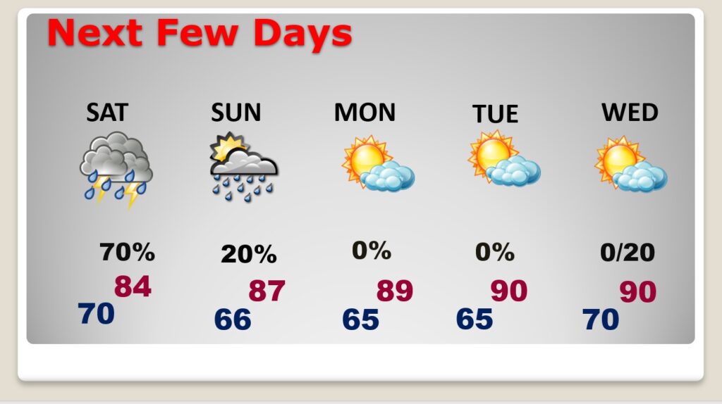
Good morning! We’re dealing with a storm system with multiple hazards, including a severe weather component and a flooding risk. Showers and thunderstorms are likely at times today, tonight and Saturday. Some storms could be strong, possibly severe. There is now a Level 2 Severe Risk from about I-85 southward. There could be a couple of leftover showers Sunday, too.Mostly sunny skies will return Monday. We’ll be near 90 by Monday & Tuesday. Another storms system approaches by the middle and later part of next week. Here’s my brief forecast discussion.
TODAY: Multiple rounds of storms. Periods of showers and storms at times today and tonight. Some storms strong, possibly severe. Locally heavy rainfall amounts. High today 83. Low tonight near 70. East winds 10 to 15, shifting to south in the afternoon, gusting as high as 20 mph.
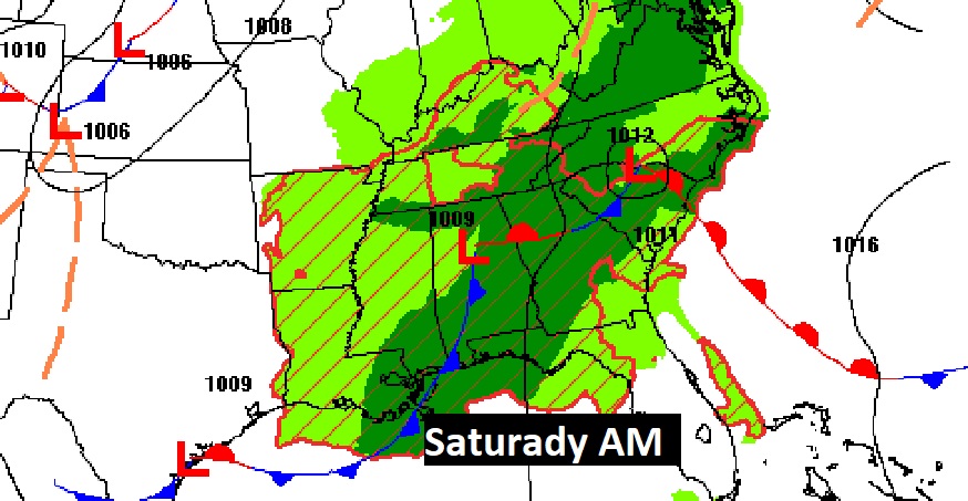
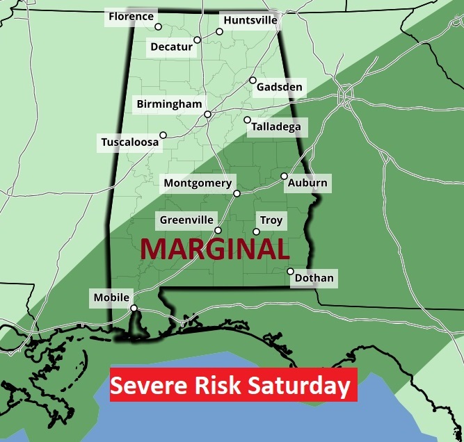
Here’s the set-up today. Some storms could be strong/severe. There is now a Level 2 Severe Risk from about I-85 southward. All modes of severe weather are possible including, damaging wind gusts, large hail and a few tornadoes area also possible.
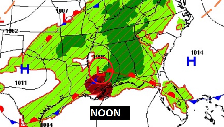
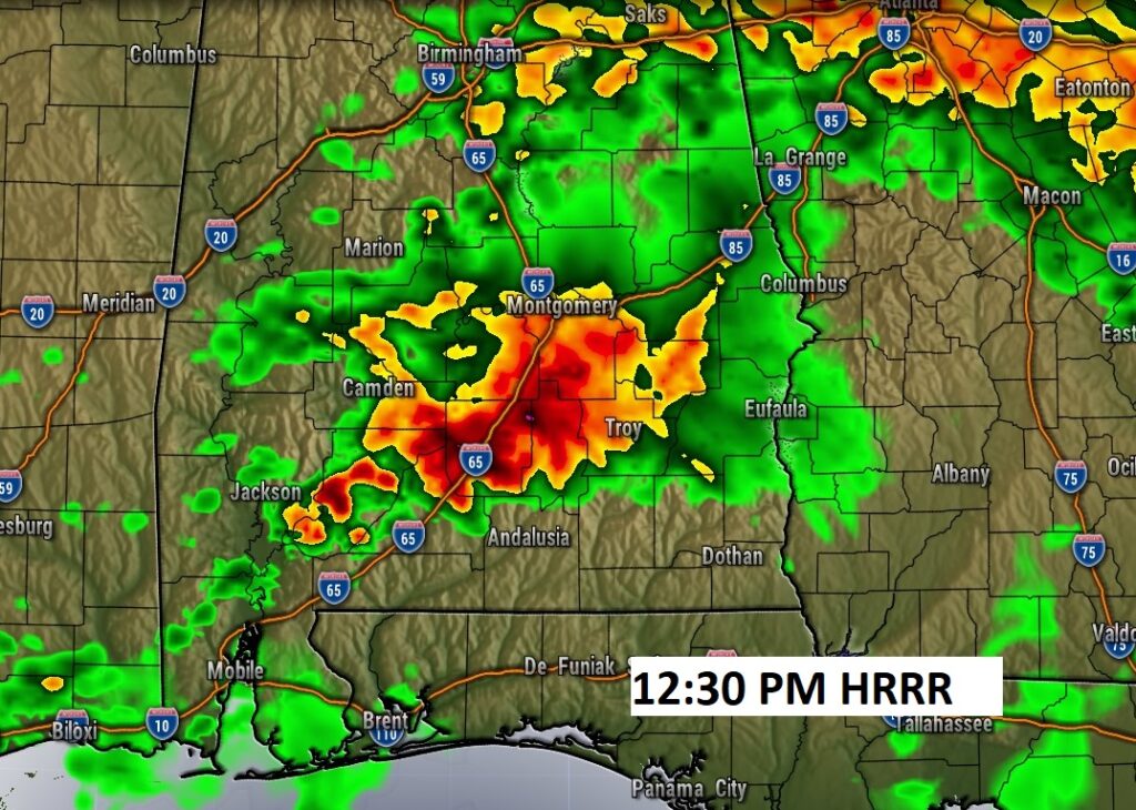
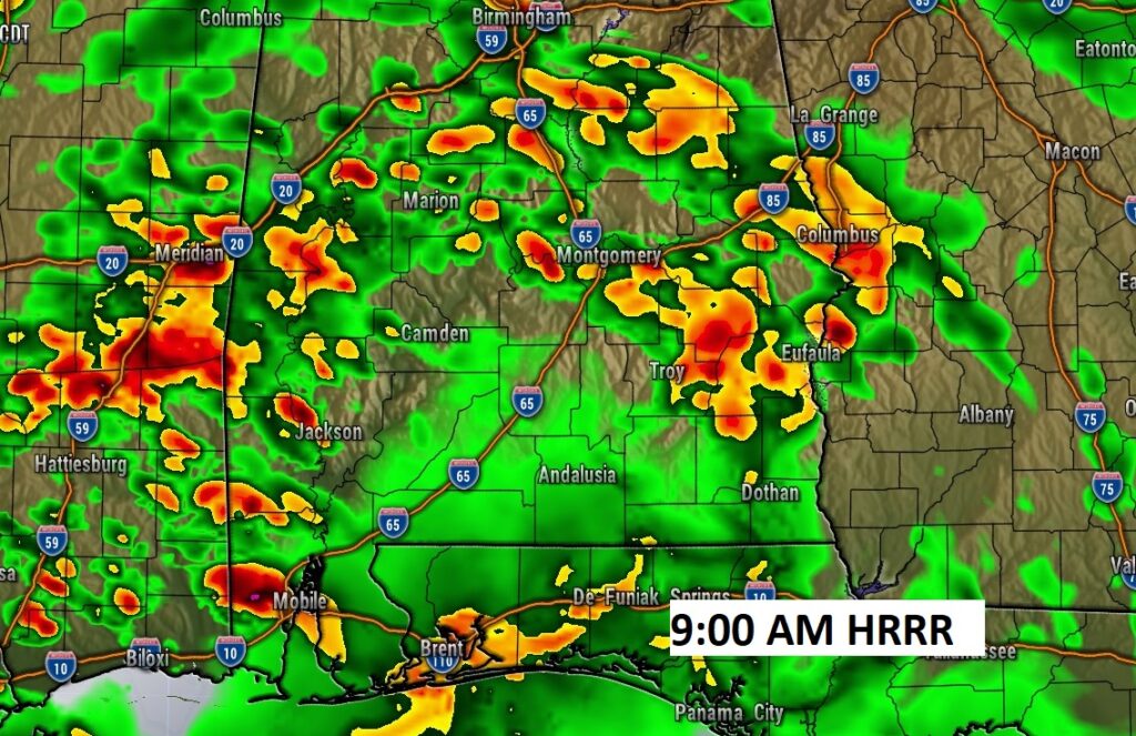
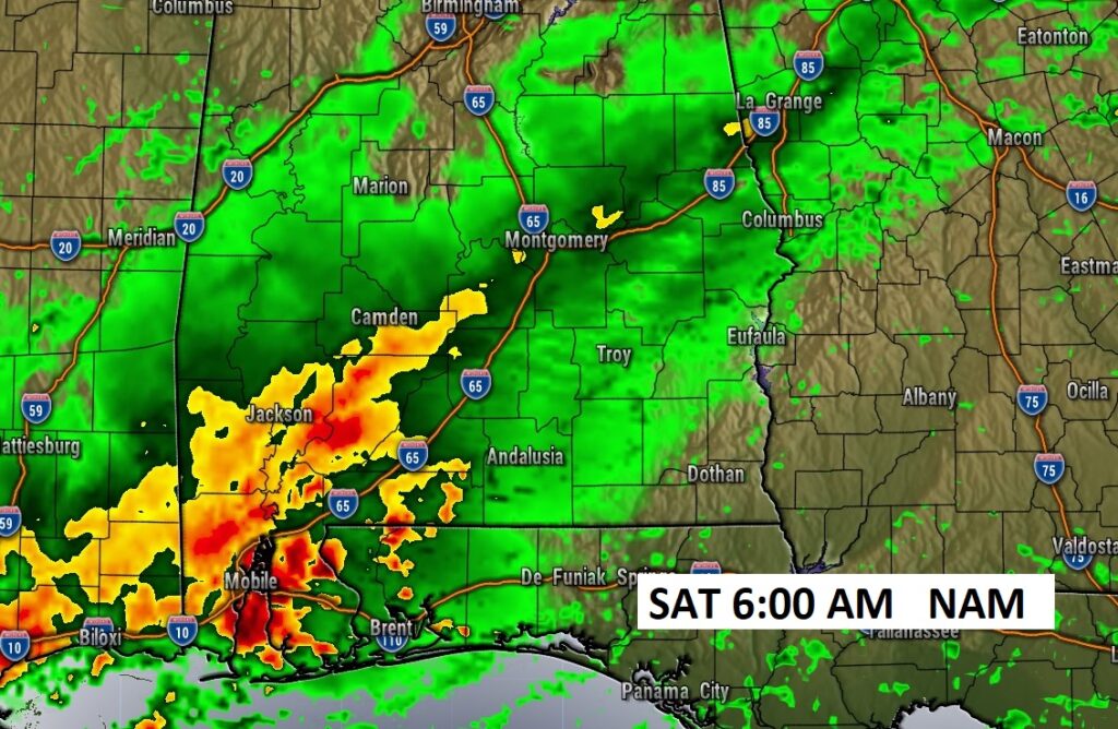
FUTURE RADAR: There will be multiple rounds of storms. Round one through the morning hours. Another round mid day and this afternoon.
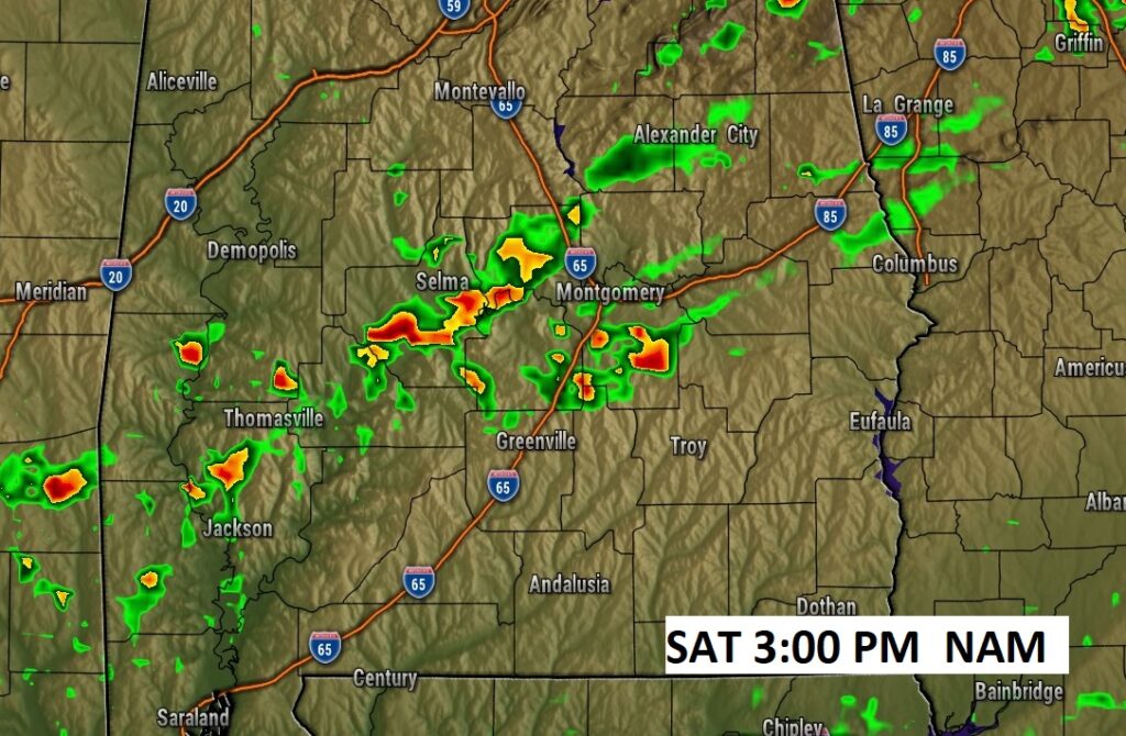
On Saturday, there will be yet another round that could even begin in the pre-dawn hours. The greatest threat of stronger storms will be across SW and coastal Alabama. Later in the day, storms will redevelop Saturday afternoon and evening. More watches and warnings are possible.
NEXT FEW DAYS: Showers and thunderstorms continue likely on Saturday into Saturday evening, before fading out. Some storms could be strong, possibly severe. I’ll keep a slight chance of showers in the Sunday forecast. Mostly skies return Monday. We’ll be near 90 by Monday & Tuesday. Another storms system approaches by the middle and later part of next week.
The risk of strong/severe storms will be ongoing Saturday morning and will be shifting into Southeast Alabama. The Day 3 Risk map begins at 7AM Saturday. Marginal Risk for most of the area. The Level 2 risk begins in the Wiregrass in SE Alabama.
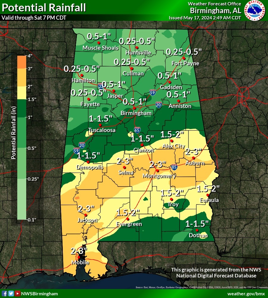
Locally heavy rainfall amounts are possible especially in central and south Alabama. Excessive amounts closer to the coast.

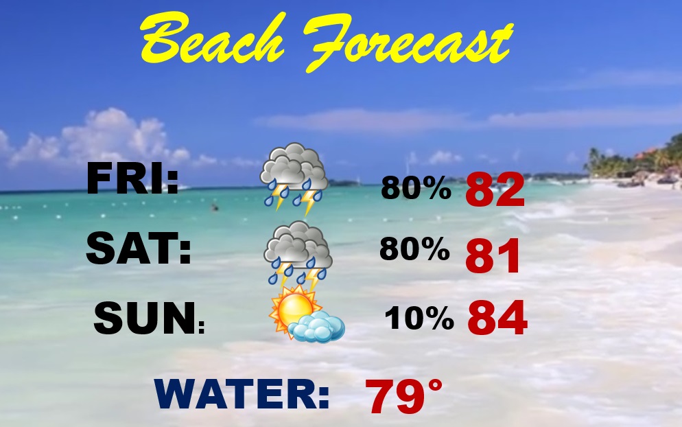
BEACH FORECAST: A pretty awful forecast. Scattered showers and storm are likely at times. Most concentrated storms today through Saturday. Potentially Severe. Locally excessive rainfall amounts. Gulf water 79.
Thanks for reading the blog. There will be another complete Blog update and video forecast discussion tomorrow morning. This morning, everything is normal including LIVE on the Radio from 6 to 9AM on NewsTalk 93.1 – WACV. Have a nice day!
–Rich