
Good morning! Alabama continues to gradually get hotter. Summer-like heat is locked in through Memorial Day Weekend. Humidity is increasing, but still not out of control. Dewpoints are in the 60’s, which is bad enough, Dewpoints will reach 70 or above this weekend, The heat index will be near or above 100. Actual highs will be in the lower 90’s each day. We’re dry through today. But, starting today, and over the Memorial Day holiday weekend, there will be a few widely scattered, random, “hit or miss” storms each day. Some strong storms are not out of the question. Here’s my brief forecast discussion.
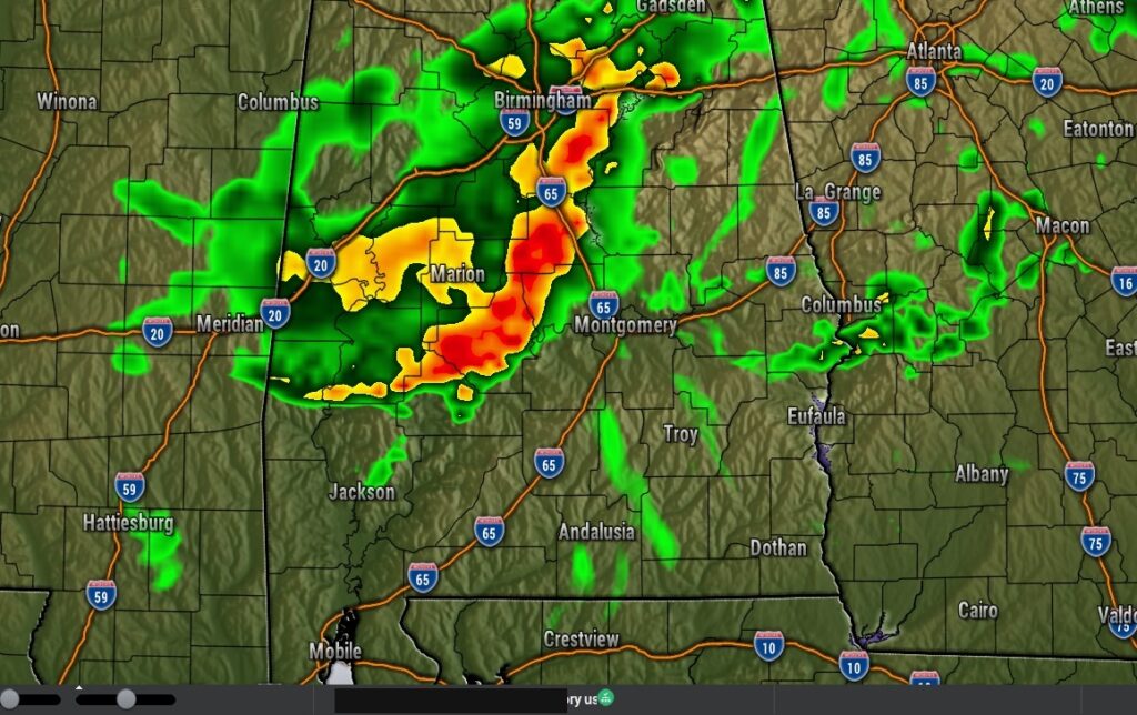
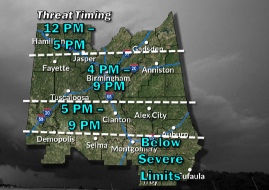
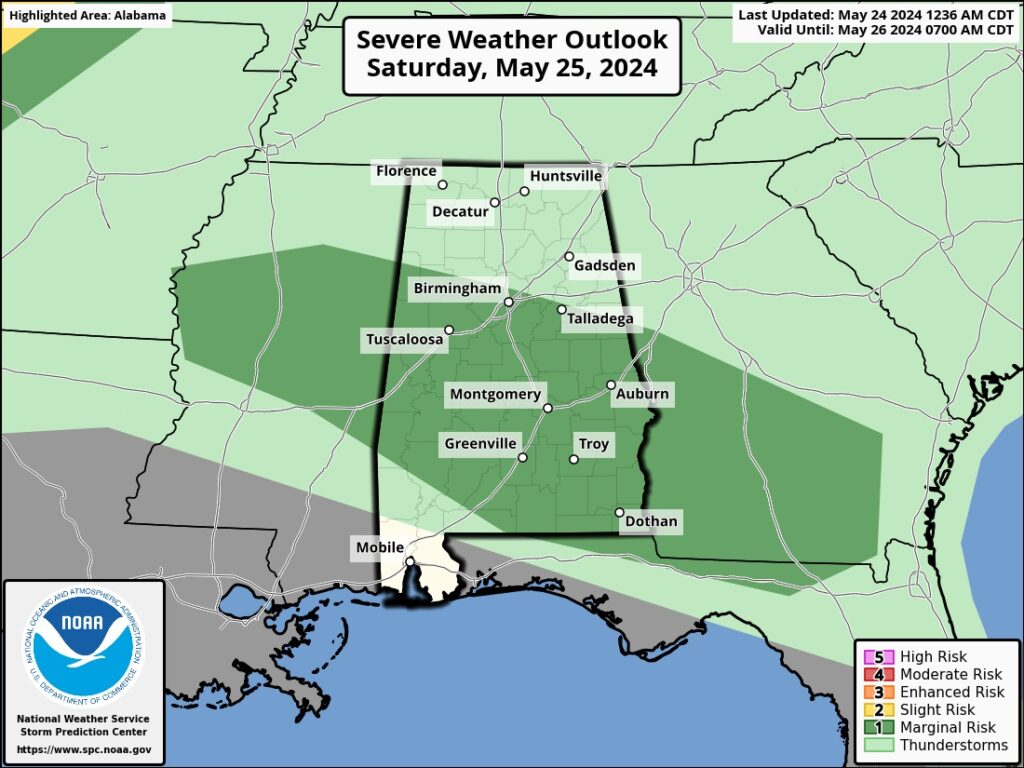
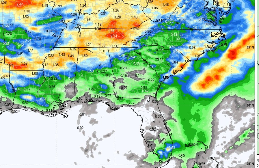
TODAY: A sun/cloud mix Very warm. High near 90. SE wind 5 to 10 mph. Can’t rule out a stray pop up hit or miss storm during the day. But, late tonight, a storm complex called an MCS could reach central Alabama in the overnight hours. It’s possible. Overnight low 71. See Future Radar below. SPC has a Marginal Severe Risk as far south as I-85. ‘Tis the MCS season.
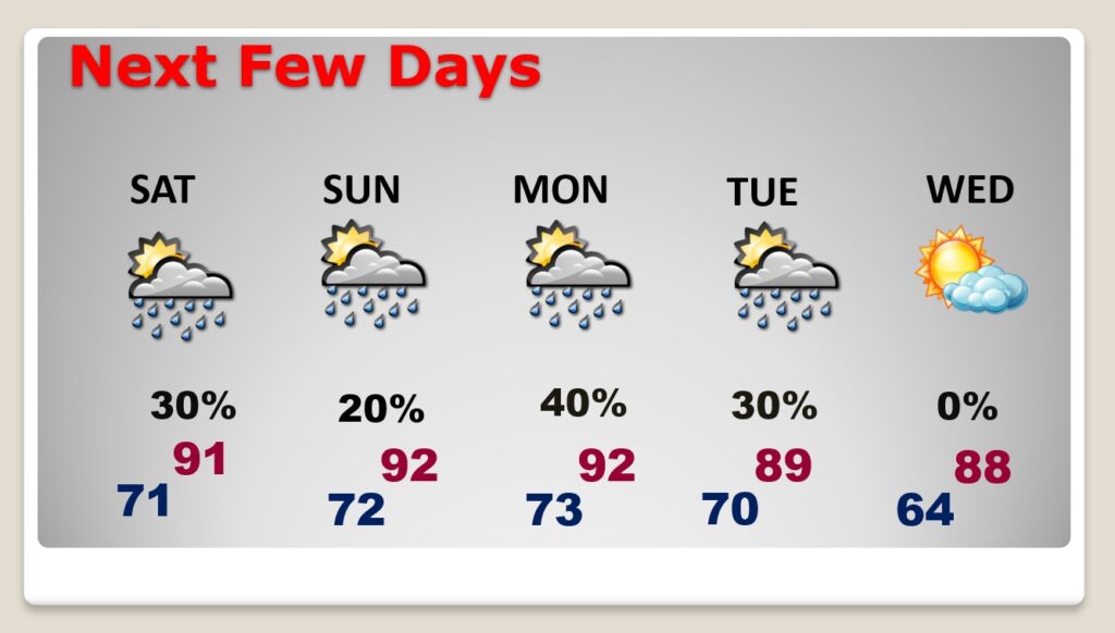
NEXT FEW DAYS: Summer heat is locked in through Memorial Day Weekend. Humidity is increasing, but so far, not out of control. Actual highs will be in the lower 90’s each day. Over the Memorial Day holiday weekend, there will be a few widely scattered, random, “hit or miss” storms each day, The heat index will be nudging the triple digit boundary Saturday through Monday,
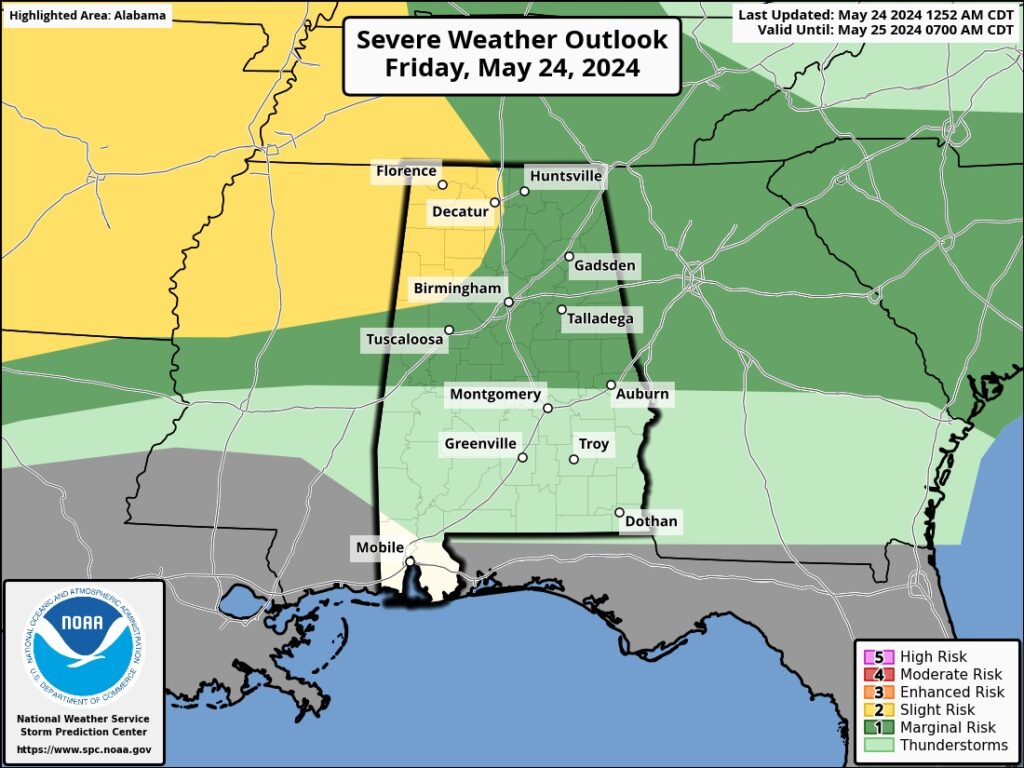
SPC has added a Marginal Severe Risk for much of the area on Saturday, as more MCS storm clusters move SE across the state.
Spotty random storms over the weekend. Best chance Monday, The best rain chance will mostly be north of I-20. Otherwise, It’s a pretty routine Memorial Day Weekend.
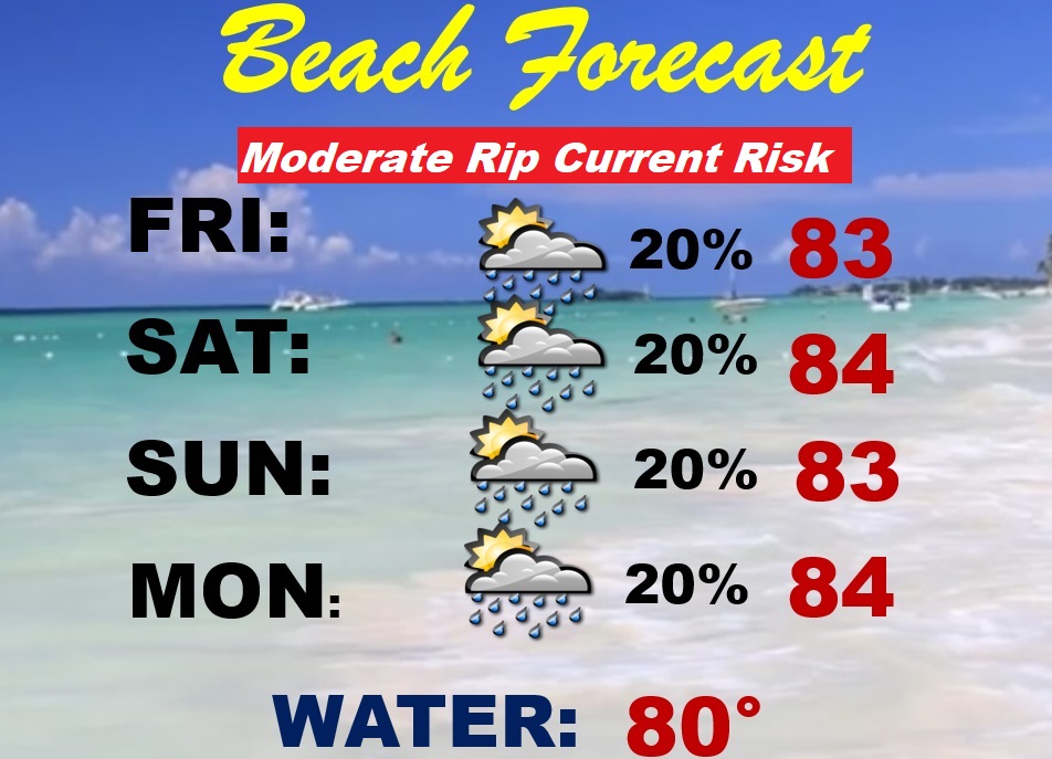
BEACH FORECAST: Should be a pretty typical Memorial Day weekend. Widely Scattered, random, “hit or miss”, mainly afternoon and evening showers and storms will be prowling around. Gulf water temperature 80. Moderate rip current risk Friday through Monday.
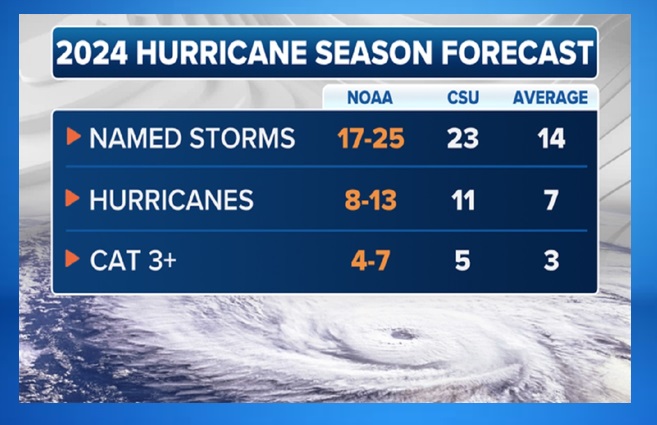
NOAA ISSUES AGGRESSIVE HURRICAE SEASON FORECAST: NOAA has released its seasonal Hurricane outlook for the Atlantic basin, and due to warm waters and a diminishing El Niño, the agency believes the year could be ferocious. The agency anticipates between 17-25 named storms will form, with 8-13 becoming hurricanes with winds of at least 74 mph. Out of those 8-13, 4 to 7 could become major with winds of at least 115 mph. It’s the greatest number of hurricanes predicted by NOAA in its annual May forecast, surpassing the forecast of 14-23 storms in 2010. In all, NOAA gives an 85% chance of an above-average season. It’s fairly similar to the Colorado State University forecast issued in April.
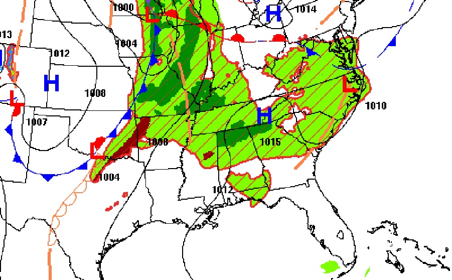
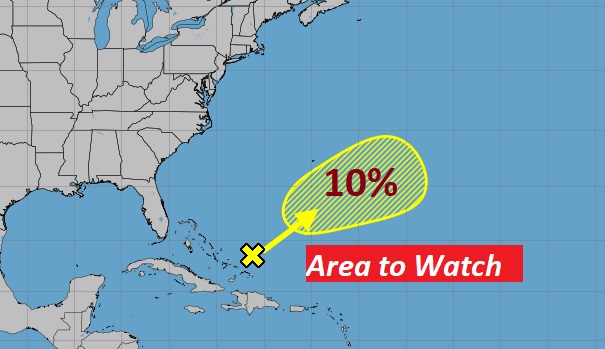
NHC is tracking a minor Area to Watch in the Atlantic. But, with all the extremely aggressive 2024 Hurricane Season outlooks, it makes one wonder how many “X”s will populate this map in the coming months. Be Ready.
Thanks for reading the blog. There will be another complete Blog update and video forecast discussion tomorrow morning. This morning, everything is normal including LIVE on the Radio from 6 to 9AM on NewsTalk 93.1 – WACV. Have a day!
-Rich