
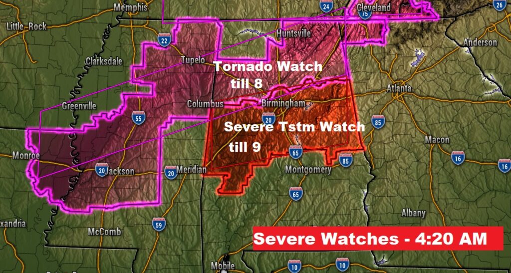
Good morning on this Memorial Day! Early this morning, the northern third of the state has been dealing with a series of watches warnings. Several counties near the Tennessee border have been under tornado warnings and severe thunderstorm warnings. Most of this morning activity will be confined primarily to the northern third of the state.
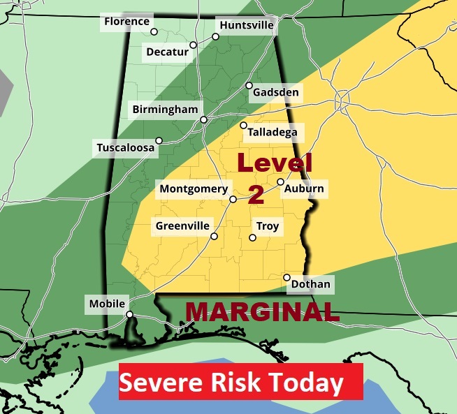
For the rest of us, storms will be more numerous today, with coverage closer to the 40-50% range especially in the afternoon and evening. Some storms could be strong, possibly severe. Level 2 risk for many. Damaging wind gusts will be the main risk. Remember, if you are close enough to hear thunder, even distant thunder. You are close enough to be struck by lightning. Our weather app will keep you on top of the action. Expect a calmer, sunnier day Tuesday with a high near 90 and lower humidity. In fact, much of the week ahead will be mostly sunny, dry and warm. But, generally dry all week till perhaps Saturday. I’ll have the next forecast video tomorrow morning.
SET-UP TODAY: A Southard moving front will be the culprit responsible for two rounds of severe weather, the first this morning for the northern counties.
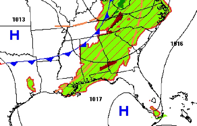
Here’s a an early morning snapshot of the various watches and warnings, from Severe Weather Round one. A new Severe thunderstorm Watch has been issued for areas as far south as Chilton, Coosa and Tallapoosa counties until 9AM.
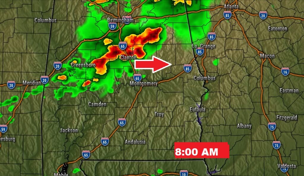
Round one storms will tend to fizzle and move out of the area later this morning as the storms reach a more stable airmass father south. Re-development farther south will occur later in the day. More on that below,
TODAY: A sun/cloud mix. Very warm, humid. Scattered random pop-up storms, especially in the afternoon and evening. Some storms will be strong to severe with the main risk damaging wind gusts. High 88 to 90. Low tonight near 70.
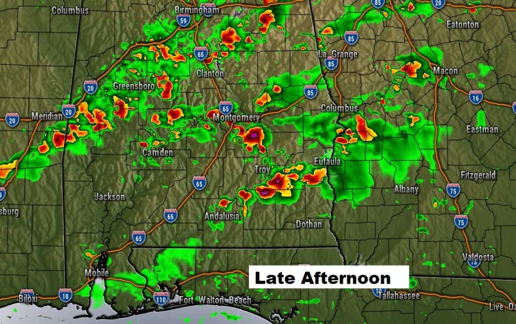
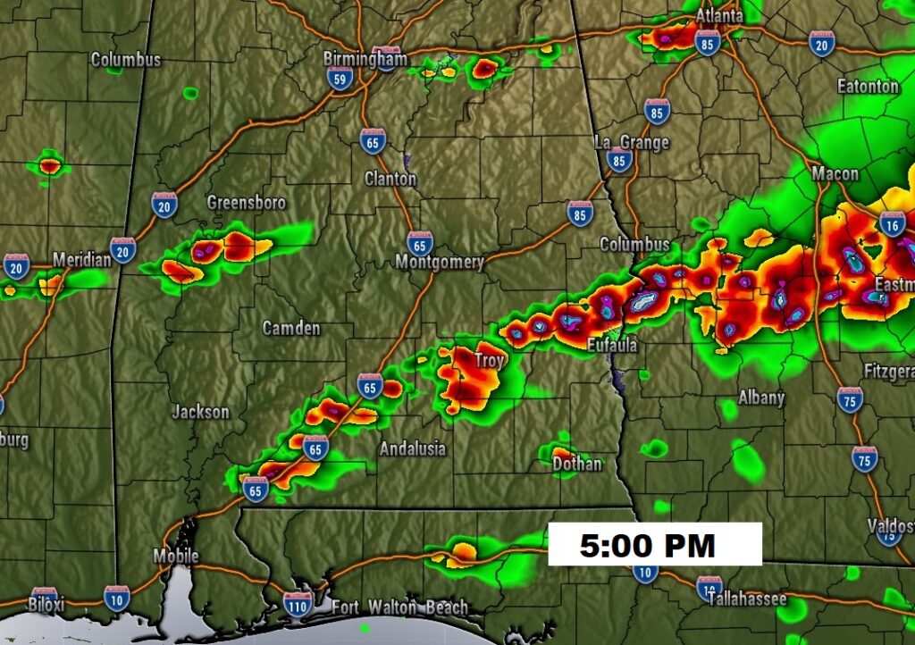
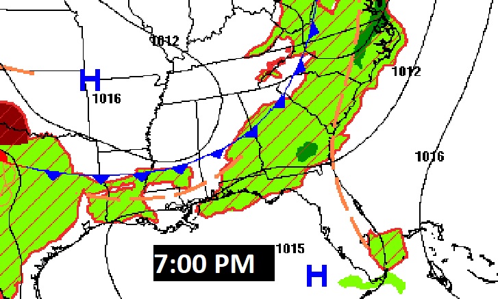
FUTURE RADAR: After the morning round of storms, the atmosphere will “reload” and a new round of showers and storms will get going. Some strong possibly Severe. Be ready. Lots of outdoor cookouts and lake trips could be greatly affected. Be flexible. Our weather app will show you where the storms are.
SEVERE WEATHER RISK: As storms redevelop later this afternoon and well into the evening hours, the area of concern will shift farther south across much of central and south Alabama. Damaging wind gusts ae the main risk We are in a Level 2 out of 5 severe risk. Our weather app will keep you on top of the action with radar, future radar, and instant severe weather notifications.

NEXT FEW DAYS: Expect a calmer, sunnier day Tuesday with a high near 90. In fact, much of the week ahead will be mostly sunny, dry and warm. But, generally dry all week till perhaps Saturday
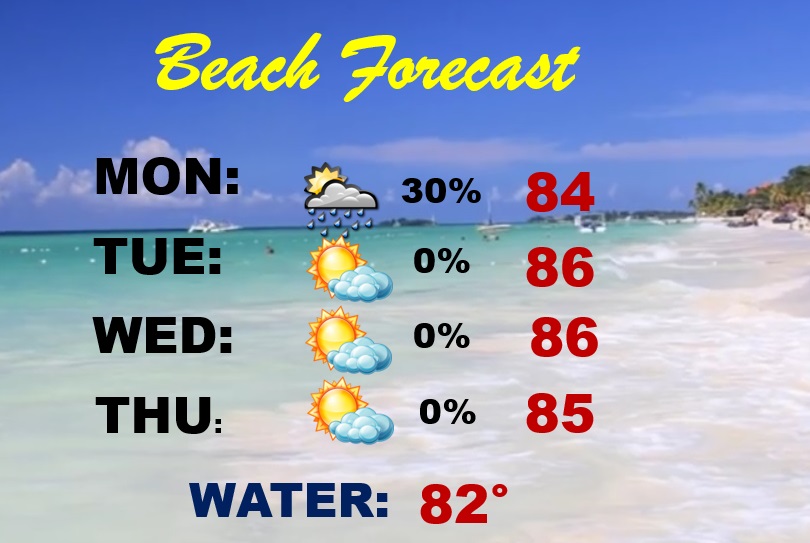
BEACH FORECAST: Should be a pretty typical Memorial Day. Widely Scattered, random, “hit or miss”, mainly afternoon and evening showers and storms will be prowling around today. The rest of the week looks dry. Gulf water temperature 82. Moderate rip current risk today & tomorrow from the Alabama coast to Destin and a High Risk east of Destin.
Thanks for reading the Blog this morning. The next complete Blog and video is scheduled for Tuesday morning. Have a nice holiday! Stay weather aware on this Memorial Day holiday!
-Rich