
Good morning! The front that brought showers and thunderstorms to the area yesterday has made it to the coast. Memorial Day was the most hot and humid day so far. The high at MGM was 91 with a dewpoint of 77, Heat Index 102 and rainfall: .85”. Today will be much more pleasant with sunshine and lower humidity. The forecast for the week looks great as May ends and June begins. But, expect dry all week till the weekend. Random, scattered showers and thunderstorms. Here’s My brief forecast discussion.
TODAY: Mostly sunny and less humid. High 88 to 90. Low tonight near 70. Light NW wind.
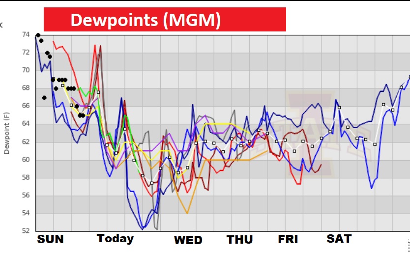
What a difference a day makes! Yesterday was so uncomfortable with a DEWPOINT of 77 at MGM, Heat Index 102. But, behind the front this afternoon we could see dewpoints in the upper 50’s. MUCH BETTER!
NEXT FEW DAYS: Much of the week ahead will be mostly sunny, dry and warm.Highs most days will be in the 80’s. But, generally dry all week till perhaps Saturday and Sunday. Scattered showers and thunderstorms.
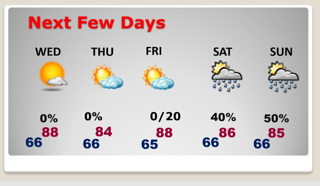
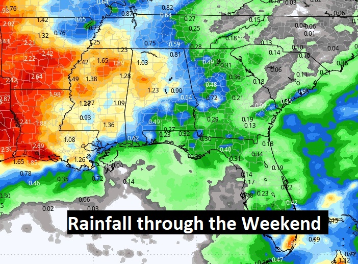
We are dry through Friday. Random scattered showers and storms return over the weekend.
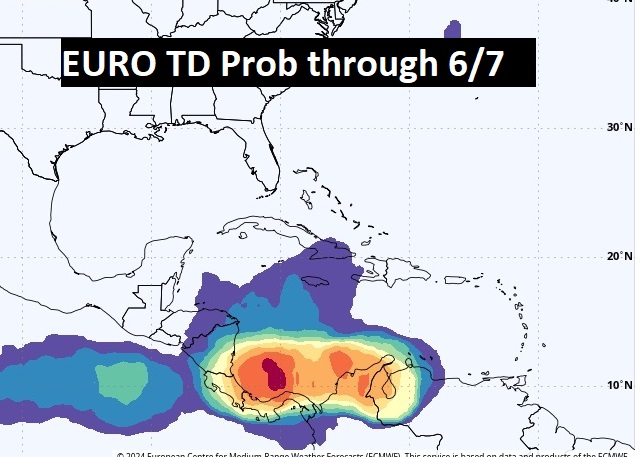
FOUR days now until official start of hurricane season and take a look at the EURO T.D. Probability through June 7. Could the Caribbean be waking up? We’ll watch it.
Thanks for reading the blog. There will be another complete Blog update and video forecast discussion tomorrow morning. This morning, everything is normal including LIVE on the Radio from 6 to 9AM on NewsTalk 93.1 – WACV. Have a nice weekend!
–Rich