
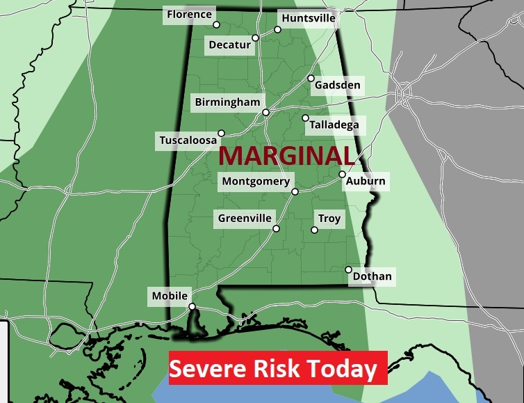
Good Morning! Welcome to June! Today is the first day of Hurricane season. And, it’s the first day of Meteorological Summer. Radar will be active today. Looks like various rounds of showers & storms today. There is an ongoing risk early this morning. Then a lull. Then, there will be redevelopment this afternoon and this evening and tonight, Scattered showers and thunderstorms. Some storms could be strong to severe. We’re in a Marginal Severe risk today. Damaging wind gusts would be the main threat. Clouds will hold the temperature down a bit. There will be another round of showers and storms tomorrow. But the number of storms will thin out a bit Monday and Tuesday.
TODAY: Looks like various rounds of showers & storms today. There is an ongoing risk early this morning. Then a lull. Then, there will be redevelopment this afternoon and this evening and tonight, Scattered showers and thunderstorms. Some storms could be strong to severe. We’re in a Marginal Severe risk today. Damaging wind gusts would be the main threat. Clouds will hold the temperature down a bit. High today 83. Low tonight 67. Breezy today. Southeast winds 11 to 18 gusting to 25 mph.
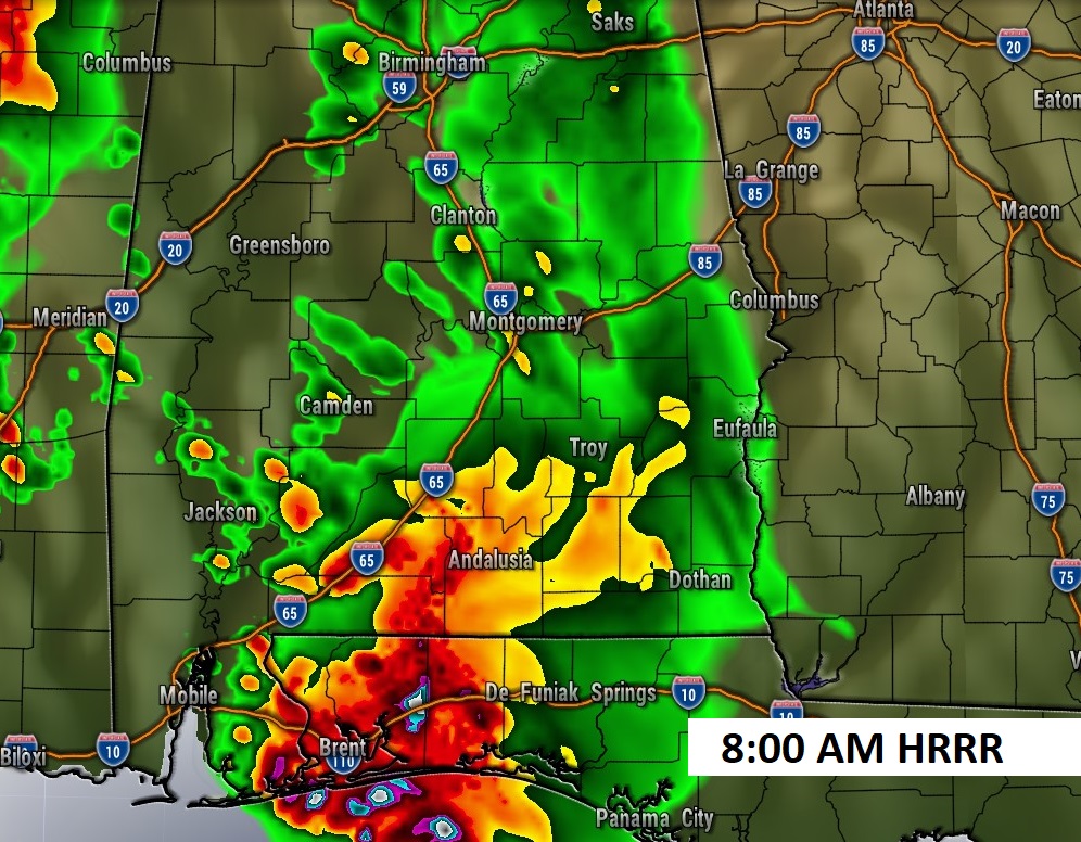
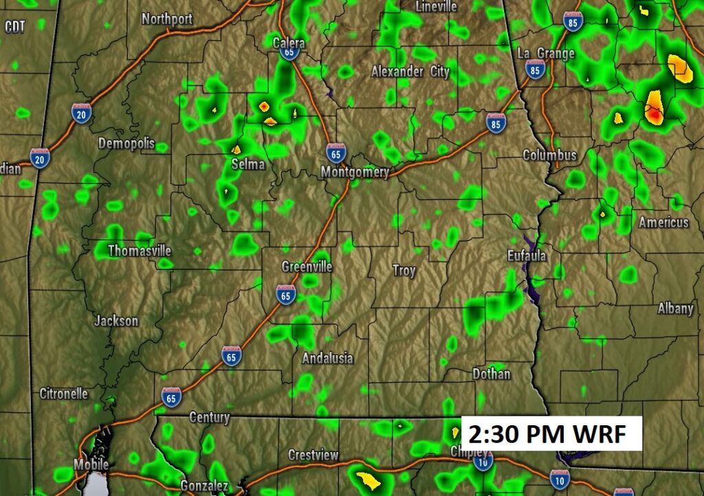
FUTURE RADAR: Potential for multiple rounds of showers and storms, this morning, this afternoon and this evening.
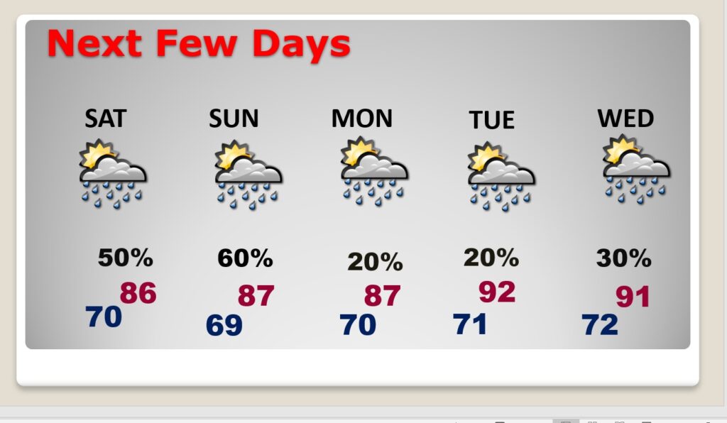
NEXT FEW DAYS: Be flexible with your outdoor plans this weekend. Saturday will feature scattered showers and thunderstorms. Some storms could be strong to possibly severe. Marginal Severe Risk. Storms could be a little more numerous Sunday. Smaller rain probabilities Monday through Wednesday.
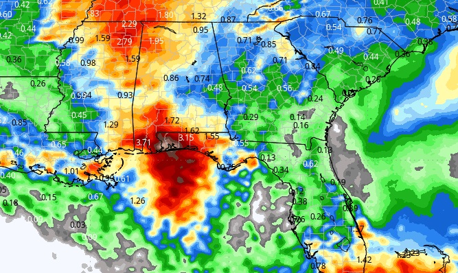
Here’s the expected rainfall outlook through the next 5 days. .Showers and thunderstorms. Best chance for the more significant rainfall totals will be near the coast.
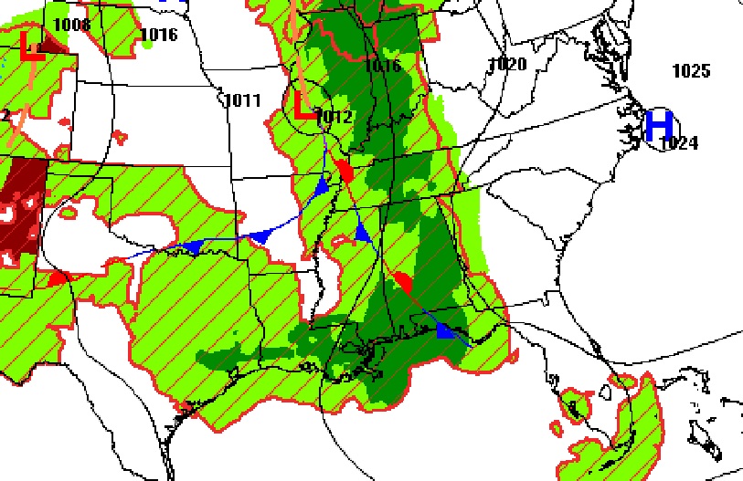
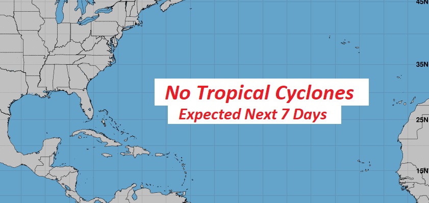
HURRICANE SEASON STARTS TODAY: There are currently no” X”s on the map from NHC on this first day of the season. But we are tracking 4 tropical waves between Africa and Central America.
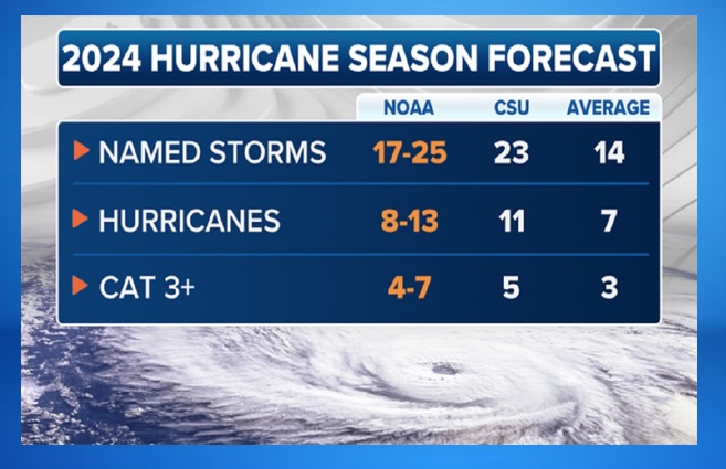
I’m sure everybody knows by now, we are expected a very hyper active season.
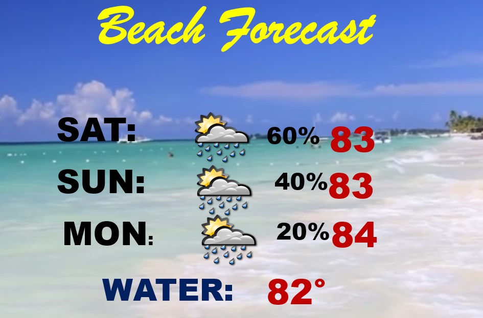
BEACH FORECAST: Be flexible with your plans. Showers and storms will be roaming around at times, interrupting your outdoor plans. Be ready to adjust your plans at times. HIGH rip current risk through Monday, especially from Destin eastward.
Thanks for reading the blog. The next complete scheduled blog update and video will be Monday morning, unless updates are needed. Havea nice weekend.
–Rich