
Good Morning! The heat is building. Today’s high will be near 90. We’ll be in the lower 90’s Wednesday. Scattered mainly in the afternoon and evening hours. Showers will be a little more numerous on Thursday as a front approaches. But, no severe weather is expected and the tropics are quiet for now. Here’s my brief forecast discussion.
TODAY: Limited sunshine. Random spotty scattered showers and pop up storms are possible, mainly in the afternoon and evening hours. High near 90. Light wind. Mostly cloudy tonight. Low 68. (Normal 90/66).
Routine day today.

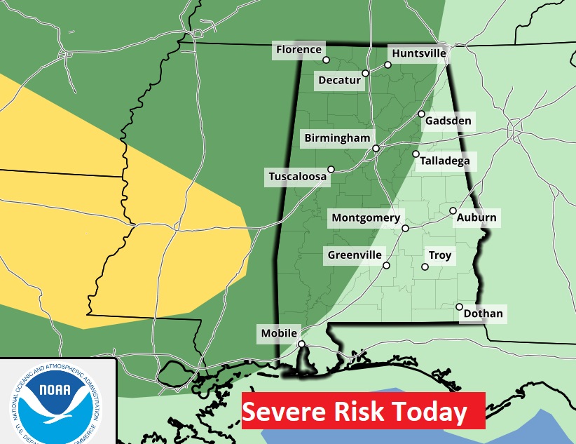
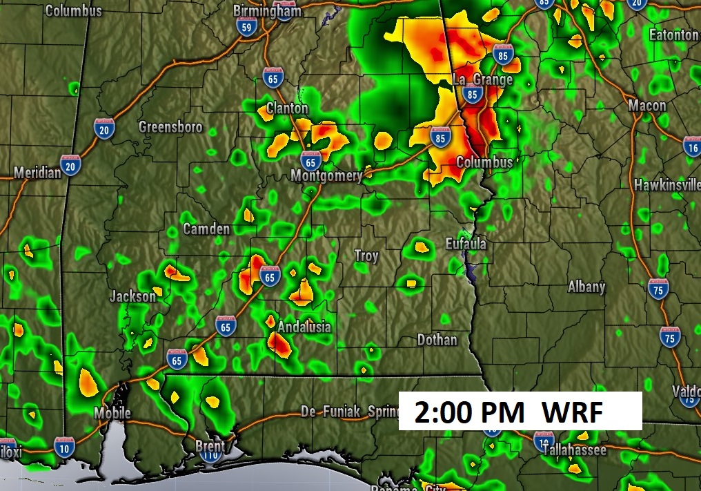
FUTURE RADAR: This model snapshot may be just a bit aggressive. But, you get the idea. Spotty random PM storms. SPC says some storms in the western counties could be strong.
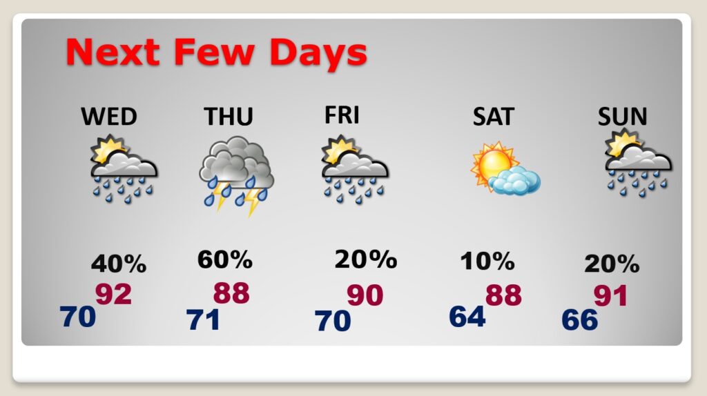
NEXT FEW DAYS: Normal high is 90. We’ll be in the lower 90’s Wednesday. Random scattered storms possible, mainly in the afternoon and evening hours. Showers/storms could be a little more numerous on Thursday as a front approaches and moves into south Alabama on Friday. Saturday looks dry behind the front. Isolated PM storms Sunday.
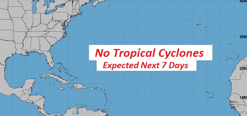
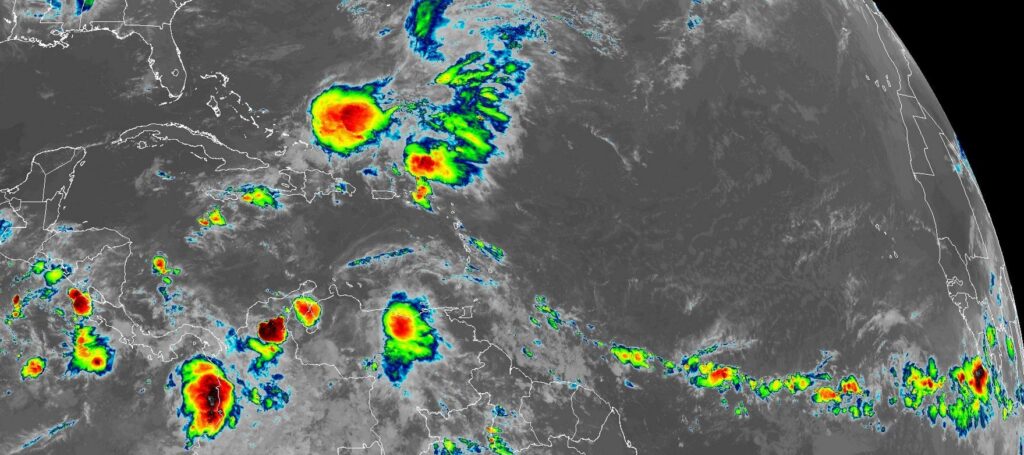
TROPICAL: Everything is quiet and routine for now. There are about ta few tropical waves out there between here and Africa.NHC says no tropical development in the next 7 days.
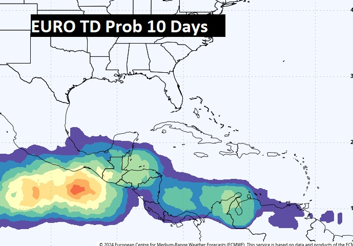
The next week could be different. We’ll be watching the western Caribbean. The EURO is hinting the Caribbean may start to wake up.
Thanks for reading the blog. There will be another complete Blog update and video forecast discussion tomorrow morning. This morning, everything is normal including LIVE on the Radio from 6 to 9AM on NewsTalk 93.1 – WACV. Have a nice weekend!
–Rich