
Good Morning! Summer officially begins tomorrow. Today is the last full day of Spring. Today’s saving grace will be a nice breeze and slightly lower humidity. Also, showers will be scarce at best today, tomorrow and Friday. Scattered storms will be more numerous Saturday and Sunday. In the southwest Gulf PTC will impact the Mexican and south Texas coast. In addition. NHC is also monitoring two Areas to Watch. One of f the southeast coast, and another new area of potential future development in the SW Gulf. Here’s my brief forecast Discussion.
TODAY: Partly sunny. High 92. Today’s saving grace will be a nice breeze and slightly lower humidity. East wind 10 to 15 gusting to 25. Low tonight. 72.
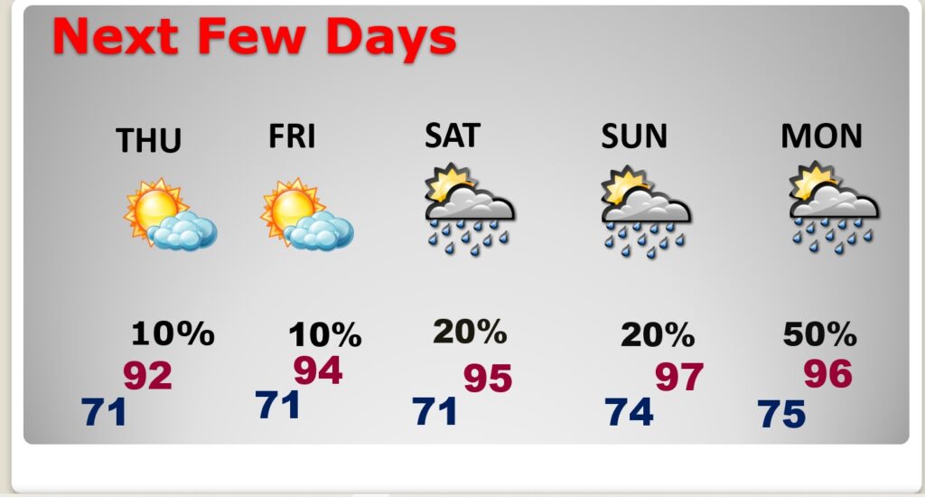
NEXT FEW DAYS: Today, Wednesday, Thursday and showers will be scarce at best. Scattered storms will be more numerous Saturday and Sunday. Highs will be in the low to mid 90’s. Dewpoints in the 70’s. Triple digit heat indices. Lows at night in the middle 70’s.
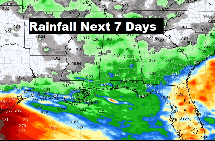
Notice all the very heavy rain will stay out in the Gulf and across Florida over the next few days.
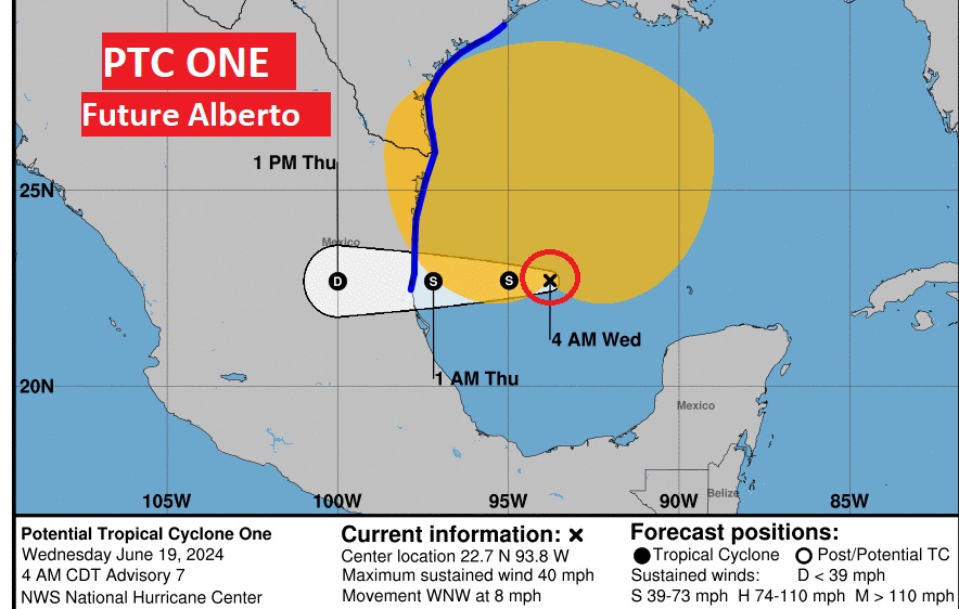
TROPICAL UPDATE: . In the southwest Gulf PTC will impact the Mexican and south Texas coast. In addition. NHC is also monitoring two Areas to Watch. One off the southeast coast, and another new area of potential future development in the SW Gulf.

Potential Tropical Cyclone One in the SW Gulf could officially become Tropical Storm later today or tonight as it heads toward the Mexican coast. Tropical storm Watch extends as far north as Corpus Cristi. .
SUMMER SOLSTICE: Summer officially begins Thursday at 3:51 PM CDT The Summer Solstice.

Thanks for reading the blog. There will be another complete Blog update and video forecast discussion tomorrow morning. This morning, everything is normal including LIVE on the Radio from 6 to 9AM on NewsTalk 93.1 – WACV. Have a nice day!!
–Rich