
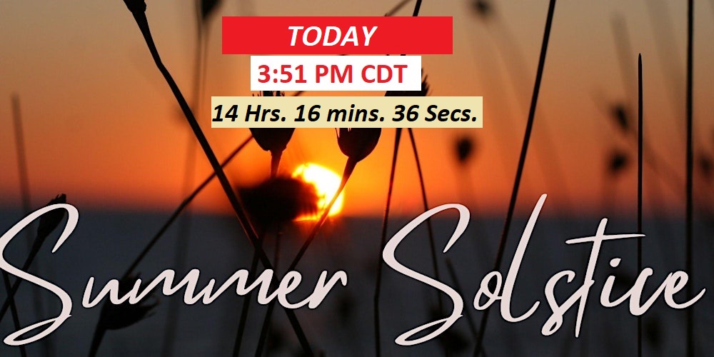
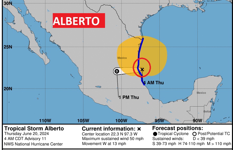
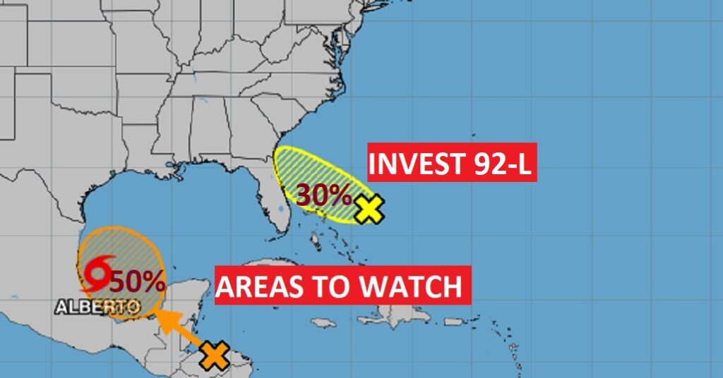
Good Morning! Summer officially begins today. The Summer Solstice, Longest day of the year. One second longer than yesterday.. Also, showers will be scarce again, at best, today and tomorrow. Widely Scattered storms will be more numerous Saturday and Sunday. Perhaps, more numerous on Monday & Tuesday. Tropical Storm Alberto will make landfall in Mexico today. NHC is also monitoring two Areas to Watch. One off the southeast coast (invest 92-L), and another area of potential future development in the SW Gulf, just behind Alberto. Could we see Beryl by the end of the weekend? Here’s my brief forecast Discussion.
TODAY: Mostly sunny. High 94. Humidity not crazy. Dewpoints in the mid 60’s. Heat index under 100. East wind 10 to 15 mph. Low tonight. 72.
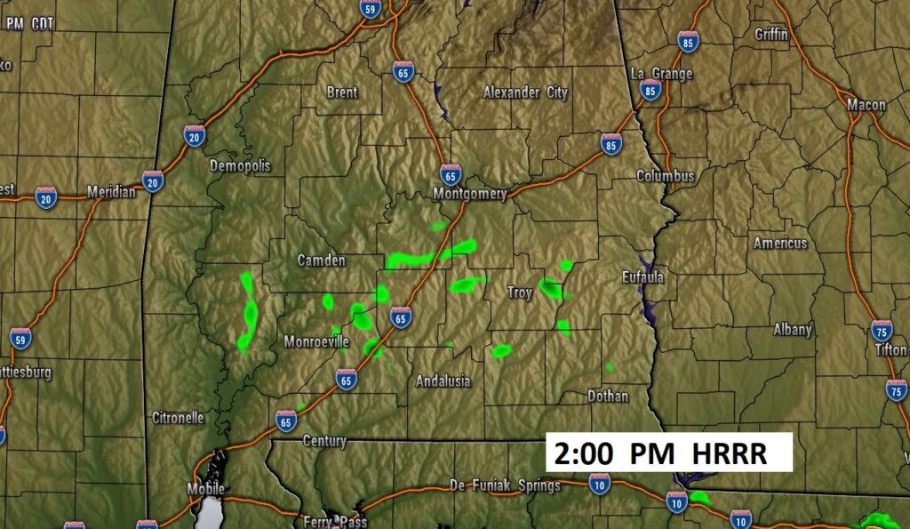
Rain Chance not zero, but 10% or less today and tomorrow.
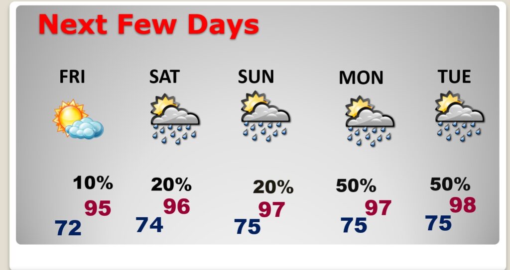
NEXT FEW DAYS: Showers on Friday will be scarce at best. 10% chance. Scattered storms will be widely scattered Saturday and Sunday. Perhaps a little more numerous Monday and Tuesday Highs will reach the mid to upper 90’s Sunday and Mondayn90’s. Dewpoints will be in the 70’s. Triple digit heat indices. Lows at night in the middle 70’s. Heat index in the triple digit territory Sunday through Tuesday and beyond.
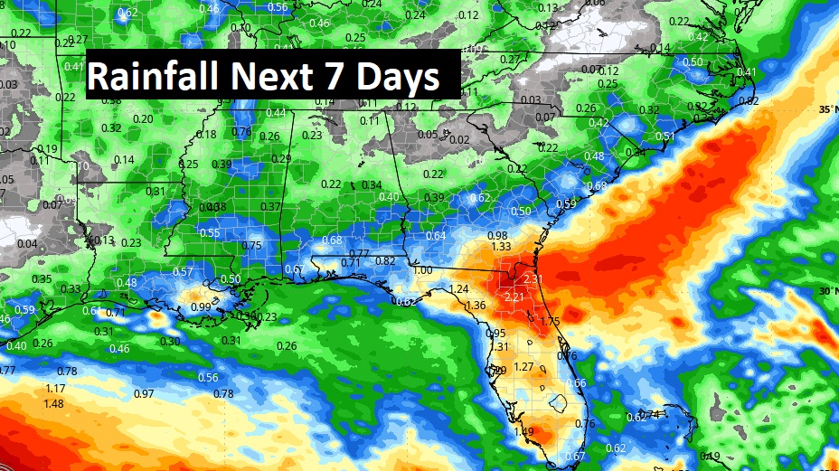
Notice all the very heavy rain will stay out in the Gulf and across Florida over the next few days.
TROPICAL UPDATE: Tropical Storm Alberto, with 50 mph will make landfall this morning near Tampico, Mexico. NHC is also monitoring two Areas to Watch. One of the southeast coast, and another area of potential future development in the SW Gulf, just behind Alberto. Could we see Beryl by the end of the weekend?
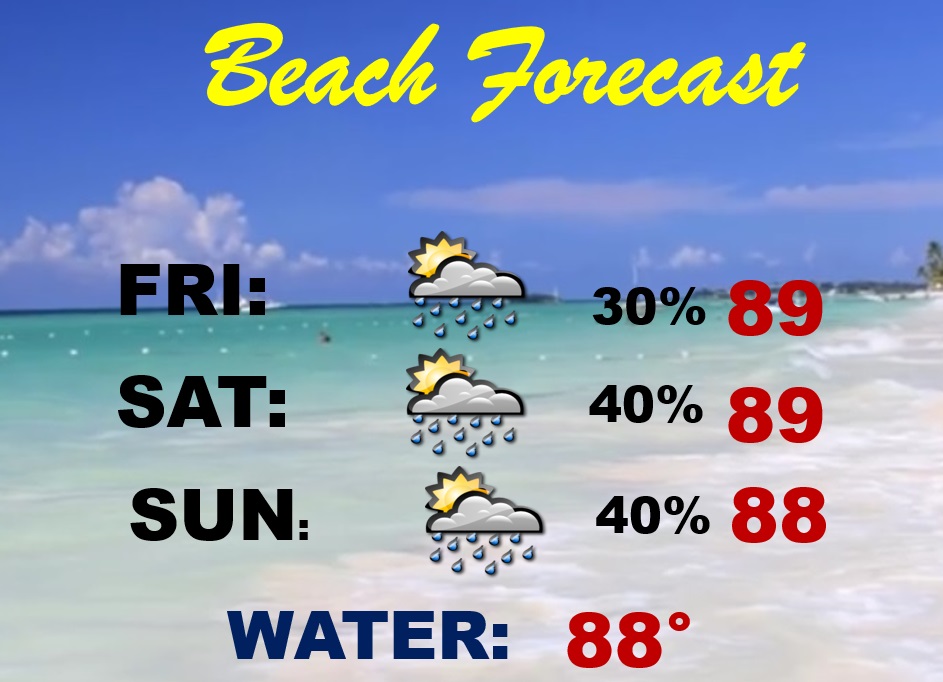
BEACH FORECAST: Watch out. High Rip Current Risk.
Thanks for reading the blog. There will be another complete Blog update and video forecast discussion tomorrow morning. This morning, everything is normal including LIVE on the Radio from 6 to 9AM on NewsTalk 93.1 – WACV. Have a nice day!!
–Rich