
Good Morning! Some towns could hear the rumble of thunder early as a weak front approaches the river region. Today, the big story will be dangerous heat, High 98. Heat index maybe105 here in central Alabama. Potentially 110 of higher in parts of SE Alabama. Some random “hit or miss” storms could redevelop in the afternoon & evening heat. Tuesday will be another day with excessive heat indices and only widely scattered random storms. The best chance of showers & storms this week will be on Wednesday and Thursday. More blazing heat by Friday. Here’s my brief forecast discussion.
TODAY: There could be a couple of windows of potential showers and storms today. One early this morning. And then, possible redevelopment in the afternoon/evening hours. The storms will be random and some tows won’t get any rain at all, Meanwhile, the big story will be the heat. High today in the upper 90’s Heat index will approach the 105 danger range with some places in south Alabama as high as 110.
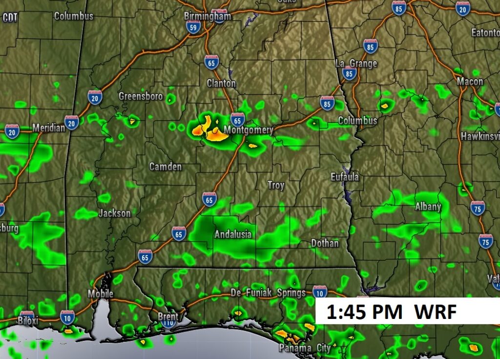
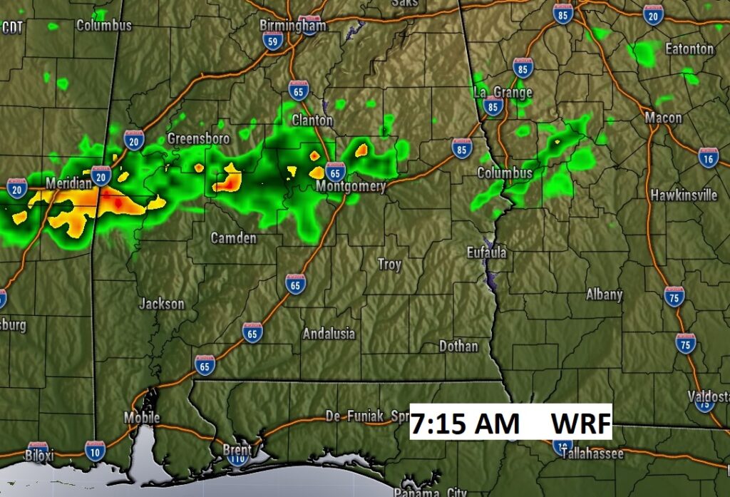
Future radar snapshots. Te WRF model suggests two windows where we could encounter a shower. One this morning and then, more PM random storms will be roaming around.
Here’s the afternoon expected Heat Index. Tuesday wil be as bad or worse.
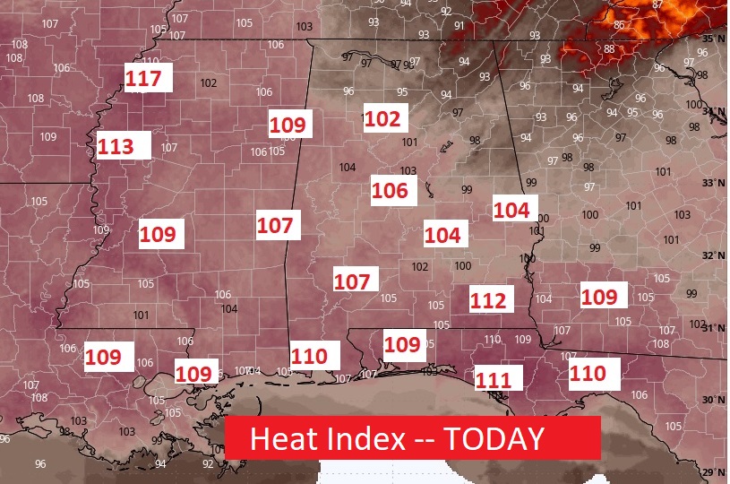
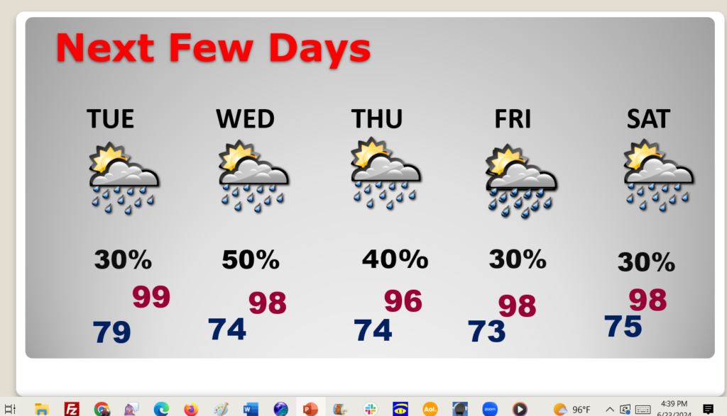
NEXT FEW DAYS: Tuesday will be another day with excessive heat indices and only widely scattered random storms. The best chance of showers & storms this week will be on Wednesday and Thursday. More blazing heat by Friday.
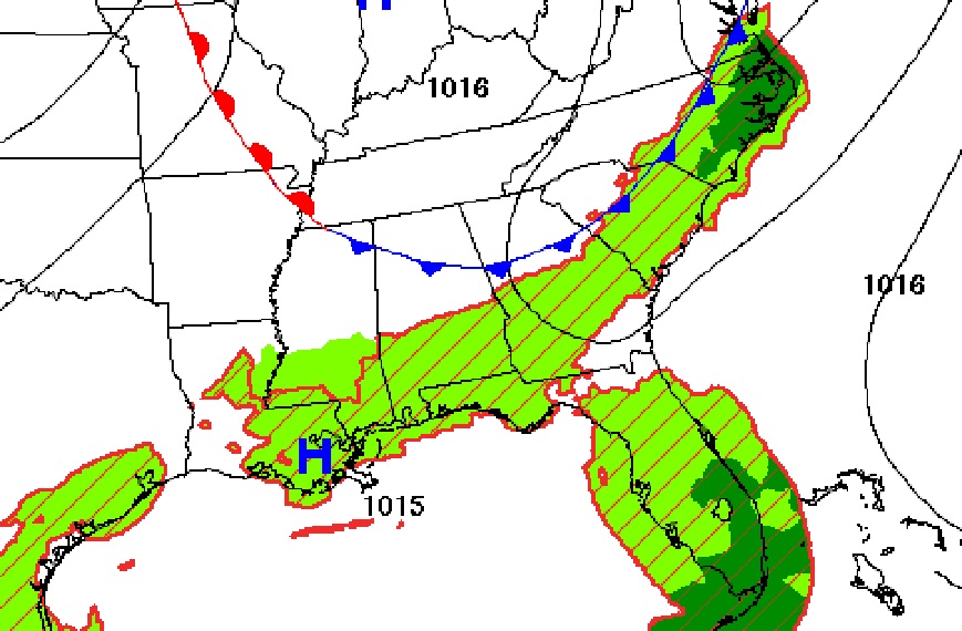
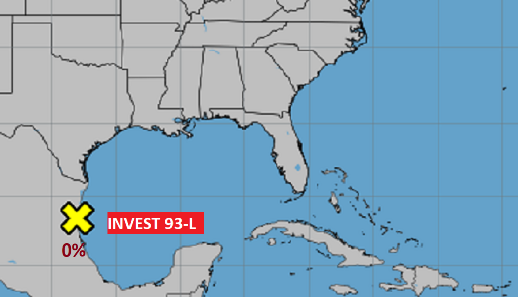
TROPICAL UPDATE: The map is quiet today. Invest 93-L in the SW Gulf has fizzled. No other “X”s on the map.
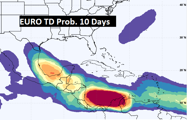
Here’s the EURO Tropical Depression probability through the next 10 days.
Thanks for reading the blog. There will be another complete Blog update and video forecast discussion tomorrow morning. This morning, everything is normal including LIVE on the Radio from 6 to 9AM on NewsTalk 93.1 – WACV. Have a nice day!!
–Rich