
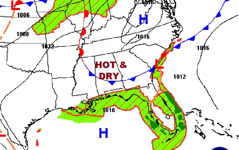
Good Morning! Today will be another very hot day with highs near 99 and Triple digit heat indices. Rain chance will be under 20%.The best chance of showers & storms this week will be on Wednesday and especially Thursday. Not every town will get wet, but storms will be most numerus on radar. More blazing heat by Friday and Saturday as the Upper Ridge gets stronger. Could be the hottest days of the year so far. Here’s my brief forecast discussion.
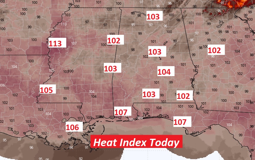
TODAY: Lots of sun mixed with clouds. Very hot and humid. High 99. Heat index 101 to 105. Rain chance very low. 20% or less. Heat index approaching the 105 dagger range. Light wind. Low tonight 74.
Slow down and take it easy today. Stay hydrated. Triple Digit Heat index.
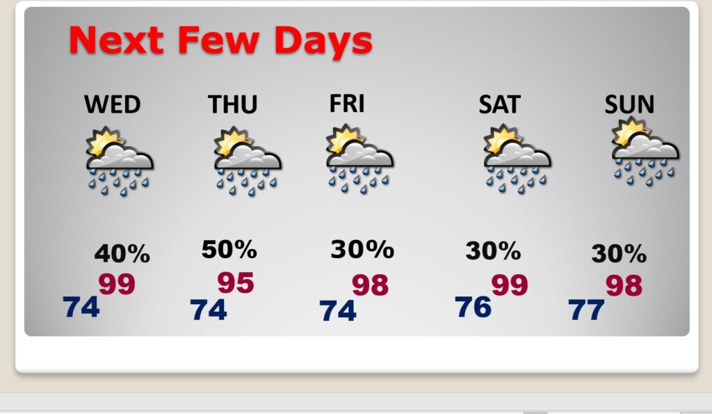
NEXT FEW DAYS: The best chance of showers & storms this week will be on Wednesday and especially Thursday. Not every town will get wet, but storms will be most numerus on radar. More blazing heat by Friday and Saturday. Could be the hottest days of the year so far.
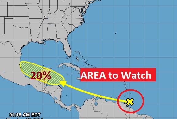
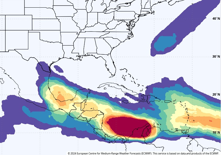
TROPICAL UPDATE: NHC has one x on the map. A Caribbean tropical wave may have a better chance of development late week when it reaches the more favorable Gulf.
Here’s the EURO Tropical Depression probability through the next 10 days. Again, the places to watch will be the Caribbean, the SW Gulf and eve into the SW Atlantic.
Thanks for reading the blog. There will be another complete Blog update and video forecast discussion tomorrow morning. This morning, everything is normal including LIVE on the Radio from 6 to 9AM on NewsTalk 93.1 – WACV. Have a nice day!!
–Rich