
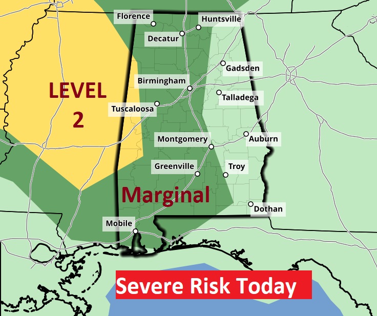
Good Morning! Yesterday was the hottest day of the year with 101 at MGM (Record 102), Heat index peaked at 103. Expect another hot day. The mercury will tease 100, with a Heat Index near 104. Big Heat can produce Big storms. Random showers and storms will return to the radar. Some storms could be strong, possibly severe especially west of I-65. Not every town will get wet, but storms will be more numerus today and tomorrow. Even Friday, and over the weekend, the heat, humidity and random storms will continue. Expect triple digit heat indices each day. Here’s my brief forecast discussion.
TODAY: A Sun/cloud mix. Very hot and humid. High 98-100. Heat index 101 to 104. Scattered random storms will develop, especially by afternoon and evening. Some storms could be strong, possibly severe especially west of I-65. Low tonight 74.
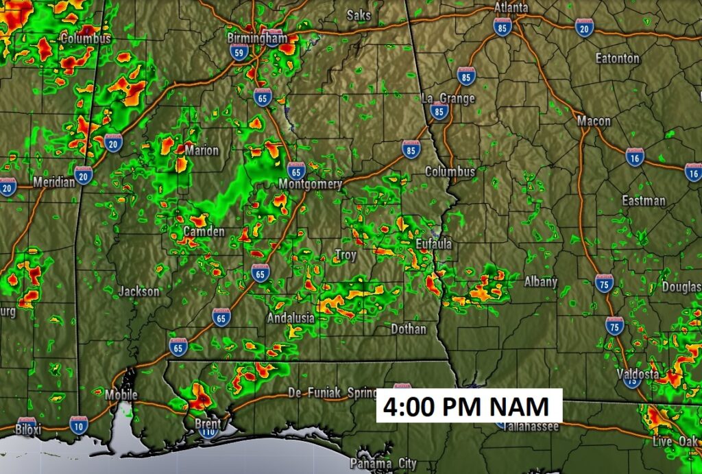
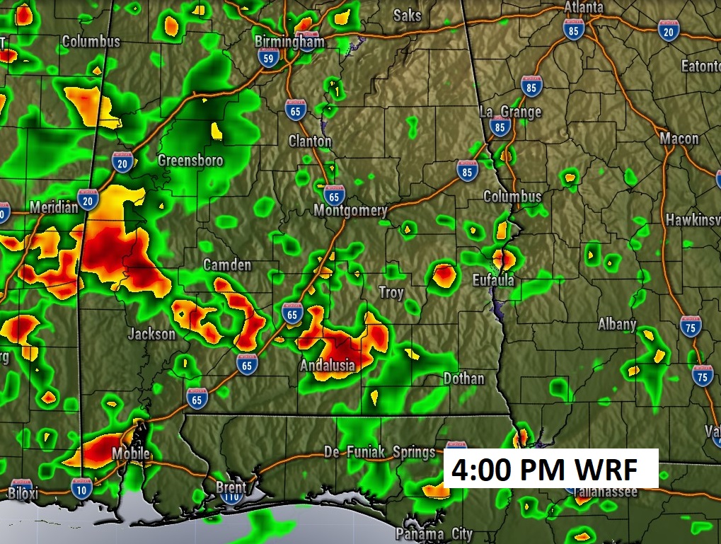
Showers and storms will be a lot more numerous, especially by late this afternoon. Here’s an example of two hi-res Future Radar model examples at 4:00PM.
SPC says some storms could be strong, possibly severe especially west of I-65
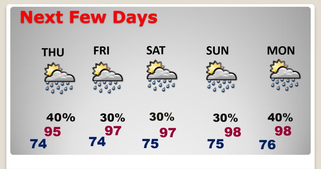
NEXT FEW DAYS: Expect another hot and humid day Thursday with random scattered afternoon and evening storms. Even Friday, and over the weekend, the heat, humidity and random storms will continue. Expect triple digit heat indices each day.
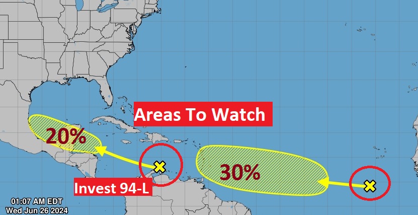
TROPICAL UPDATE: NHC has two “X”s on the map one in the southern Caribbean heading for the Gulf. The other disturbance in the Tropical Atlantic heading for the Islands,
Thanks for reading the blog. There will be another complete Blog update and video forecast discussion tomorrow morning. This morning, everything is normal including LIVE on the Radio from 6 to 9AM on NewsTalk 93.1 – WACV. Have a nice day!!
–Rich