
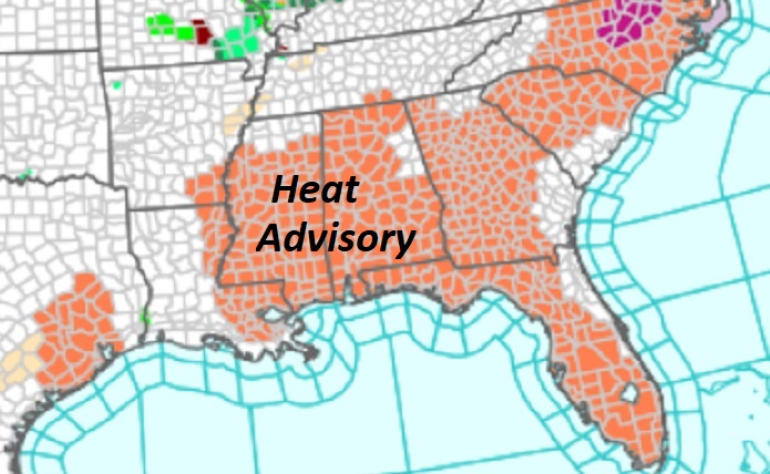
Good Morning! Here we go again. Heat Advisory in effect, again. Heat index as high as 110 in parts of the state. Big heat can produce big storms. Radar will be more active today, as a complex of storms, ahead of a frontal system, slides southeastward. No widespread severe weather is expected, but watch out for frequent intense lightning and gusty winds in some of the stronger storms. Otherwise, expect more spotty random storms will be around Saturday through Wednesday. Powerful Hurricane Beryl, just shy of Cat 3 status, is headed for the Yucatan today and then into the Gulf. As you’ll see on the latest NHC cone, the storm bends to the northeast and Beryl could make landfall as a hurricane in the United States, specifically along the Texas coast by late Sunday night into Monday morning.
TODAY: Heat Advisory in Effect, again. Sun/cloud mix. Dangerous Heat indices. High 96. Heat index 103 to 108. Big heat can produce big storms, Radar will be more active today as a complex of storms, ahead of a frontal system slides southeastward. No widespread severe weather is expected, but watch out for frequent intense lightning in some of the stronger storms. Low tonight 75.
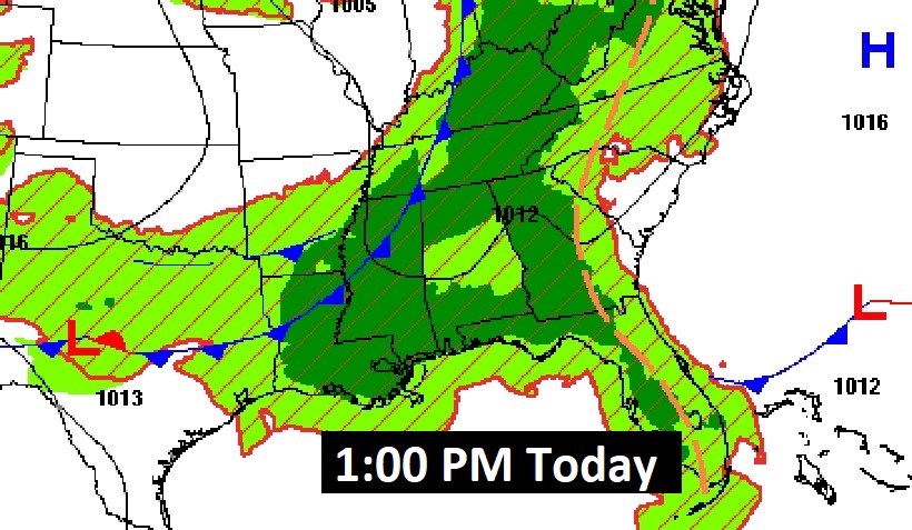
Watch as an approaching front slides southeastward today through tomorrow morning. This will be the added catalyze for a busy day on the radar.
Extreme heat continues over a multi-state area. Heat Advisory again.
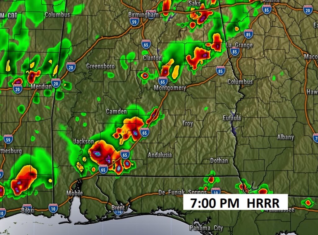
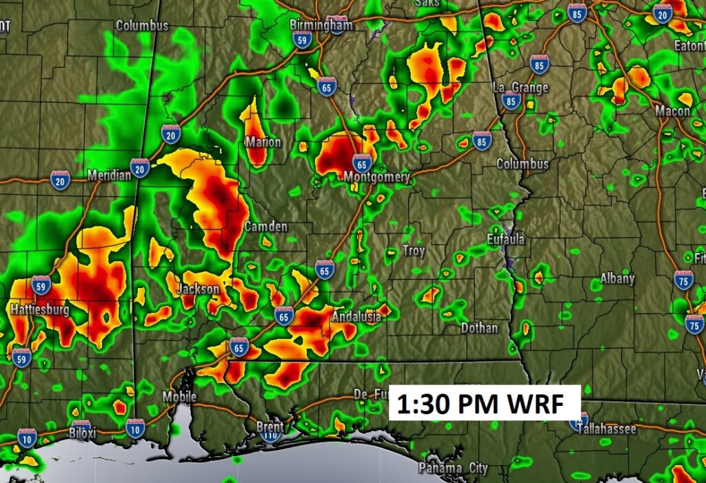
FUTURE RADAR: Radar is likely to become much more active today. A complex of storms, ahead of a frontal system slides southeastward. No widespread severe weather is expected, but watch out for frequent intense lightning in some of the stronger storms. The WRF model may be overdone at 1:30 PM, but the point is, there will be more storms to go around, The storm risk continues well through the evening hours and into tonight.
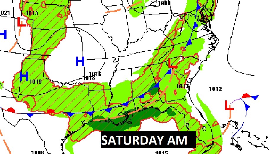
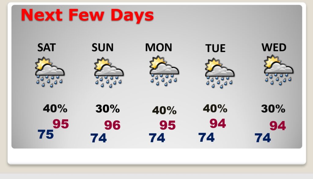
NEXT FEW DAYS: Hot and humid. Highs most days in the mid 90’s. Expect triple digit heat indices each day. Scattered random hit or miss storms each day through Wednesday. The random storms will be most numerous In the afternoon and evening hours. Lows at night in the muggy mid 70’s. Watch out for frequent intense lightning.
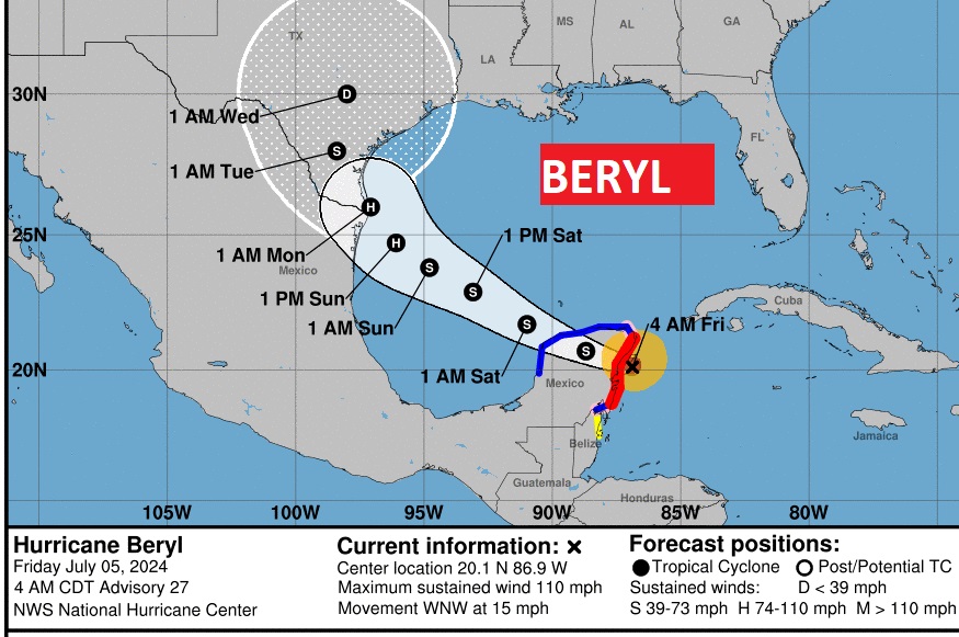
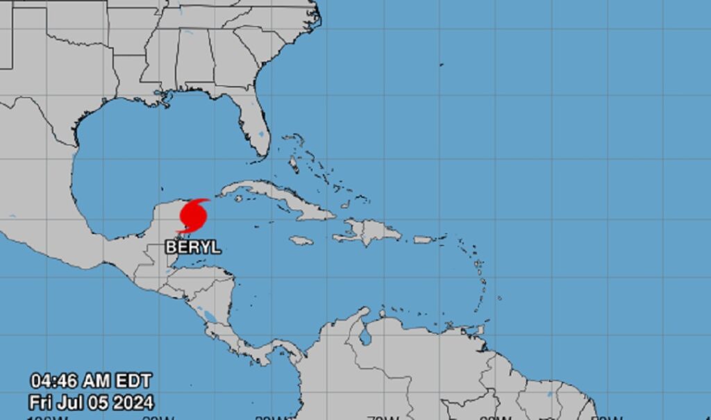
TROPICAL UPDATE: Powerful Hurricane Beryl, just shy of Cat 3 status (110 mph), this morning, is headed for the Yucatan today and then into the Gulf. As you’ll see on the latest NHC cone, the storm bends to the northeast and Beryl could make landfall as a hurricane in the United States, specifically along the Texas coast by late Sunday night into Monday morning.
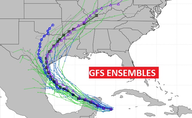
Meanwhile, better news. Invest 96-L is now gone. Fortunately, for now, we don’t have anything else left on the map for now
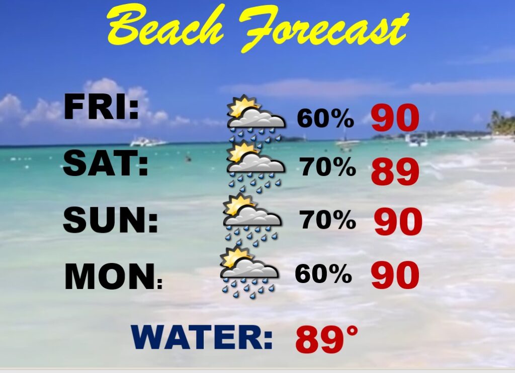
BEACH OUTLOOK:  Be Flexible with your plans. Random storms will be a little more numerous. A generous supple each day but not a washout. .  Highs near 90.  Watch out for lightning.

A Long period swell associated with distant Hurricane Beryl will arrive
along area beaches this evening into tonight and linger through the
weekend. This will favor the development of dangerous rip currents
from this evening through the weekend. If visiting the beach, please
be familiar with the dangers of rip currents and heed the advice of
local beach officials. Be aware of what beach flags are flying. Single
red flags imply that life threatening rip currents are likely in the
surf zone. Double red flags mean that the water is closed to the
public.
.
Thanks for reading the blog. . Have a great holiday weekend!
–Rich