
Good Morning! There are some subtle new wrinkles in our forecast for the rest of the week and into the weekend. Storms will become quite isolated. Any storms will be few and far between in the afternoon and evening. The BEST rain chance will be along a stalled front on the coast. It will be mostly sunny and hot, but not quite as humid as the last few days. Highs in the middle 90s Thursday. Could we see a weekend heatwave? Expect Upper 90’s Friday through Monday. Triple digit heat index. Overnight lows in the low to mid 70’s. The Tropics are quiet right now. Here’s my brief forecast discussion.
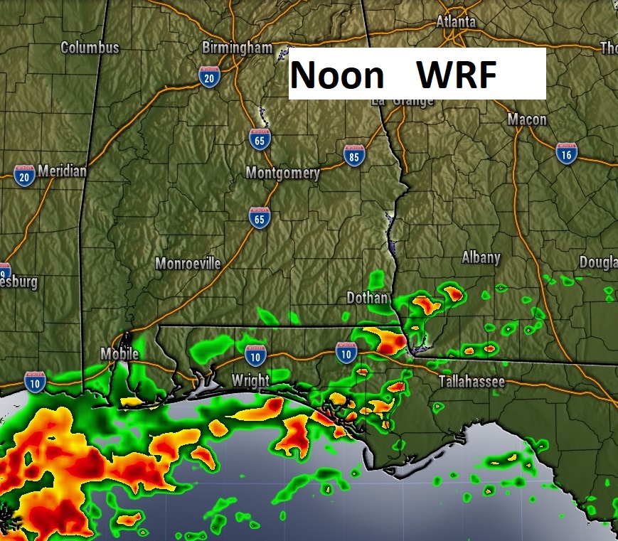
TODAY: Mostly Sunny, hot but not quite as humid High 94. Heat index 100+. Rain chance 20% or less. Amy storms will be few and far between and mainly closer to the coast. Low tonight 73.
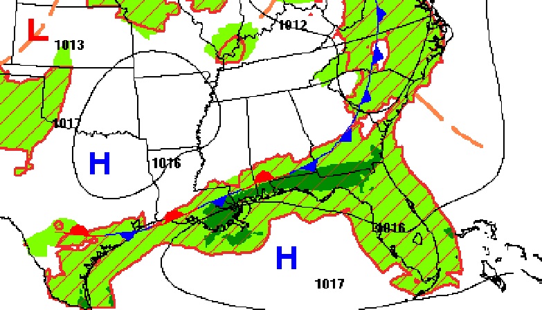
Today the BEST chance of rain will be along a stalled front close to the coast.
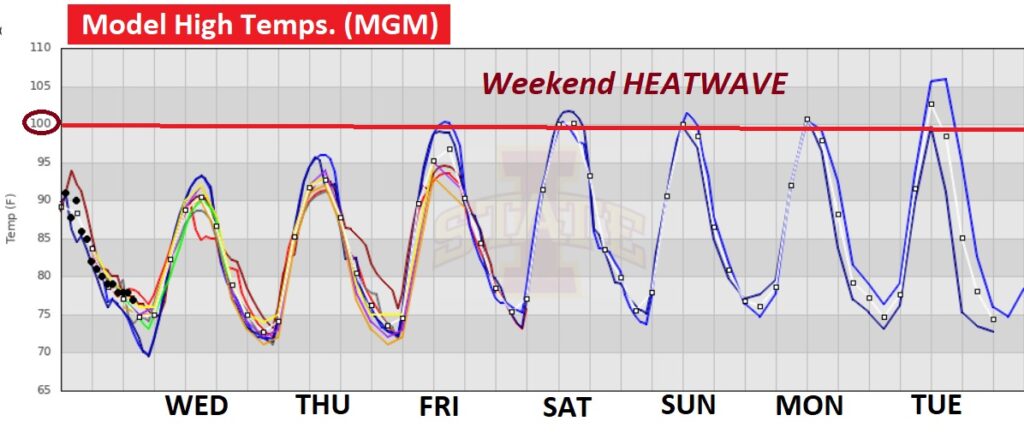
NEXT FEW DAYS: More sun andfewer storms next few days. Any storms will be few and far between in the afternoon and evening. It will be mostly sunny and hot, but not quite as humid as the last few days. Mid 90s Thursday. Could we see a weekend heatwave? Expect Upper 90’s Friday through Monday. Triple digit heat index.

The model trends hint at the highest temperatures of the summer so far Friday through Tuesday. I’ve got us in the upper 90’s, however, as you can see, some models are hinting at 100 or higher this weekend and early next week.
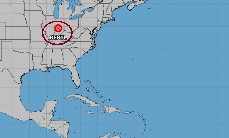
TROPICAL UPDATE: The remnants of Beryl are over Indiana today still prompting dozens of tornado warnings. Even some touchdowns with damage. Meanwhile, Tropical trends come in cycles. It looks like, for at least a little, while we are going into a quiet cycle. There are no features bring tracked in the tropics right now.
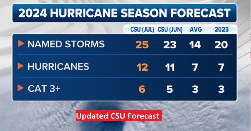
CSU experts increase hurricane forecast for Atlantic season: Beryl likely ‘harbinger of a hyperactive season’. The July update bumps up the number of storms to 25 named storms, 12 Hurricanes and 6 major hurricanes. #alwx
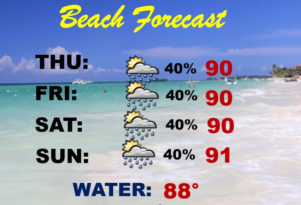
BEACH OUTLOOK: Next few days, the better rain chances will be near the coast along a stalled front. Spoty random PM storms are possible. Highs mainly near 90. Nighttime lows near 80. Gulf water temp. 88.
Thanks for reading the blog. I’m sure there will be some sort of update tomorrow. The next complete blog and video will be Monday morning. Have a great holiday weekend!
–Rich