
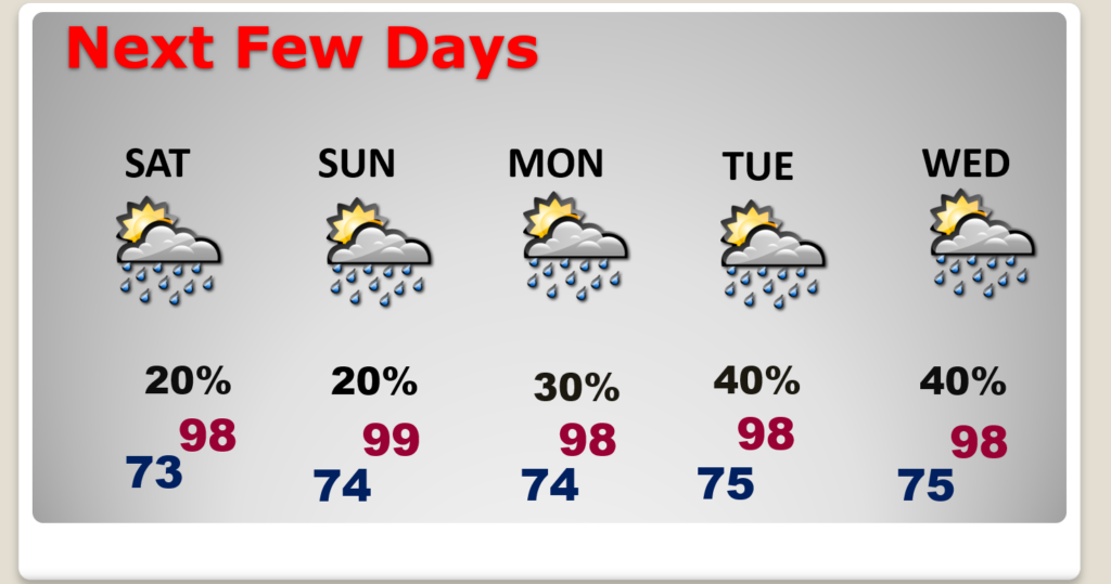
Good Morning! It’s still a dry forecast for another day or two and it’s going to start to Heat up and gradually more humidity is in our future. Even though highs will reach the upper 90’s today, the heat index will probably fall shy of 100 for the third day in a row. Over the weekend that will change. Hotter, more humid days will elevate the Heat Index closer to the Danger Range especially by Sunday and next week. Although rain chances are close to zero today, and probably tomorrow, expect random, pop up, “hit or miss” storms to return Sunday and next week. Next week’s bets rain probabilities will return Wednesday through Friday, Here’s my brief forecast discussion.
TODAY: Mostly Sunny. Still hot, but again today, relatively tolerable humidity. High 98. Heat index should stay below 100. Rain chance just about zero. As close as we get this time of the year. Amy storms will be closer to the coast. Low tonight 73.
Today the BEST chance of rain, once again will be close to the coast.
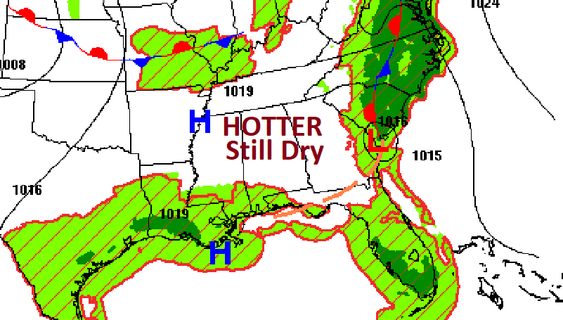
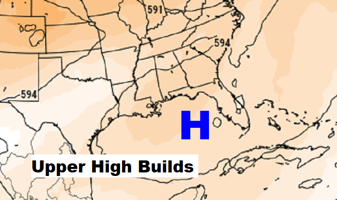
Meanwhile an upper Heatwave high, building will expand.
NEXT FEW DAYS: Over the weekend, hotter, more humid days will elevate the Heat Index closer to the Danger Range especially by Sunday and next week. Actualhighs will be in the upper 90’s to near 100. Although rain chances are close to zero today, and probably tomorrow, expect random, pop up, “hit or miss” storms to return Sunday and next week. Next week’s bets rain probabilities will return Wednesday through Friday. Overnight lows in the low to mid 70’s.
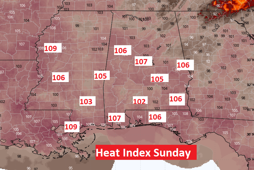
Here’s the Model Guidance on the Heat Index. We’ll be nearing the Heat Advisory Criteria Sunday through Wednesday.
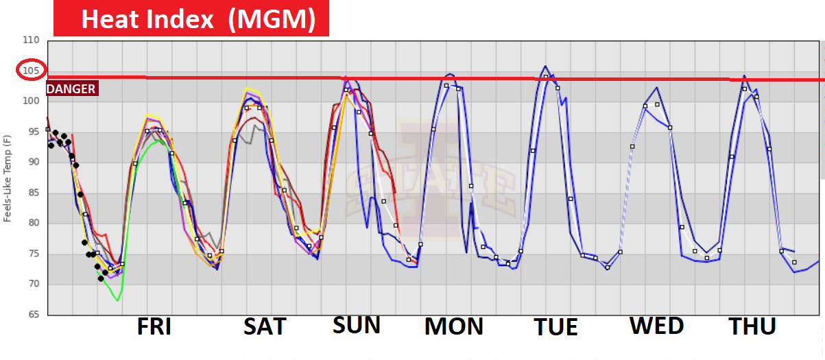
A sample of some Sunday afternoon Heat Indices.
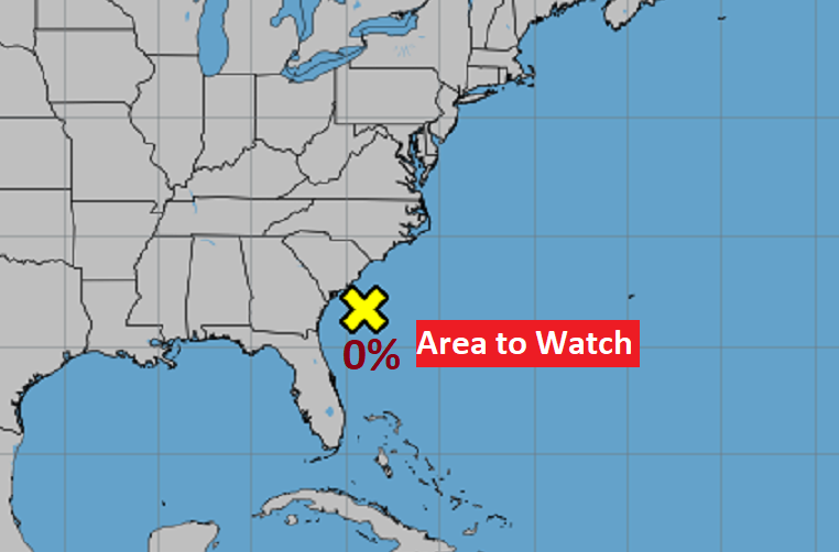
TROPICAL UPDATE: The Area to Watch off the SE Coast has fizzled. For now, the rest of the Atlantic, the Caribbean and the Gulf of Mexico are quiet.
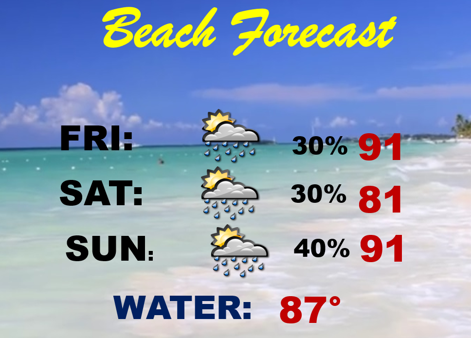
BEACH OUTLOOK: Routine weekend Beach Forecast. Spoty random PM storms are possible. Highs mainly near 90. Nighttime lows near 80. Gulf water temp. 86. Higth Rip Current Risk today, especially from Destin eastward through Panama City. Moderate Saturday and Sunday.
Thanks for reading the blog. I’m sure there will be some sort of update tomorrow. The next complete blog and video will be Monday morning. Have a great holiday weekend!
–Rich