
Good Morning! Yesterday there were scattered, drenching rainfall totals across the South, once again. Showers and storms will continue random, but quite numerous, especially in the afternoon and evening at least through the upcoming weekend. Some of the storms will produce very heavy downpours. Localized urban flooding is possible. Watch out for dangerous lightning. Highs will continue in the upper 80’s to lower 90’s. Here’s my brief forecast discussion.
TODAY: Limited sunshine. High near 88-91. Random but scattered to numerous “hit or miss” storms, any hour of the day or night, but especially in the afternoon and evening. Low tonight 73.
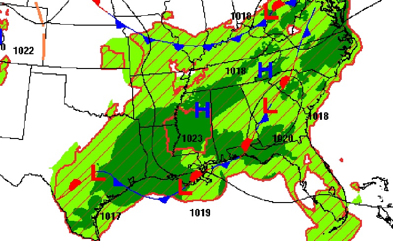
The better than normal rain chances continue as a couple of fronts haunts the South, helping to act as a focus for more Storms.
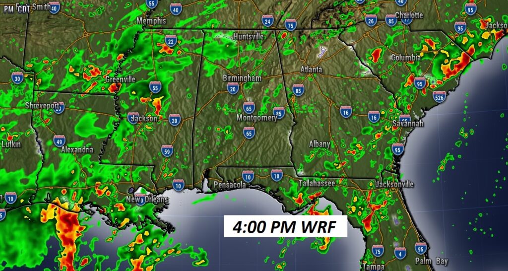
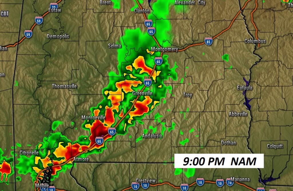
FUTURE RADAR: I like this hi-res Future Radar profile, showing widespread showers and storms across the South at 3:00 PM. And, look at a 9:00PM Nam snapshot. Storms could continue well into the evening.
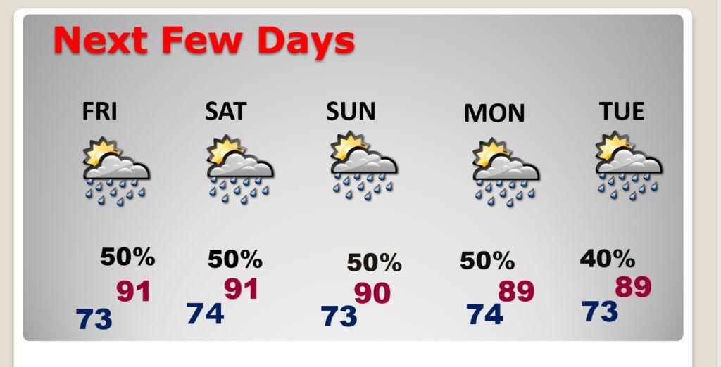
NEXT FEW DAYS: Showers and storms will continue random, but scattered to numerous, especially in the afternoon and evening at least through the upcoming weekend. , Highs will mostly be in the upper 80’s to near 90. Lows at night in the lower 70’s.
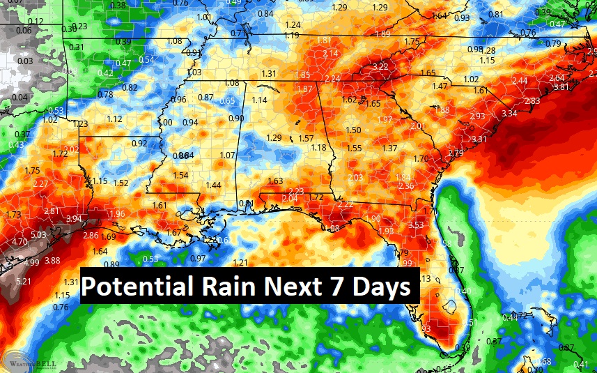
Here’s a profile of additional “average” rainfall potential through the next 7 days. The :average” numbers are starting to come down a bit.
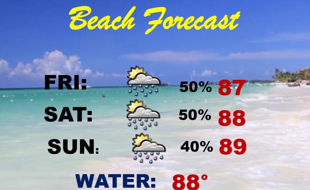
BEACH OUTLOOK: Not a washout at all, but be flexible. Expect a better than normal rain coverage through the weekend. Highs in the upper 80’s. Gulf water temperature is 87.
.
Thanks for reading the blog. There will be another complete Blog update and video forecast discussion tomorrow morning. This morning, everything is normal including LIVE on the Radio from 6 to 9AM on NewsTalk 93.1 – WACV. Have a nice day!!
–Rich