
Good Morning ! Yesterday’s high was held down to 88 because of clouds and showers, There will be fewer storms on radar. And, get ready. Alabama will be heating up over the next few days, especially by mid and late week. The Heat index will continue to be a factor and we could easily be in the105+ Danger range by Wednesday. Thursday and Friday. Afternoon & evening storms will “thin out”. Becoming widely scattered. Few and far between. Meanwhile, NHC is still monitoring that Area to Watch in the Caribbean and SW Atlantic. Here’s my brief forecast discussion, from the shores of Lake Erie.
TODAY: Partial sunshine. High near 93. Very humid with triple digit heat index. Not as many storms on radar. Random but scattered to numerous “hit or miss” storms, especially in the afternoon and evening. Low tonight 75.
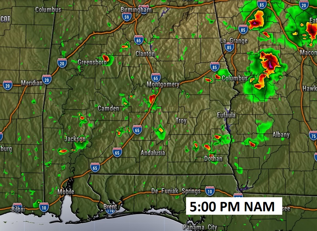
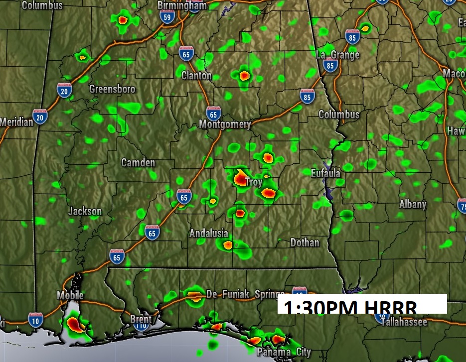
FUTURE RADAR: Storms will be fewer and far between today, finally. Here’s a couple of examples.
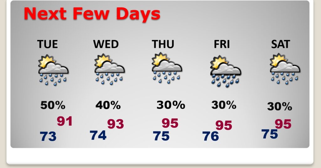
NEXT FEW DAYS: Alabama will be heating up over the next few days especially by mid and late week. The Heat index will continue to be a factor.Storms will become rather few and far between. Widely scattered. Highs will reach the middle 90;s by mid week. near 90. Lows at night in the lower 70’s.
Here comes the heat, Dangerous heat Index later this week as July ends and August begins.
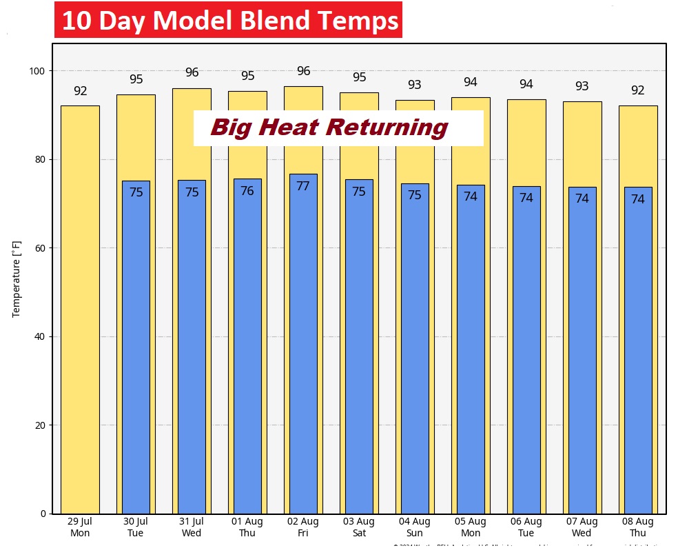
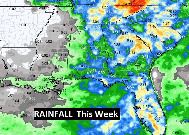
Storms will finally start to thin out in the week ahead. Rainfall totals will be little more sparse on average.
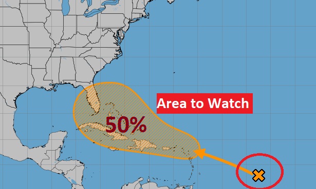
TROPICS UPDATE: Area to Watch in the Tropical Atlantic, as a tropical disturbance interacts with a Tropical Wave, Conditions will become more favorable for Tropical Development as this system reaches the islands and then heads for the Bahamas.
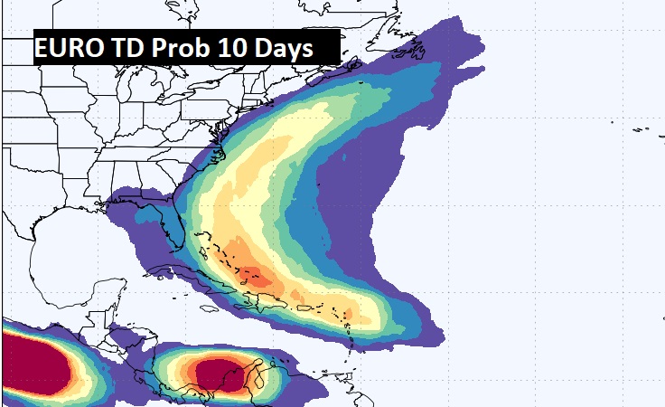
The EURO model, out 10 days gives this system a decent chance of tropical development. Stay tuned.
Thanks for reading the blog. After my Class Reunion weekend, today will be a travel day for me. Tomorrow morning, everything will be back to normal. Have a great day!
–Rich